Advertisement
Heavy Rain And Wind Will Usher In Christmas Day
ResumeDo you have a big inflatable Santa out on the front lawn? If so, you might want to think about taking him down a little early so he doesn’t fly off on Christmas morning.
We have a significant wind and rainstorm on the way for Christmas Eve and Christmas day.
There are three components to the upcoming storm. The first and probably least significant is the warm weather. Temperatures are going to reach into the 50s to near 60 degrees and melt most of the snow that's on the ground. It's unlikely to be an official "White Christmas" because for that you need an inch on the ground at 7 a.m. on Christmas morning.
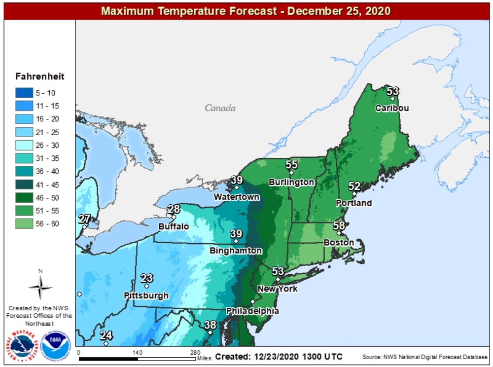
The warm weather won't last as colder air moves back into the region later on Christmas night and continues through the weekend.
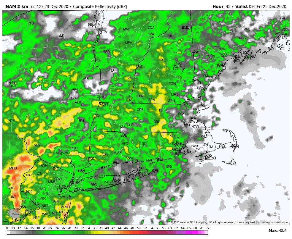
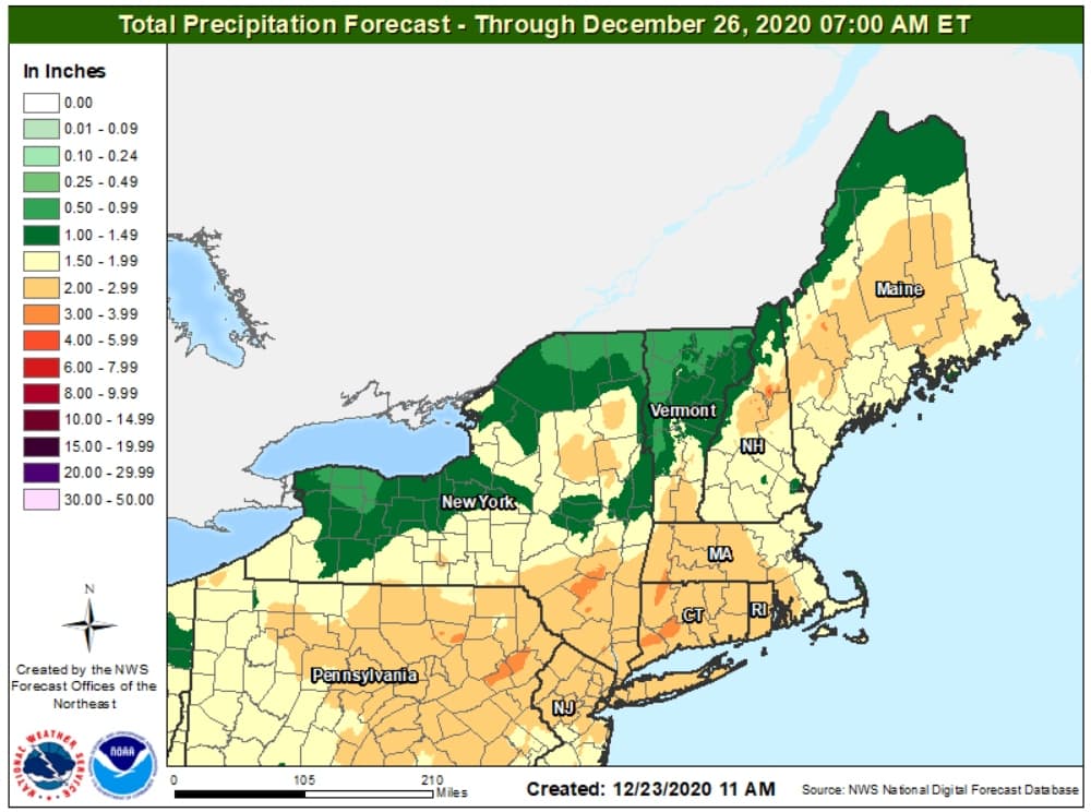
The next aspect of the storm is going to be heavy rain. Most areas will see anywhere from 1 to 2 inches of rainfall combined with melting snow.
This will create some urban street flooding and has the possibility of flooding basements that are particularly prone to this type of issue. It's a good idea to check your sump pumps in the next day or two before the rain arrives.
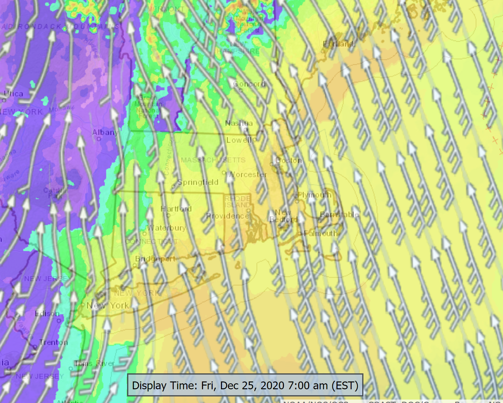
The most serious issue is going to be wind. There's no question that the winds several hundred feet above the ground are going to be gusting over 60 mph. The forecast challenges how much of that wind will make it down to the ground. Right now it appears many of us will experience wind gusts over 40 mph and up to 60 mph. This will create some tree damage and subsequent power issues. The wind will be strongest from roughly midnight Thursday, to an hour or two after sunrise on Friday morning.
The good news is the storm will quickly exit the area later Christmas day and temperatures will fall back down into the 20s Christmas night and be in the 30s with sunshine over the upcoming weekend. Unfortunately, with all the snow gone, we won't be able to use those new skis or sled that were under the Christmas tree.
This segment aired on December 24, 2020.
