Advertisement
The Snow Is Falling Slowly In Boston, But The Storm Isn't Finished Yet
ResumeThe storm moving through the region could still bring predicted levels of snow accumulation by the time it's over, but it's slow going after just about 1 inch of snow fell in Greater Boston on Thursday.
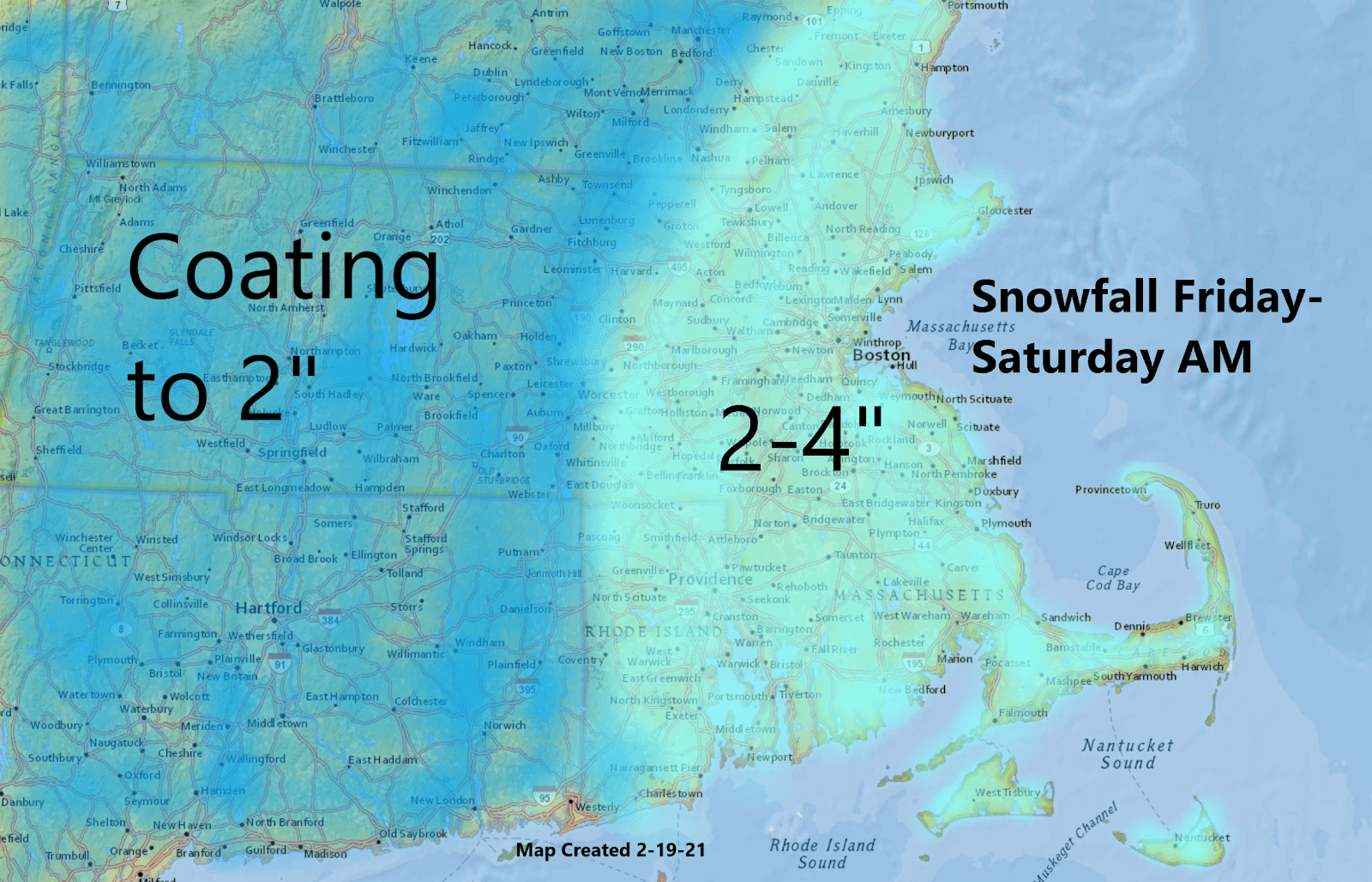
The lack of snow north of the south coast was a little surprising, but by day's end, Boston had seen an inch and there will probably be a couple more, which will likely get us close to the low end of the predicted totals for this storm at about 4 inches.
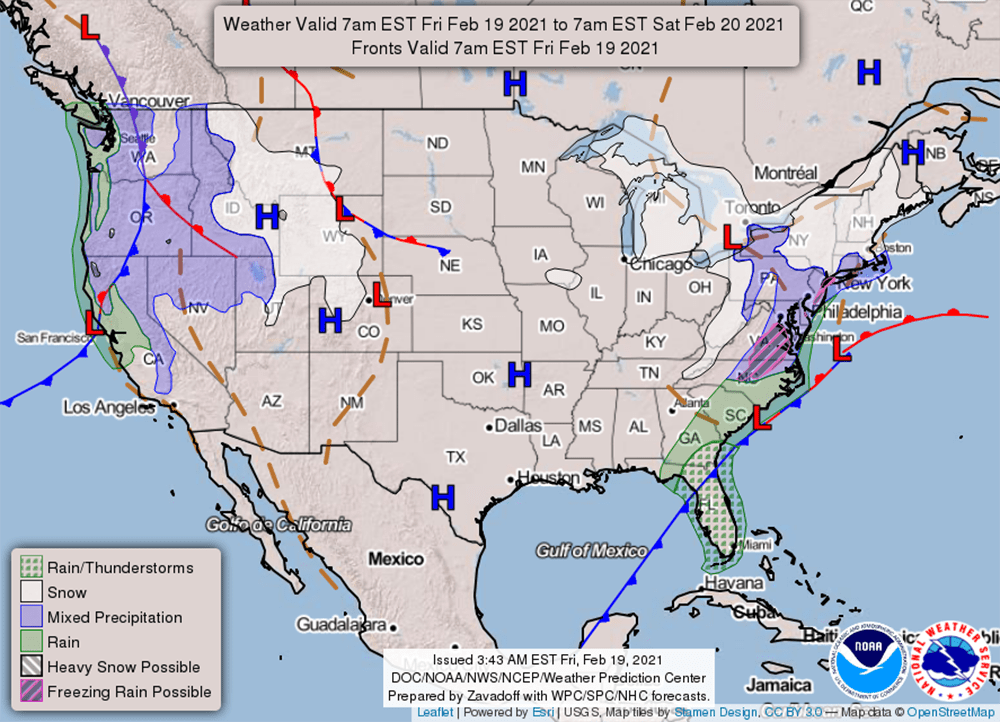
Little waves of low pressure have been riding to our south for the past 24 hours. Between these impulses, there isn't much precipitation, and then you get an enhancement for a little while before it stops again.
We will see snow today, but it's not going to be heavy. As a matter of fact, at times, the snow may taper off to just a few flurries. At other times, it will be steadier. With temperatures in the upper 20s and lower 30s, most of the snow texture will be light; although, it will be heavier and wetter across southeastern Massachusetts.
There will likely be a little increase in the snowfall overnight, and that's when Boston may see most of its accumulation for the next 24 hours and perhaps for the entire weather system.
The map below shows the additional snow I'm expecting to occur through Saturday morning. Yes, there may actually be some snow falling Saturday until about sunrise over extreme Eastern areas.
Thereafter, we will clear out and can expect some sunshine during the day Saturday, followed by a very bright and sunny day Sunday. Temperatures over the weekend will be in the low to mid-30s. It's likely the last of the very cold weekends for this winter.

Next week, a warming trend moves in after some light rain or snow Monday. By the middle of the week, temperatures will be getting into the 40s and you're definitely going to notice quite a bit of melting.
This segment aired on February 19, 2021.
