Advertisement
Heat index to soar over 100 again this weekend
Boston's heat wave is official — and it's only half way over.
The high on Thursday reached 94 degrees, with heat index values eclipsing 100 for many, including in the city.
On Friday, the biggest change you'll notice is the humidity has dropped a bit. Instead of dewpoint values in the oppressive range, they will fall into the lower to mid-60s, which should feel slightly more comfortable. This will have an impact on the "feels like" temperature, which will hover in the mid-90s. Along those lines, our thunderstorm risk is much lower today as well.
While an isolated storm may pop — particularly north and west of Boston this afternoon — the risk is fairly low, and anything that does develop should be fairly short-lived.
On Saturday, our weather will be fairly similar, with highs topping out in the mid-90s and an isolated thunderstorm possible. Not much relief is forecast on Cape Cod, where highs will be 85 to 90 for us there through the weekend.
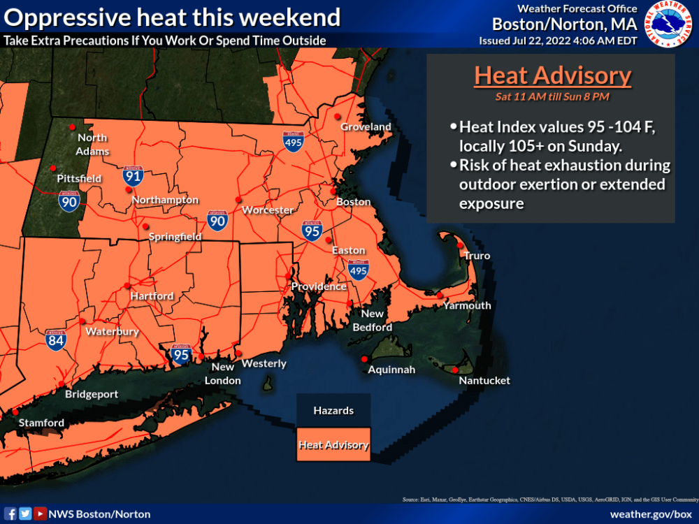
On Sunday, the heat will peak. Expect highs in the upper 90s, stifling humidity and heat index values in the low 100s. A heat advisory is in effect for Saturday and Sunday.

Thunderstorms will be more scattered ahead of an approaching front, particularly by Sunday evening, some of which could become severe.
There's an outside shot that we could hit 90 again on Monday, and if we do, our then-seven-day heat wave will be the longest we've observed since a weeklong stretch back in July 2013.
While our temperatures won't be nearly as hot next week, they will still be above average, in the mid- to upper 80s most afternoons.