Advertisement
How Nicole, weakened to a tropical depression, will affect New England weather this weekend
Tropical Storm Nicole was downgraded early Thursday to a tropical depression, but even as the storm weakens New Englanders will still see some significant impacts over the holiday weekend.
The storm made landfall as a Category 1 hurricane that morning just south of Vero Beach, Florida. The hurricane was the second this year to hit the continental U.S.
Nicole will weaken some more. The jet stream — basically, a fast-moving band of air high in the sky that steers storms — is expected to carry Nicole north andnortheast over the Appalachian Mountains Friday afternoon and intoNew England the evening and Saturday morning.
Nicole will no longer be "tropical" at that point, and instead, she will resemble a large swath of rain and gusty wind.
Clouds will increase and thicken rapidly Friday, but despite the lack of sun, the southerly wind will bump afternoon temperatures up to around 70 degrees. A few isolated showers are likely to develop by early afternoon and continue through the evening drive.
But steady rain late Friday evening is the "main event" of impacts New Englanders will witness from this storm.
The rains will carry on overnight and into Saturday morning with pockets of heavy downpours and even rumbles of thunder at times. We'll see a sharp back edge of the rain move through from 10 a.m. to 11 a.m. Saturday in central and eastern Massachusetts. The rains will clear rapidly, though, and temperatures near 70 will warm the area again.
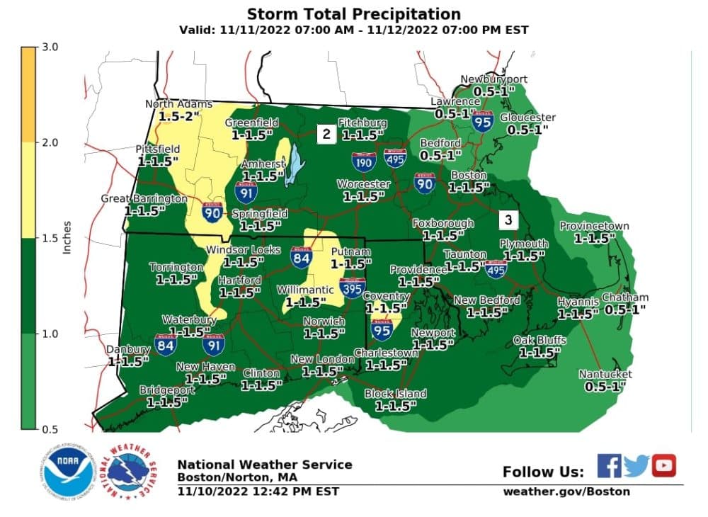
The Boston area and many other parts of the state are expected to see between 1 and 1.5 inches of total rainfall. Some areas in western Mass. might see up to 2 inches of precipitation.
The rains likely won't cause much disruption beyond some isolated urban street flooding or pockets of highway that could cause hydroplaning.
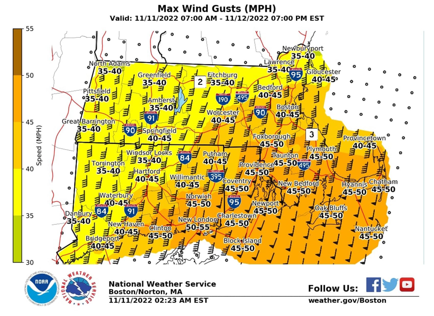
As for wind, widespread damage is not expected, but the storm could weaken trees and scatter limbs in the predawn Saturday hours through late Saturday morning across parts of the South Shore, Cape and Islands and south coast. The south and southwesterly winds will gust up to 55 mph at times near the coast.
Residents in these areas should secure loose objects before the rains pick up Friday night. Elsewhere, including in the Boston, gusts up to 40 mph may result in some isolated tree damage and power outages. The strongest winds will occur between 4 a.m. and 10 a.m. Saturday.
Behind Nicole's remnants, the wind will shift late Saturday and usher in colder air. On Sunday, highs will remain in the low 50s under a mix of sun and clouds.
Next week, it's going to be quite chilly. A chance of showers increases by Wednesday and again next Friday, along with the possibility of some snow in western Massachusetts. Most days next week will see highs in the 40s.