Advertisement
Winds howl at coast as snowstorm lingers; Boston may get an additional coating
A snowstorm that began Friday continues to drop a range of precipitation across the state, with major winds gusts howling along the coastline.
The storm's center is strengthening and moving over Cape Cod Saturday. Meanwhile, in eastern Massachusetts, the snow has largely transformed into rain and sleet for most inland areas.
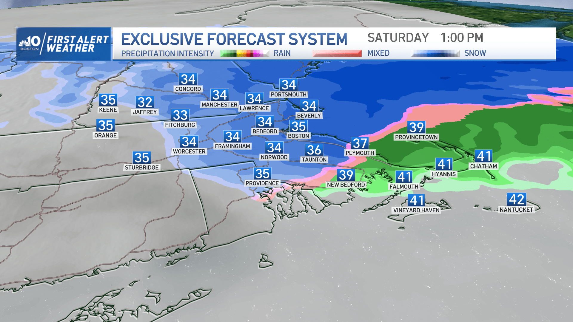
Towns and cities outside of I-495 were greeted Saturday with wet and thick snow that kept falling through the late morning hours.
The line or wet or rainy snow is expected to collapse as it heads eastward sometime in the mid-day or early afternoon. However, at that time, a flip back to snow will occur, including for Boston.
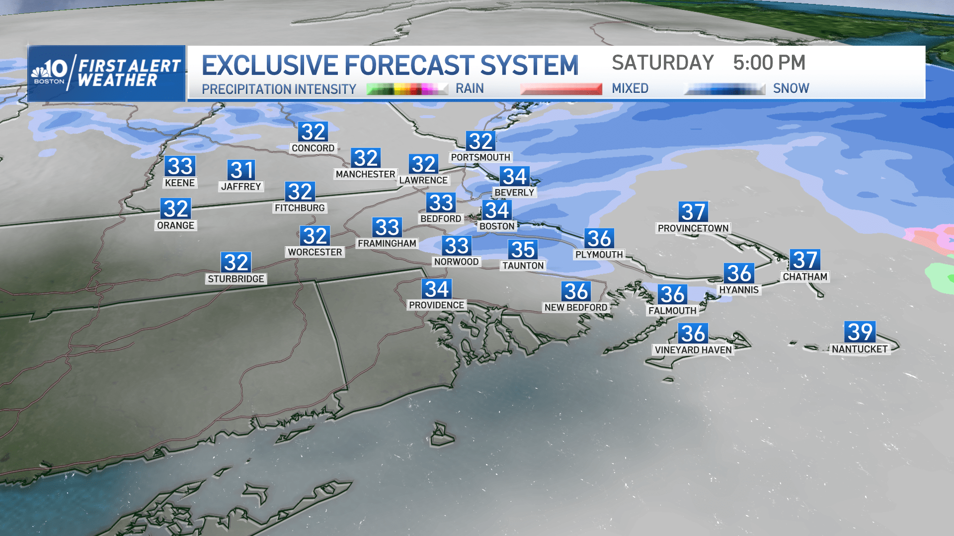
But no need to worry about too much extra shoveling, as the afternoon's accumulation totals are set to be fairly minimal.
From the South Shore to Boston, neighborhoods will see a fresh but slim coating. And for communities west and north of the capital, there may be another 1-2 inches. Along the Massachusetts and New Hampshire border, there could be up to 3 additional inches of snow this afternoon.
The snow winds down by late afternoon and should end sometime between 5 and 7 p.m. as it travels east. Some snow showers may linger a bit longer on Cape Cod.
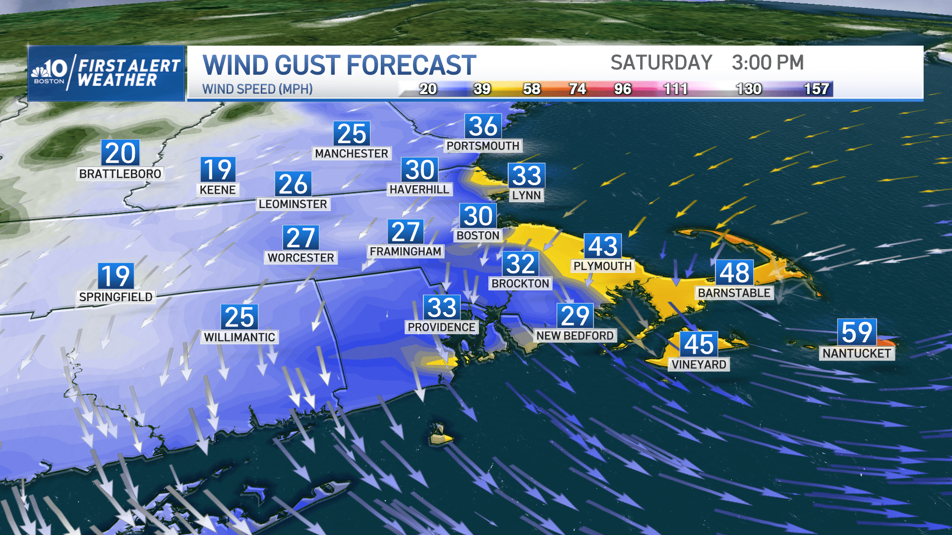
Beyond snow, the major weather concern for the coastline has been the wind. Several eastern communities are contending with gusts between 40-50 mph, with winds as strong as 60 mph winds occurring from Cape Ann to Cape Cod. There likely will be pockets of isolated wind damage and power outages through the early evening hours in these areas.
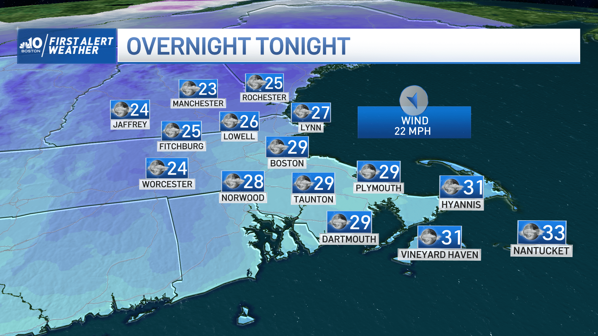
As the storm pulls away from New England this evening, the winds will ease.
Skies will clear tonight, with temperatures dropping into the 20s. This will create icy spots on roadways not treated with salt or sand.
On Sunday, temperatures will rise into the 40s, with a blend of sun and clouds.
Much of next week should see highs in the 40s, with the exception of Tuesday when another weak storm system may bring some mixed snow and rain showers to the region.
Otherwise, the weather should be fairly quiet until next weekend. While it's too early to be certain, there's increasing confidence the Northeast will be impacted by another snowstorm on Sunday.