Support WBUR
Forecast: A bitter cold weekend follows Friday's snow
New England is gearing up for some slippery travel Friday evening — and bitter cold temperatures this weekend.
While it won’t be a blockbuster snow event, it will bring accumulation for much of the region, followed by an Arctic blast this weekend. As we head into the holiday week, several weather disturbances could bring additional chances for snow and rain.
A snowy Friday
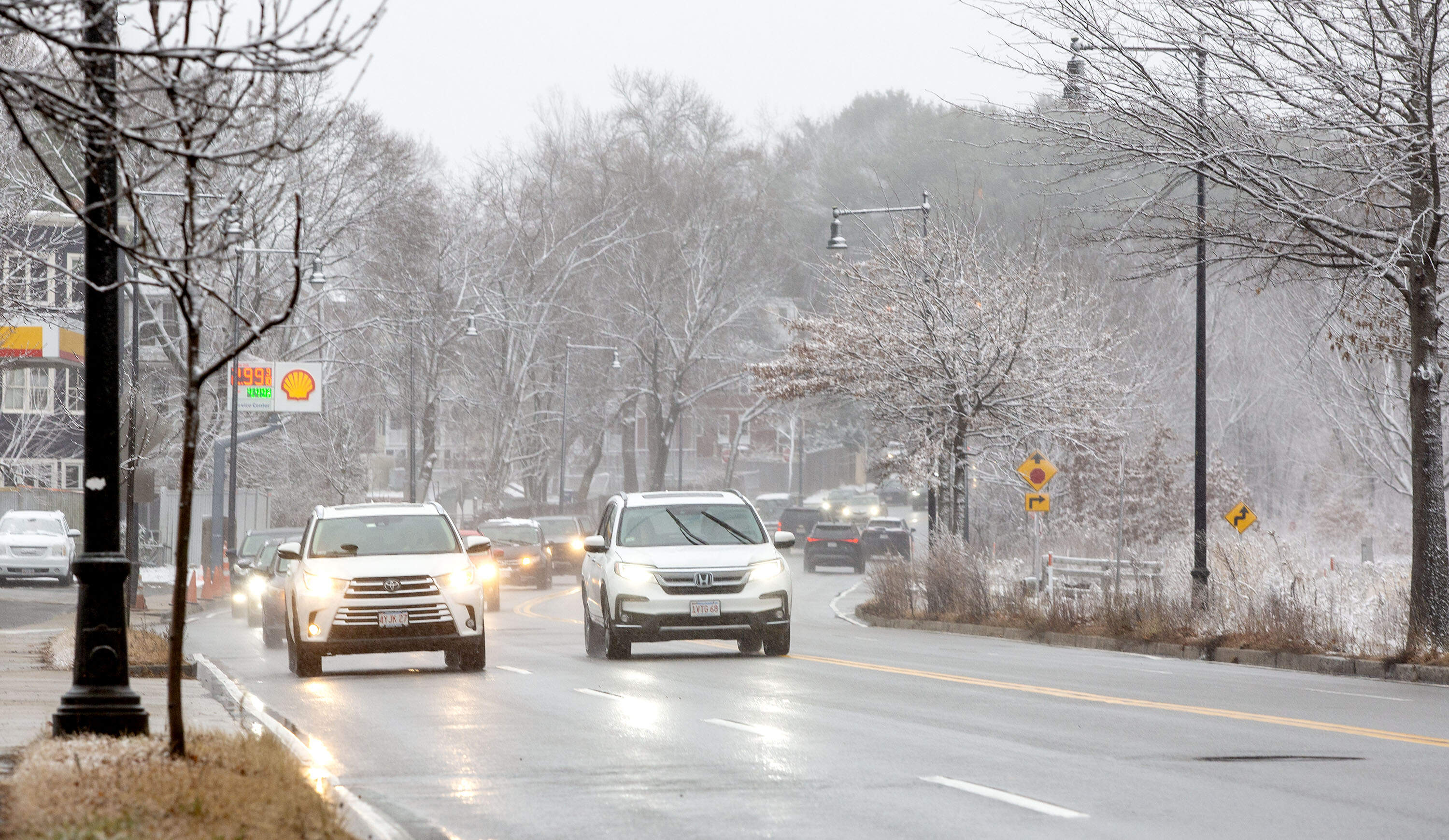
An energetic disturbance triggers an offshore storm Friday. The brunt misses New England, but onshore winds interacting with cold air will create pockets of accumulating snow.
Timing:
- Afternoon and evening: Areas of snow continue to fill in, becoming steadier by late afternoon/evening. Expect rain at times in southeast Massachusetts to Cape Cod.
- Late evening and overnight: Areas of snow and mixed precipitation flips to snow from north to south as temperatures drop.
- Saturday morning: Lingering snow showers clear out early.
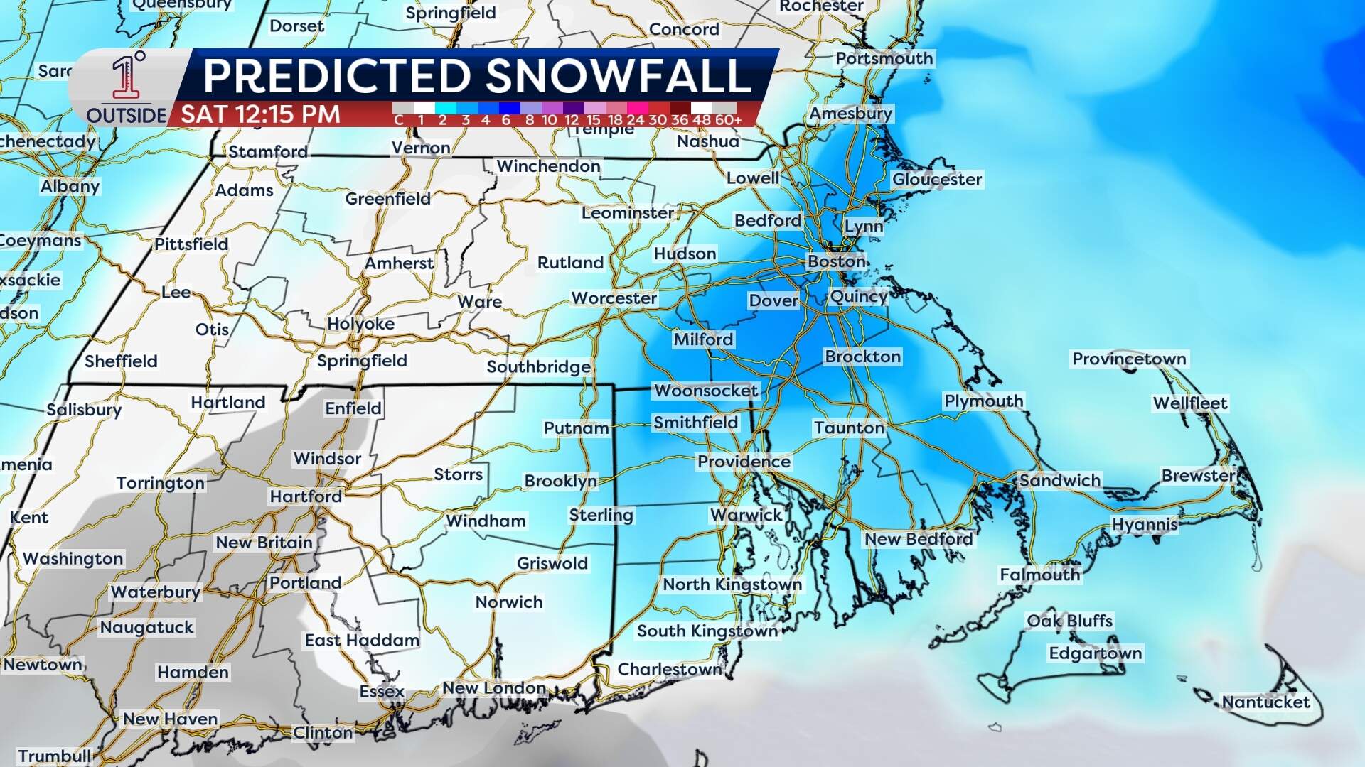
Snowfall totals:
- Eastern Massachusetts: 1-3 inches
- North and west of Boston: There may be some localized ocean-effect bands, bringing isolated accumulation of 4 inches.
- Cape Cod and South Shore: Coating of 1 inch, and up to 2 inches in some isolated areas.
Impact:
- Slick roads will develop Friday afternoon, expanding in coverage through the evening and overnight.
- Early Saturday morning travel may still be slippery in spots, especially anything untreated.
Arctic blast for the weekend
The coldest air of the season arrives Saturday night, bringing biting winds and frigid temperatures that will linger into early next week.
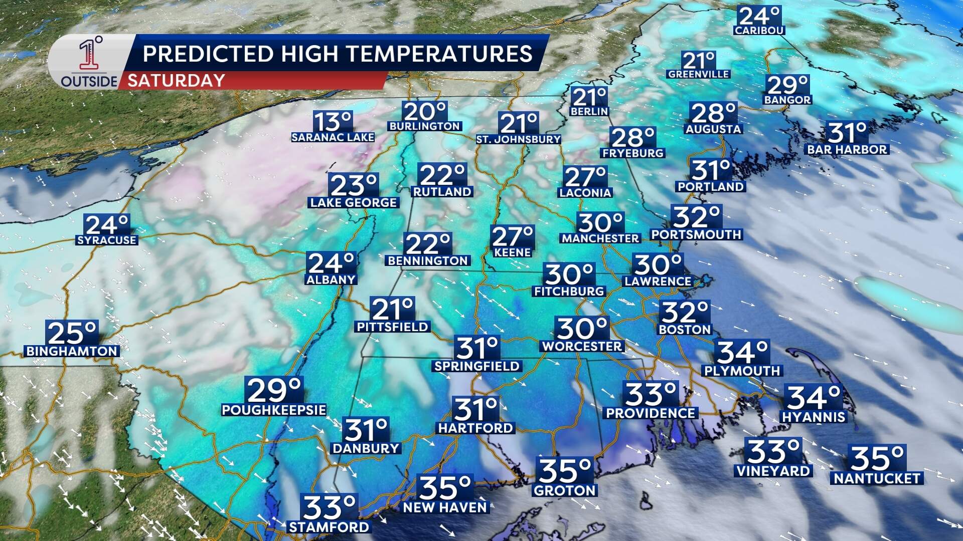
Saturday:
- Temperature: Expect 20 degrees for a high north of Boston, dropping to single digitals at night. South of Boston, temperatures will reach 30 degrees during the day, and drop to teens at night.
- Wind: Northwest winds increase, adding to the cold. Wind chills plunge to near or below zero across much of New England at night.
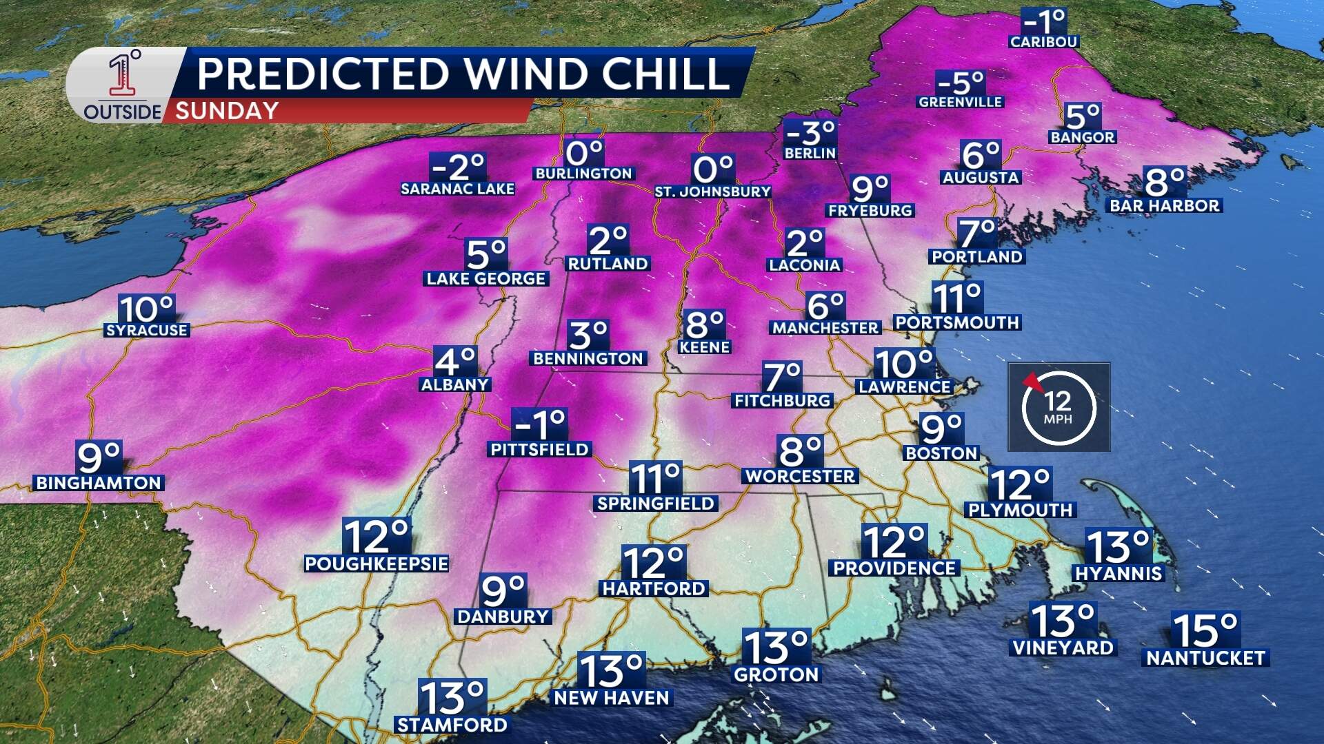
Sunday:
- Temperature: The northern part of the state should expect 10 to 15 degrees for a high, while the southern part could reach 20 degrees. Overnight lows below 0 could mean frozen pipes in poorly insulated buildings, particularly in northern New England.
- Wind: The wind chill will reach single digits south of Boston. It'll be below zero across northern New England with some areas seeing wind chills as cold as -10 degrees.
A white Christmas?
The holiday week has multiple chances for snow and rain showers across the region, particularly on Tuesday — Christmas Eve:
- Precipitation: Accumulating snow is likely in northern and central New England. Southern New England could see rain mixing with snow.
- Timing: Specific details will become clearer as we approach the event, but many areas have a solid chance for a white Christmas.
