Support WBUR
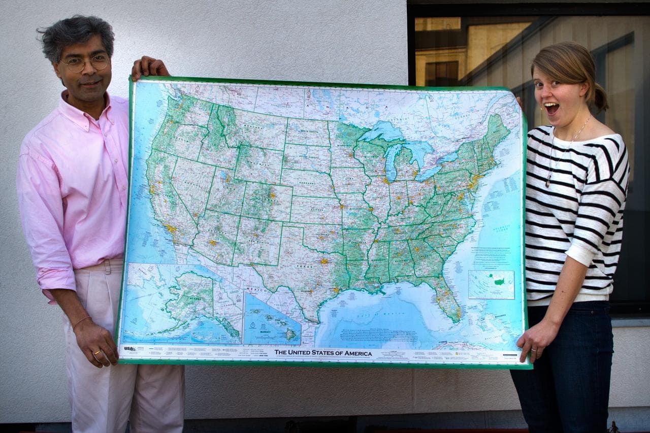
'The Greatest Paper Map Of The United States You'll Ever See'
Have you ever been completely enthralled by a map?
Many of us at Here & Now were mesmerized recently when we unraveled a new map of the U.S by Dave Imus. We ogled at the details! Pointed out familiar landmarks. Marveled at our utter lack of geographic awareness. OK, we're public radio nerds, but we aren't alone in our appreciation of a good map.
Slate magazine calls Imus' cartographic work of art, "The Greatest Paper Map Of The United States You'll Ever See."
What's all the fuss about?
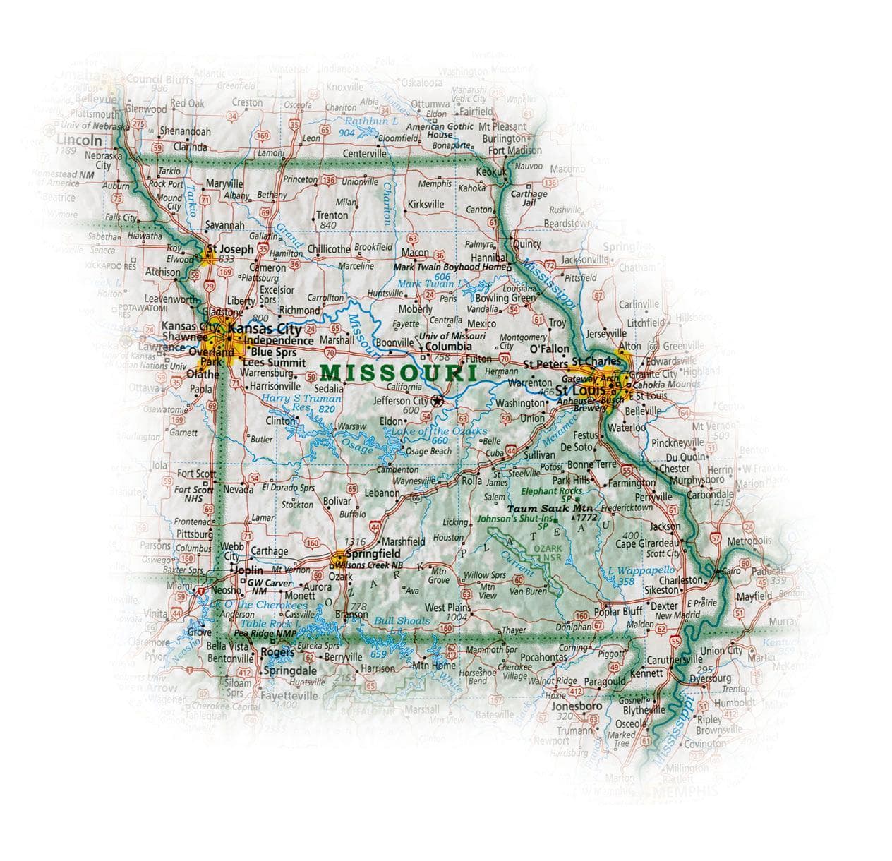
"What I did different than anybody else who ever made a map of the United States was that I brought into focus... the basic geography," Imus told Here & Now's Robin Young. "People that read this map or look at it on the wall can understand and appreciate more deeply the character of the United States... the lay of the land."
"We can distinguish one state from another by its unique geographic character instead of by these arbitrary colors that one might assign to them."
Cartographer Dave Imus
Imus spent hours picking the levels of colors and shading. For instance, the large population centers pop with a bright yellow, but on the outskirts of big cities, the yellow becomes more diluted until it fades out completely.
Instead of just coloring mountain ranges the standard brown, Imus used more subtle shading to mark higher versus lower elevations.
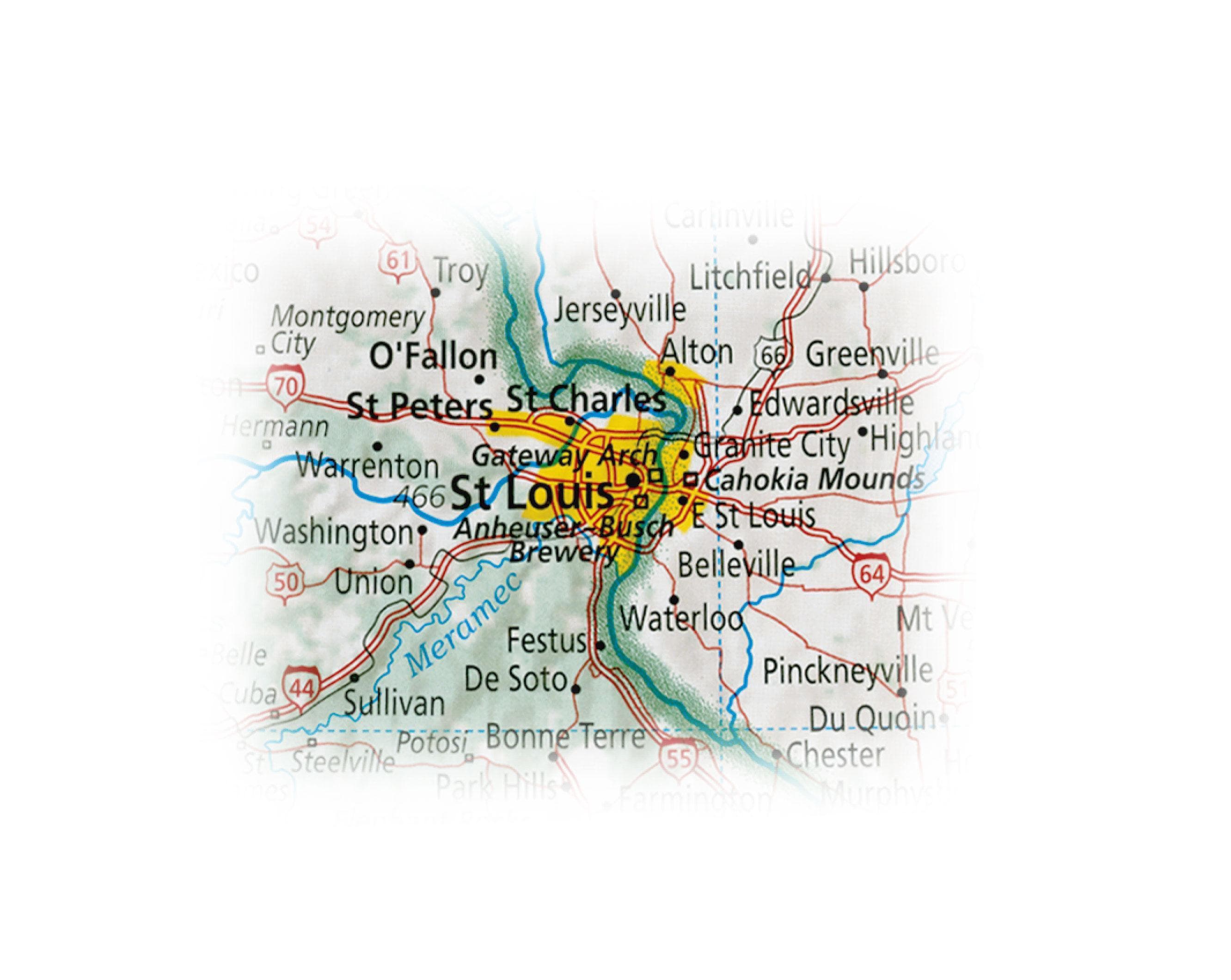
And, bucking tradition, he did not make each state a different color.
"We can distinguish one state from another by its unique geographic character instead of by these arbitrary colors that one might assign to them," he said.
Editorial Judgements
Imus also made a lot of editorial choices. He omitted some Chicago suburbs, so he could include the Chicago Cub's Wrigley Field.
Imus explained, "If you are looking at a map of Egypt and it had a bunch of towns on it, but didn't include the pyramids, wouldn't you say, 'Hey, wouldn't the pyramids have told us something about Egypt?"
It was no small feat for Imus to make this map.
"I worked on it seven days a week, 10 or 12 hours pretty much every day for two years," he said.
Imus' map won top honors at last year's Cartography and Geographic Information Society Competition.
Guest:
- Dave Imus, cartographer of Imus Geographics
This segment aired on January 26, 2012.