Support WBUR
Forecast: Rapidly Intensifying Nor'easter Hitting Mass. Late Thursday
Any clouds this morning will quickly depart leaving us with a mostly sunny and pleasant day. Temperatures will be seasonably chilly, but certainly not very cold by winter standards.
Tonight is dry with no weather problems. Temperatures will fall to the 20s, and again, this is all about what you'd expect for late December.
A storm will approach the area from the south and west on Thursday, however. At first, warm air will be pulled into the system causing it to rain along the coast up to 20 or so miles inland. Further west, snow will mix with the rain, while even further north and west, up to northern Worcester and Franklin Counties, an all-snow event is in store.
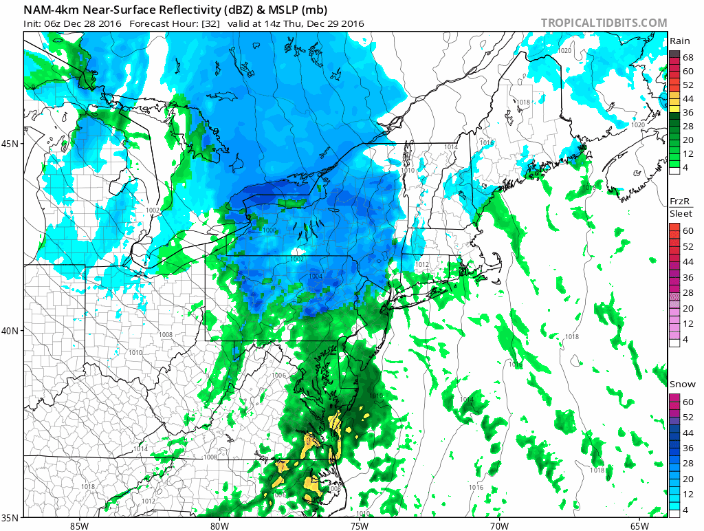
As the storm becomes stronger Thursday night, colder air will be pulled back into the system. This is when the rain/snow line will move back toward the coast, likely never reaching Boston in time for much, if any, accumulating snow.
The challenge for other forecasters and me is determining just how much cold air ends up getting back into the system as it pulls away early Friday. It's unlikely Boston is going to get more than a coating to a half an inch of snow. The areas where snowfall could be as little as that or end up with a few inches are near Route 128 and especially toward Route 495.
The snowfall totals you see on the map below could be off by a few inches depending on the exact evolution of the storm. If the warm air wins out, those closest to the Worcester to Lawrence line will see less snow than I am forecasting right now.
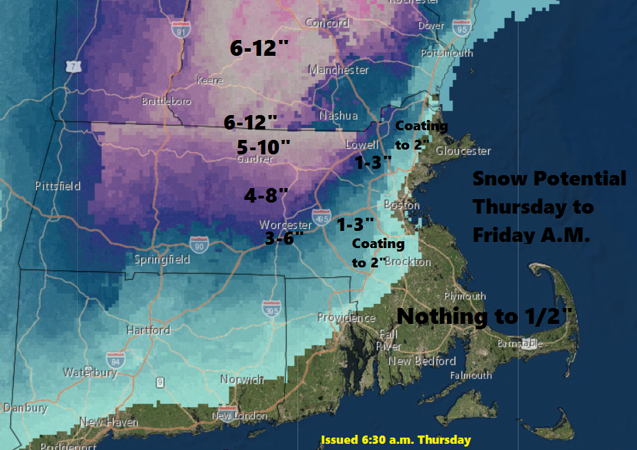
The Thursday evening commute will be impacted the most by the storm. By Friday morning, it will be over. In addition to the heavy, wet snow, winds may also be strong enough to cause some power outages in certain areas.
The system winds down on Friday, with clearing skies and blustery conditions.
You can follow my weather updates on Twitter at @growingwisdom.
Wednesday: Becoming mostly sunny. Highs in the upper 30s.
Wednesday Night: Clear to partly cloudy and chilly. Lows 22-30.
Thursday: Clouding up, snow and rain developing Thursday afternoon and evening. Heavy snow well inland at night, rain at the coast. A mixture of precipitation across the interior. Highs in the mid- to upper 30s.
Thursday Night: Rain at the coast, heavy snow over central and northern Massachusetts and much of northern New England. Lows 29-35.
Friday: Partly sunny. Highs in the upper 30s.
Saturday: Sunshine and chilly. Highs near 30.
