Advertisement
Forecast: Record Warmth This Week
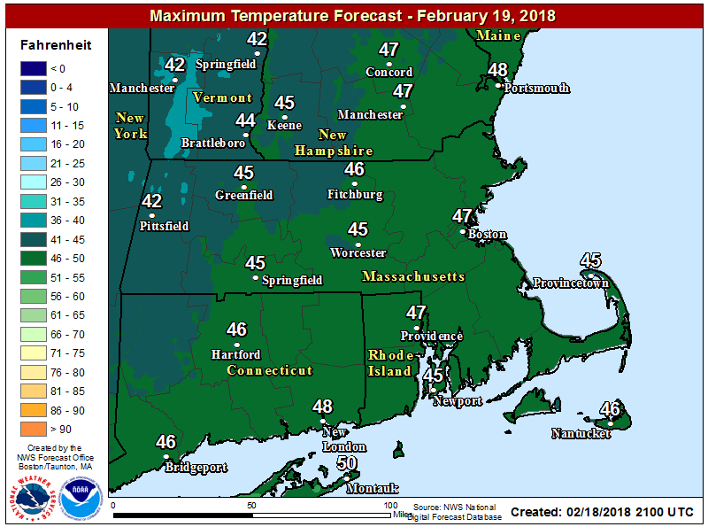
Yesterday's snow storm is long gone and much of it has melted. With temperatures today getting back into the 40s and some rain showers expected tonight, the rest should melt quickly.
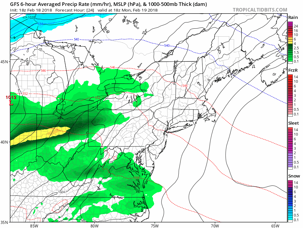
A warm front is moving northward today and will thicken the clouds and bring the chance for showers overnight tonight. Behind this warm front, record-breaking temperatures are coming our way. You can see the showers move in overnight below.
Record-Breaking Highs Again
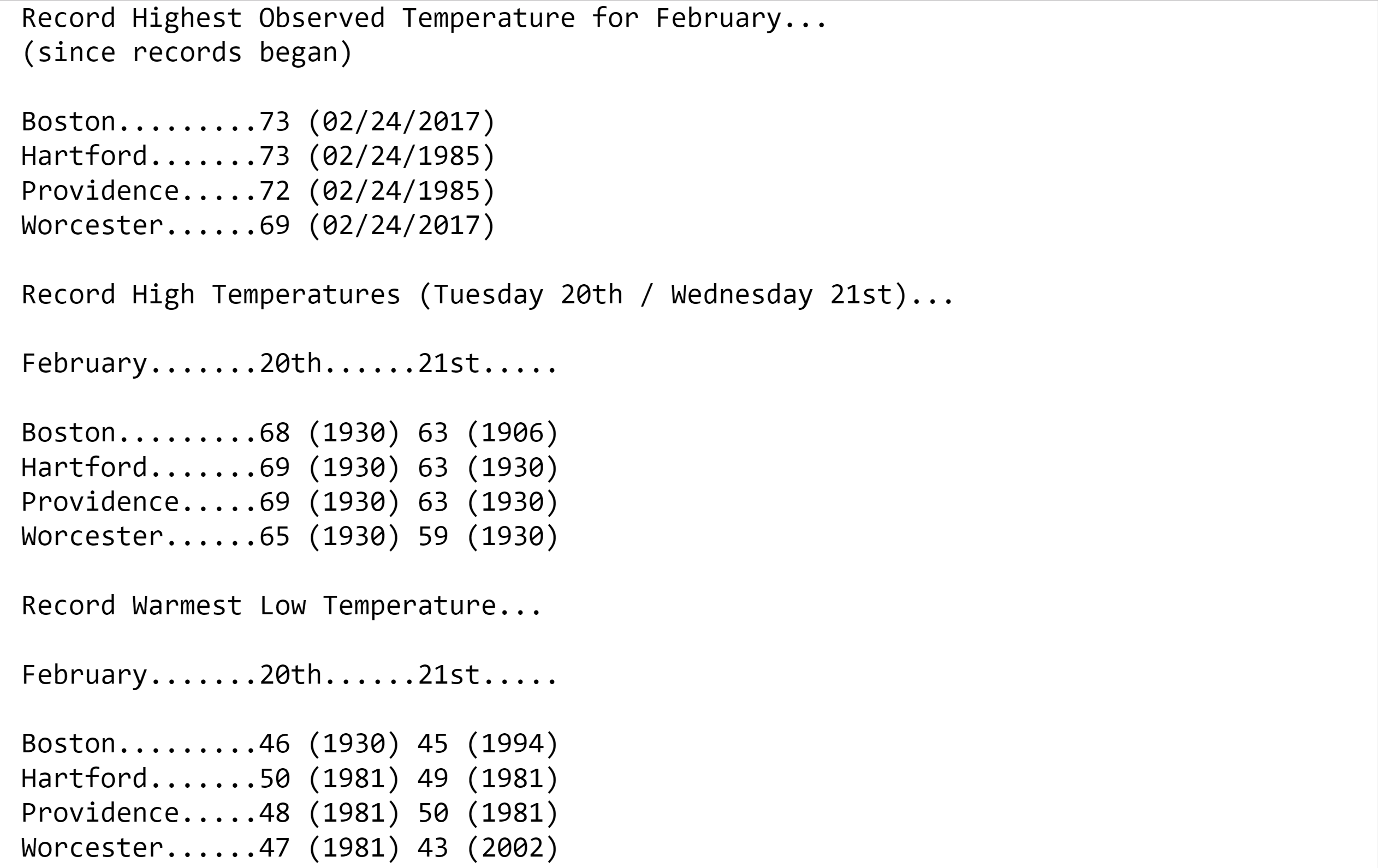
This same week last year saw high temperatures reaching the 70s across much of New England. In Boston, records have been kept in since 1872, and the only time we've seen a 70 degree reading prior to last year was back in 1985.
Now it looks as though we're going to do it for a second year in a row. On the one hand, this is a welcome treat, but it shouldn't be lost on any of us that seeing this kind of warmth two years in a row has potential bad consequences. This is especially true for those industries that depend on winter cold and snow.
Record warmth is possible Tuesday and highly likely on Wednesday. The records for Wednesday's date are actually a few degrees colder, and predicted highs will be a few degrees warmer, making it that much more probable February 2018 will see some of the warmest readings ever.
There is a frontal system poised to cross the area for Thursday and that drops temperatures back too more reasonable levels, but still above average for this time of year.
I don't think that this upcoming warmth will harm the apple or peach crops because the fall was cold enough that the trees are pretty dormant by now.
You can follow my updates here and on Twitter @growingwisdom.
Monday: Early sunshine. Then a lot of clouds, late day showers. Highs in the 40s.
Monday Night: A few showers, very mild. Lows 41-46.
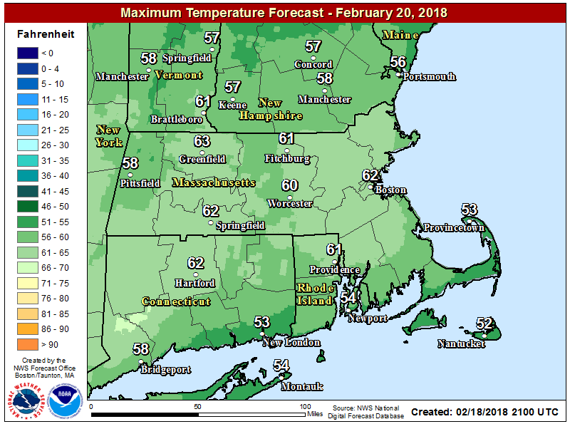
Tuesday Clouds, mild. Maybe a morning shower or two. Highs 58-63.
Wednesday: Record warmth with clouds and sunshine. Highs 65-72.
Thursday: Mild, but not as warm. A few showers. Highs in the mid to upper 40s.
Friday: Sunshine and some clouds. Highs 39-45.
