Advertisement
Forecast: Mild Today, Winter-Like Thursday
With the exception of some gusty winds this afternoon, it's going to be a very mild day with temperatures getting into the 60-degree range. This mild air is ahead of a cold front which will slip through later this afternoon and overnight, ushering in the coldest air of the fall season.
Look for lots of sunshine today, although I can't rule out a quick sprinkle as that frontal system approaches this afternoon. Winds will be noticeably gusty but not as strong as Monday night, when there was actually some tree damage.
Temperatures this time of the year average in the upper 50s and lower 60s, but tomorrow they will stay in the lower and middle 40s. That is more typical for early December.
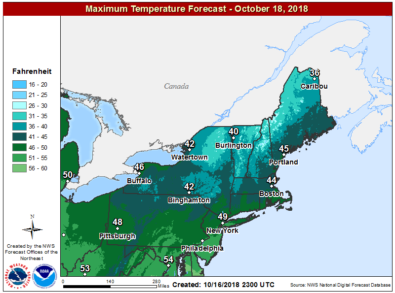
As I've been saying much of this week, this could be the coldest high ever recorded on Oct. 18. The cold won't last very long, although we will start very chilly on Friday morning with many areas below freezing. This cold will put an end to the growing season with tomatoes, peppers and basil also coming to the chilly temperatures. I expect a nice rebound Friday afternoon with readings getting back into the 50s to around 60.
The weekend is split in terms of temperature. Saturday readings will get near 60 degrees and although there is the chance for a couple of showers, I don't expect much in the way of rain, and it should not be as wet as last Saturday. After the frontal system passes Saturday night, skies will clear and Sunday looks blustery and chilly with reading struggling toward the 50-degree mark. They will remain below average on Monday next week as well.
You can follow my updates here and on Twitter @growingwisdom.
Wednesday: Mostly sunny, a quick afternoon sprinkle with a high around 60. Still very breezy.
Wednesday Night: Some clouds, an early snow shower over the hilly terrain, otherwise clear. Lows 32-39.
Thursday: Partly sunny and chilly. Highs in the mid-40s. Blustery.
Friday: A cold start. Partly sunny, with a high 55-60.
Saturday: Perhaps a few showers with clouds and a few breaks. Highs around 60.
Sunday: Cooler and blustery. Highs in the upper 40s to near 50.
