Advertisement
Winter storm brings poor road conditions, just in time for morning commute
Resume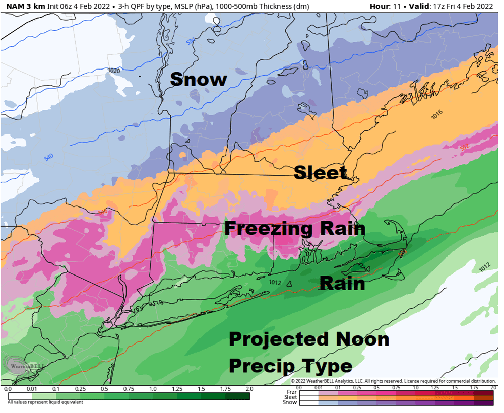
It was just a week ago where we were getting ready for a blizzard. Today, we're getting ready for ice.
Temperatures early Friday morning are well above freezing across most of the area, but are going to get significantly colder in the coming hours.
By 8 a.m., the freezing line should be somewhere around the Mass. Pike and then continue to push south.
For those of you on Cape Cod and the Islands, this is not a big deal. As a matter of fact, it may stay above freezing the entire day, with a little bit of icing this evening before the precipitation ends.
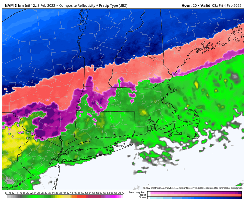
Across the rest of the area — especially the northern two-thirds of Massachusetts and southern New Hampshire, Vermont and extreme southern Maine — travel will be difficult later this morning and throughout the afternoon.
At first, the rain will start freezing on walkways and trees and your car. Eventually, as it gets cold enough, those raindrops will be coming down as sleet pellets or little balls of ice. Some people may even refer to it as hail, but that's actually a completely different type of precipitation formed in thunderstorms.
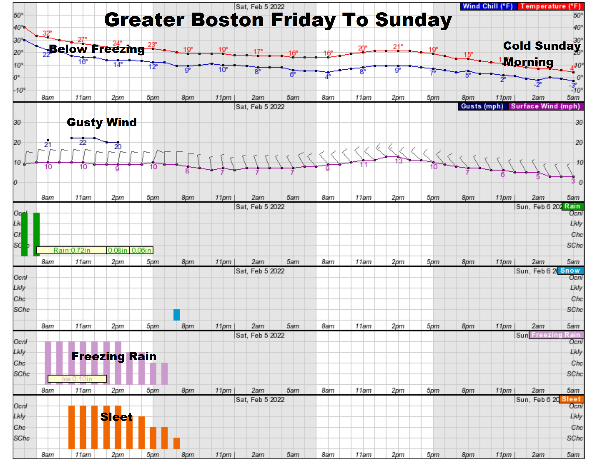
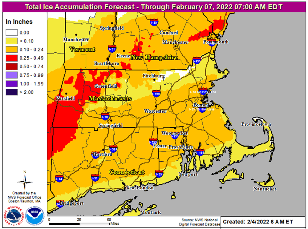
Once the changeover from freezing rain to sleet occurs, crews will be able to treat roads more effectively. Freezing rain encapsulates the melting products, rendering them somewhat ineffective but sand, salt and calcium can go on top of the sleet, keeping roadways safer.
The reason freezing rain is so problematic is because ice has very little friction and renders the traction you need between the road and your tires ineffective. Your brakes may stop your wheels, but your car's still going to slide across the ice. Four-wheel drive or not, the car will not stop.
During the early afternoon, the freezing rain will transition to sleet from north to south. Once this occurs — while it still will be slippery — it's actually easier for the roads to be successfully maintained.
Temperatures will continue to tumble overnight under clearing skies, with readings in the teens. It will be cold on Saturday and Sunday. If there are clouds Saturday morning, it will become sunny with a blustery breeze and temperatures only in the low to mid-20s.
It remains in the 25 to 30 range on Sunday, with less wind. Temperatures will warm a bit to above freezing during the work week, with no storms for now.
