Advertisement
Boston could see up to 1 foot of snow on Friday
ResumeThe temperature reached 69 degrees at Logan Airport on Wednesday for a new record high. Now, it's cold again and a snowstorm is coming.
The snow will start in the early morning hours Friday. By the time the sun is up, there will already be up to 4 inches on the ground in some spots. I expect snowfall rates of 1 to 2 inches per hour early Friday, making travel difficult.
If you can work from home on Friday, that's the best idea. There will be delays at Logan Airport and some ferry service may be interrupted. The evening commute will likely be better.

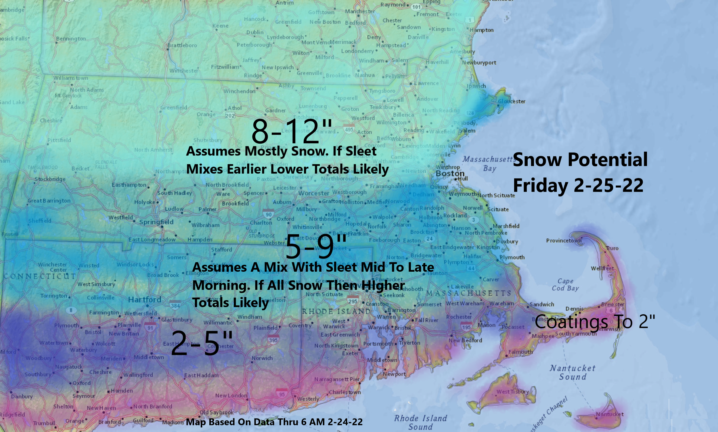
The snowfall map below shows how much I'm expecting during the storm. There are a couple of important assumptions made in this map: The first is that sleet will not mix with snow north of the Mass Pike. The second is that sleet will mix in just south of the Pike. Since the snow will be coming down at up to 1 or 2 inches per hour, the exact time the mixing occurs will have implications for snow totals.
If there's no mixing in Boston, the city could end up with 10 to 12 inches of snow. But if mixing occurs a little earlier, it could be closer to 5 to 8 inches.
As cold air works back into the system, the precipitation will change back over to snow before ending. Although most of the snow will have fallen by roughly 1 p.m., there can be some light accumulation of 1 to 3 inches after that. The afternoon snow will be lighter and fluffier than the morning.

Skies will clear for the weekend; temperatures on Saturday will be in the lower 30s and into the mid- to upper-30s by Sunday.

This segment aired on February 24, 2022.
