Support WBUR
Irene Brings Widespread Outages, Flooding To Mass.
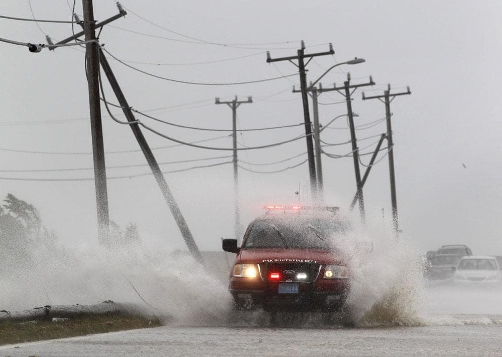
Tropical Storm Irene moved through Massachusetts Sunday afternoon, leaving in its wake hundreds of thousands of power outages, extensive tree damage and flooded areas. While 21 deaths were attributed to Irene along the East Coast, there were no fatalities or serious injuries reported in Massachusetts.
As of 9:00 p.m. Sunday, more than 600,000 residents were without power statewide, according to the Massachusetts Emergency Management Agency (MEMA). Agency spokesman Scott MacLeod said it could be as long as a week before the outages are fully restored.
"We're certainly going to be dealing with trying to restore power over the next several days," MacLeod said. "So the big message is to be safe, be patient."

"At first light [Monday], we will have an army of crews out doing restoration and damage assessment across our affected service area," National Grid's Jackie Barry said.
In eastern Massachusetts, state emergency officials and forecasters were keeping an eye on the potential for a storm surge following evening high tide on the south coast.
"[High winds] could present a problem with the tide driving in by the wind," said meteorologist Mark Rosenthal. "There could be some low-lying coastal flooding. I don't think it'll be as bad as it was [Sunday] morning, but we really need to follow that."
Wind gusts up to 72 mph were reported at Fairhaven in southeastern Massachusetts at midmorning Sunday, the National Weather Service reported.

WBUR’s Curt Nickisch, reporting from Fairhaven, said the wind “literally takes your breath away,” but that didn't stop people from coming out to get a look at the storm. He reported that at one point spectators had to lay down on the ground because the wind was so strong.
"We got a lot of wind damage," said Scott Shippy, building commissioner in nearby Marion. "It could have been worse — could've been a lot worse."
Western Massachusetts, which received higher rainfall totals, bore the brunt of flooding from Irene. People were evacuated for flooding in the Berkshire County towns of Otis, Chester and Huntington, state police said. The Robin Hood Lake Dam in Berkshire County spilled over, according to officials.
Widespread rainfall of 3 to 6 inches was forecast Sunday, with up to 10 inches in the eastern slope of the Berkshires.
Morrissey Boulevard in Dorchester was among many roadways that experienced some flooding late Sunday morning.

In Boston, the MBTA suspended service on Sunday morning to avoid the storm and prepare to resume commuter service on Monday. T GM Richard Davey told WBUR the goal is for “seamless rush hour service” Monday morning.
Logan International Airport remained open, but no flights were scheduled. Massport, which operates the airport, said normal service should resume midday Monday.
Though Gov. Deval Patrick asked motorists to stay off the roads Sunday, tolls were suspended on the Massachusetts Turnpike until 10 p.m. Sunday. The bridges to Cape Cod remained open, as Patrick said Saturday they would be closed if sustained winds reach 70 miles per hour.
Irene was downgraded from a Category 1 hurricane Sunday morning when the system's winds fell to 65 mph, below the 74 mph dividing line between a hurricane and tropical storm. The system was still massive and powerful, forming a six-shaped figure that covered the Northeast. It made landfall at Coney Island in New York and was moving at 25 mph, twice as fast as the day before.
With reporting by The Associated Press and the WBUR Newsroom
More Irene Coverage:
This article was originally published on August 28, 2011.
This program aired on August 28, 2011. The audio for this program is not available.