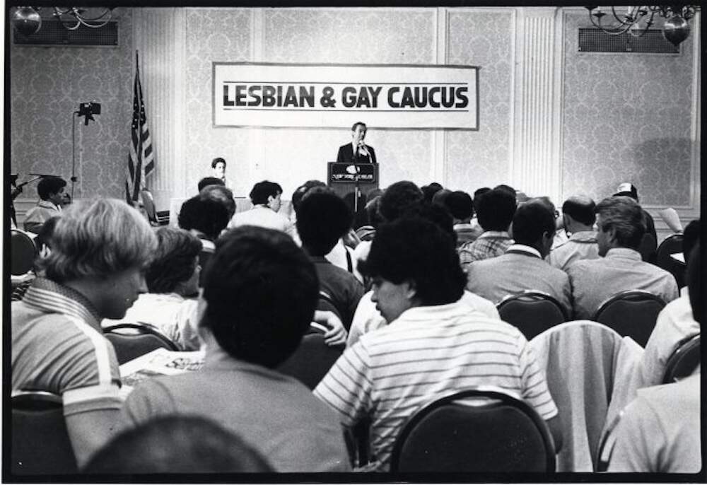
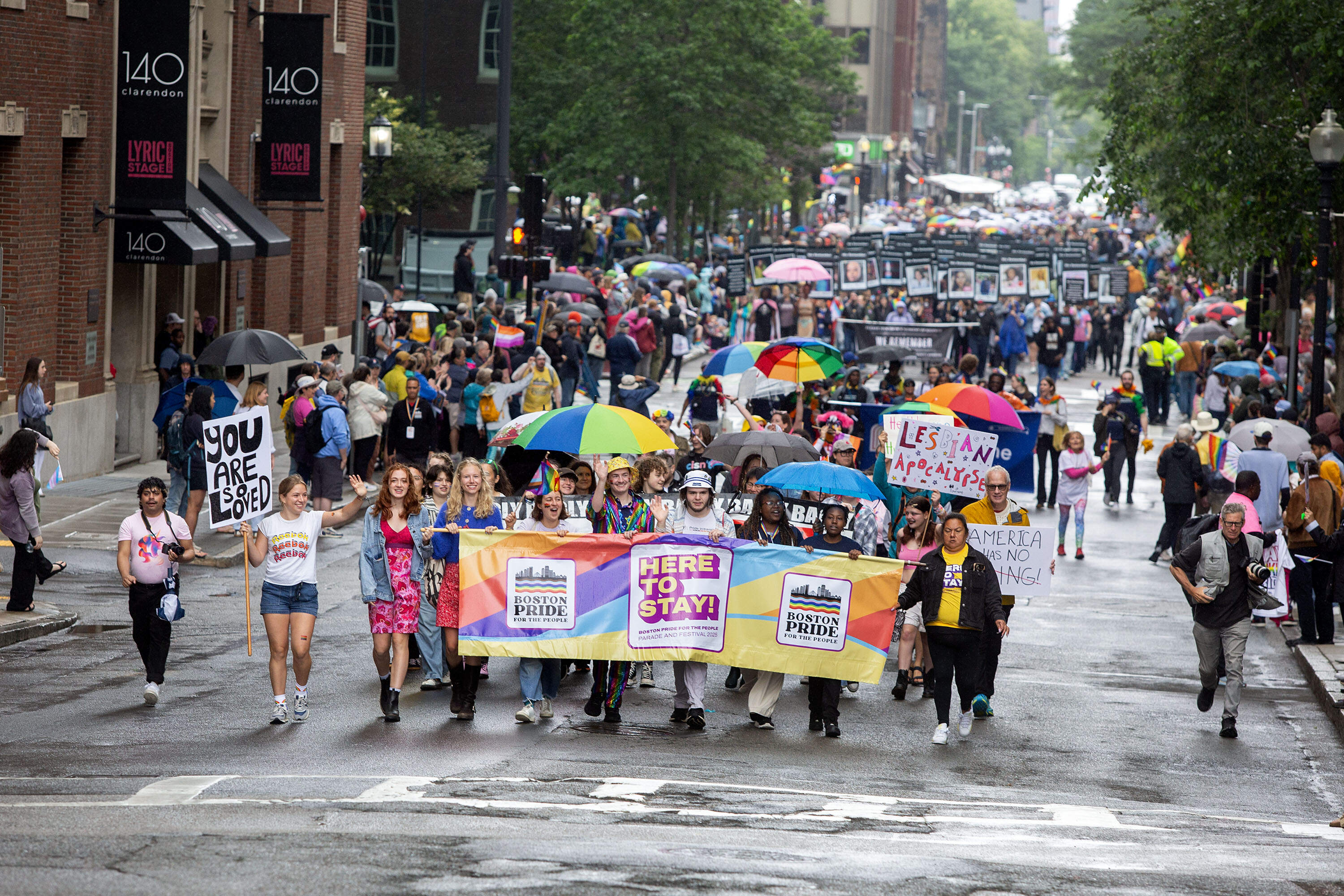
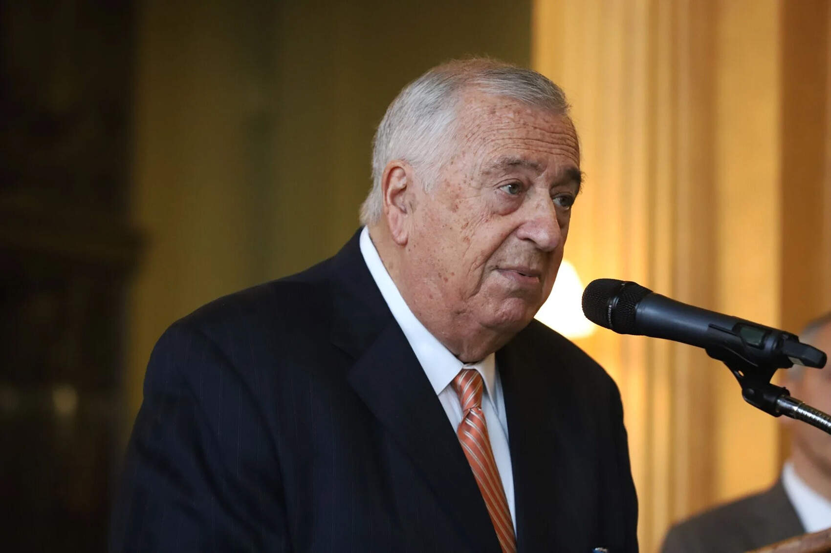
Listen Live! Link to Schedule Link All Shows Link to Archives
  Home
Search


WBUR Newsroom
Election 2008
CommonHealth Blog
Boston Weather
BBC World News
NPR Top Stories
NPR's Morning Edition
NPR Topics: Books
NPR Topics: Movies
Fresh Air
All Things Considered
Marketplace
Submit a Story Idea


RSS Feeds
Podcasts


In the Zone
By Bianca Vazquez Toness

Listen to story (Real Audio)

Mike Nakagawa, outside his North Cambridge home, is appealing a new flood zone map. (Photo: Bianca Vazquez Toness)
NORTH CAMBRIDGE, Mass. - August 12, 2008 - Some residents of Cambridge have learned this summer that they live in a high-risk flood zone.

A federal agency has updated its maps of high-risk areas, and that means more homeowners may soon be required to pay for flood insurance. The policies would cost between and $1,000 and almost $3,000 a year.

WBUR's Bianca Vazquez Toness has more on the story.

BIANCA VAZQUEZ TONESS: The "Great Swamp:" That's what much of North Cambridge used to be called. Developers filled in the wetland about a hundred years ago, built houses and in more recent years, the Alewife T station.

It's still a little swampy in some places. Imagine a giant funnel that collects rain water from Belmont and Arlington and channels it through the floodplain of north Cambridge.

Mike Nakagawa kept this in mind when he was looking for a house 10 years ago.

MIKE NAKAGAWA: It's a big commitment to get a house in Cambridge.

VAZQUEZ TONESS: He and his wife ruled out houses directly in the flood plain. Realtors are required to notify potential buyers if a house is in a high-risk area. Nakagawa and his wife chose a two-story bungalow considered by the Federal Emergency Management Agency to be at low risk for flood.

But then FEMA drew up new maps for the first time in 30 years.

NAKAGAWA: I was highly annoyed because we had spent effort trying to do what we thought was the right thing.

VAZQUEZ TONESS: FEMA now says Nakagawa's property is in a high-risk flood zone. And there's a 25 percent chance that his house will have serious flooding over the course of his 30-year mortgage. So, once Cambridge accepts the new flood maps, he's required to get insurance.

Same is true for half of the people on Nakagawa's street, and more than 100 property owners in North Cambridge. If they still have a mortgage on their homes, they'll have to pay up to $2,600 a year for flood insurance.

EVA DOUCETTE: I just don't like it.

VAZQUEZ TONESS: Eva Doucette says she owns her home outright, so she's not required to get flood insurance. But she's still skeptical.

DOUCETTE: I've been living here 39 years and I?ve never been flooded out.

PAUL MOREY: If you haven't seen a flood in 30 years does not mean its not going to flood -- whether it's tomorrow, or whether it's 10 years from now, whether it's 20 years from now.

VAZQUEZ TONESS: Paul Morey works in Boston's FEMA office and is in charge of explaining the new maps and insurance requirements to residents. He says one reason history isn't a great indicator of future floods is that the landscape has changed.

The land funneling water into North Cambridge is increasingly paved, or grassed over, and that stops the soil from soaking up rain water. So Morey says the water will slide down to North Cambridge and could create faster and deeper floods.

MOREY: We do know through science that these areas that are mapped as 1 percent annual chance areas are at the highest risk of flooding, and it?s imperative that people understand that and know what do to protect themselves and communities.

VAZQUEZ TONESS: Cambridge will likely adopt the map by next spring. In the meantime, the city and residents can appeal or challenge the maps.

Mike Nakagawa and his neighbors want to amend the section of the map detailing their properties. They believe their land is higher than the flood zone and are paying a land surveyor thousands of dollars to prove it. If they succeed, it could save them from drowning in insurance bills.

FOR WBUR, I'm Bianca Vazquez Toness.


RELATED LINKS


City of Cambridge info about updated flood map

Government guide for appeals re: maps

National Flood Insurance Program


   From The WBUR Newsroom

Councilor Turner Says He's Locked Out Of Office
BOSTON (November 21, 2008) Boston City Councilor Chuck Turner says the City Council president has locked him out of his office after getting arrested on federal corruption charges.
Some Roxbury Residents Shocked By City Councilor Turner's Arrest
BOSTON (November 21, 2008) Some Boston residents are shocked and dismayed by City Councilor Chuck Turner's arrest on federal corruption charges.
Turner Previously Linked to Wilkerson Case
BOSTON (November 21, 2008) Boston City Councilor Chuck Turner, arrested Friday by the FBI, had previously been linked to the federal investigation into public corruption involving former State Sen. Dianne Wilkerson.
Boston City Councilor Chuck Turner, seen in an undercover video still, allegedly accepts a cash bribe from an FBI informant. Turner was arrested Friday on federal corruption charges. <strong><a href="/news/2008/turner/turner-exhibits.pdf">See the images (PDF)</a></strong>Boston City Councilor Chuck Turner Arrested In Connection With Dianne Wilkerson Case
BOSTON (November 21, 2008) FBI agents arrested Boston City Councilor Chuck Turner after he was allegedly videotaped taking a $1,000 bribe from an undercover agent in an expanding investigation into corruption at City Hall and the Massachusetts Statehouse.


Sponsor
spacer
NPR spacer BBC spacer PRI spacer CopyrightBoston UniversityFAQContact UsPrivacy StatementSite Map