Support WBUR
4 Reasons Why Sandy Could Be 'The Perfect Storm' For New England
The National Weather Service in Taunton released a statement Thursday morning saying that it is confident the New England region could see a close pass or direct hit from Hurricane Sandy by late Monday. By then, Sandy is supposed to be a tropical or post-tropical storm.
According to NWS, the increase in confidence is due to the narrowing down of three computer models of Sandy’s trajectory to two models, which both place the impact of the storm on New England, but to varying degrees. The worst-case scenario, however, could create terribly destructive conditions. Here are four reasons why meteorologists are saying Sandy could become “the perfect storm” for New England.
1) A Low-Pressure Trough Coming From The West Could Energize Sandy
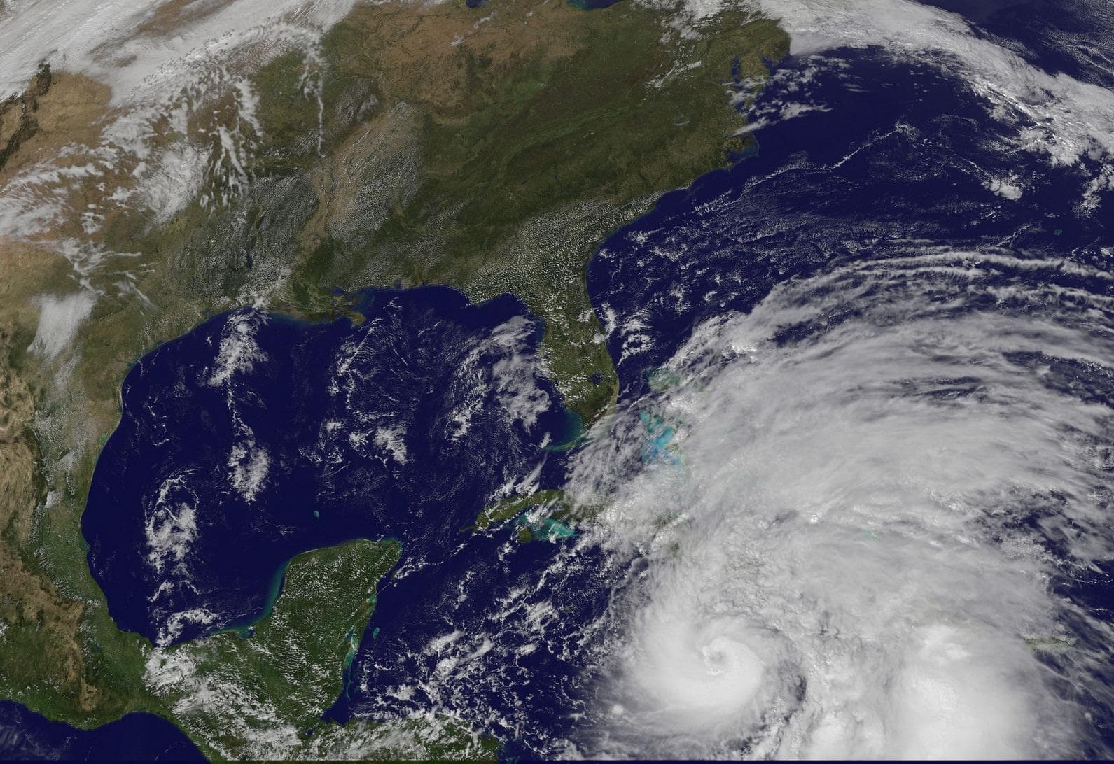
As Hurricane Sandy exits Cuba and moves toward us, a low-pressure trough from the West is headed our direction as well. The energy from the east-moving trough is likely to interact with Sandy, in the process energizing the storm as it approaches.
This would create an environment that Sandy would thrive in, increasing its strength as it moves up the coast.
2) A Dip In The Jet Stream Would Allow Sandy To Piggy-Back North
As a dip in the jet stream from the aforementioned trough brings down dry air that will increase Sandy’s strength, the dip will also carry Sandy north, maintaining its strength all the way up the East Coast. Weather Underground had this to say:
The highest winds will likely be at or just below hurricane strength, but over a larger and larger area. It looks like Sandy will ride the Gulf Stream a long way north, so it should be able to maintain its strength as it passes the Carolinas with similar effects to Florida, but a longer duration of wind.
3) A Pressure-Blocking System West Of Greenland Will Prevent Sandy From Continuing North
Normally, a storm like Sandy would continue heading north as it moves to the mid-Atlantic region, says NWS meteorologist Charlie Foley. Instead, the effects of the blocking high-pressure system west of Greenland mean that Sandy will be forced to move either left or right.
“We don’t think it’s going to make a right turn out to sea,” Foley said. “We think a left turn on the coast or near the coast is a bigger possibility.”
4) The Full Moon Will Create Astronomical High-Tides
Sandy is already expected to create destructive storm surges. Combine that with the above-normal astronomical tides, and the chances of coastal flooding increase. But, while the full moon does have an impact, according to Foley, it likely won’t be the major contributor to damage done in the region.
"Fortunately at this time the astronomical tides are above normal, but they are not as high as they could be," he said. "That could be a contributor but they won't be a major contributor.”
The storm is expected to reach the mid-east Atlantic and/or the Northeast U.S. between Sunday and Wednesday, and while some computer models estimate minimal damage to the East Coast, Foley urges that this could potentially be a storm for the record books.
"If, in fact, all these things phase together," Foley said, "if Hurricane Sandy is in a position when the jet stream is actually moving over and going to capture it, and this storm moving east to west also gets involved with that energy and combines, then all these factors would make for a perfect recipe for probably a historical storm."
This program aired on October 25, 2012. The audio for this program is not available.