Support WBUR
Boston Forecast: 'It's Just Going To Go Crazy Around These Parts'
Hurricane Sandy is expected to make landfall on the eastern seaboard Monday night. Meteorologist Mark Rosenthal said the Greater Boston area could start feeling Sandy's effects as early as Sunday evening, with the bulk of the wind and rain assaulting the area on Monday:
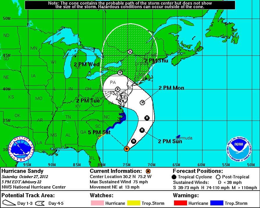
As of 5 a.m. Sunday, the storm was located about 260 miles due south-southeast of Cape Hatteras, N.C. It's moving northeast at about 13 miles per hour. It will continue to move northeast for the next 24 hours, but by midday on Monday it's going to start to turn left. That means the old left hook is coming, which is going to bring it into southern New Jersey by late Monday night.
There's still some variance in some of the computer models, but I'm thinking the storm moves northeast, cuts up about 100, 150 miles south of Block Island, and then takes as sharp hook, moving south of Block Island right into the Jersey Shore. So we're going to be in a very strong wind belt, the rain belt. We're still talking about serious coastal flooding along with numerous power outages.
Sunday night we'll have rain getting steadier and heavier. The winds are going to start to increase from the northeast at 20-40 miles an hour. Once again, by the time we get into the shank of the day on Monday, the wind in Boston could gust over hurricane force.
This sort of has shades of the "Perfect Storm," the Halloween storm of October 1991, when we had a cold air mass coming down and actually capturing old Hurricane Grace way out in the Atlantic Ocean. Now, at that time the upper level winds took the storm several hundred miles east of New England and brought it all the way back to Cape Cod.
This time the storm is coming up the coast. The cold air is going to mix with the warm air over the next 24-36 hours. And that's why we're going to call this a "hybrid storm." It's going to develop over the Gulf Stream and it's going to really intensify. That's why we're very nervous about all the flooding, the rain and the wind up in the New England area.
Certainly late Monday morning, all of Monday afternoon and Monday night, it's just going to go crazy around these parts with all the elements — the rain, the wind, the flooding, the whole nine yards. That could last into Tuesday morning. And even Tuesday, with a strong southeast wind and bands of rain coming through, it's not going to be a walk in the park.
This article was originally published on October 27, 2012.