Support WBUR
Forecast: Strongest Winds And Heaviest Precipitation End, But Storm Lingers Overnight
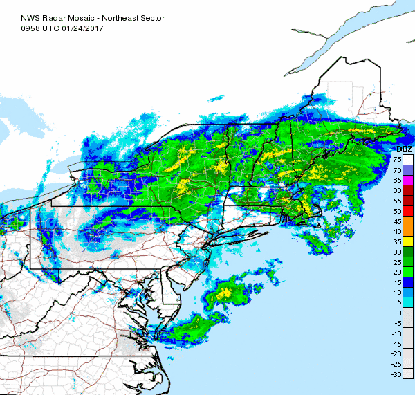
This morning we find a storm system — aka nor'easter — tucked under Long Island and moving northeast. The storm brought several inches of sleet and some snow mixed to north central Massachusetts with rain along the coastline.
As the storm spins, our lull in rainfall will end with more showers moving into the area later this morning and continuing through the evening.
Winds have subsided from overnight. While they will continue to be noticeable throughout the day, I don't expect any damage from the winds. The north shore will see the strongest winds, but even there, gusts will diminish throughout the day.
Across the far interior and areas along the New Hampshire border, freezing rain is still a concern.
Temperatures north of Worcester are still below freezing, so any precipitation that falls will freeze upon contact with the ground, trees or wires. It's a borderline ice storm situation. If you are headed to that part of the region today, conditions will be worse than in eastern and southern areas, where highs will remain above freezing.
Overnight, the storm will continue its progress out to sea and relinquish control of our weather. I can't rule out an early morning shower Wednesday, but the trend will be for clearing skies and above-average temperatures. Where sleet and ice fell, a good deal of melting will happen relatively quickly.
More tranquil weather continues through the rest of the week. It's mild for January through Friday, but temperatures return to more seasonable levels during the weekend. There won't be any storms, however.
You can follow David's weather updates on Twitter at @growingwisdom
Tuesday: Periods of rain. Freezing rain west of Route 495. Still windy at the coastline. Highs 32-38 inland, 38-44 along the south coast.
Tuesday Night: A few showers with lows in the low to mid-30s.
Wednesday: Early clouds, then a blend of sun and clouds. Highs 45-50.
Thursday: Mostly sunny and pleasant. Highs in the mid- to upper 40s.
Friday: Partly sunny and cooler. Highs around 40.
Saturday: Colder, but with sunshine. Highs in the mid- to upper 30s.
This segment aired on January 24, 2017. The audio for this segment is not available.
