Support WBUR
Forecast: Sunny Start To The Week, Stormy Weather On The Horizon
The weather this week will start on a beautiful sunny note. It's the end of February, but once again, it's going to feel more like April. Sunshine abounds the next several days, with temperatures in the low to mid-50s. There's even a chance on Wednesday that some areas could touch the 60-degree mark.
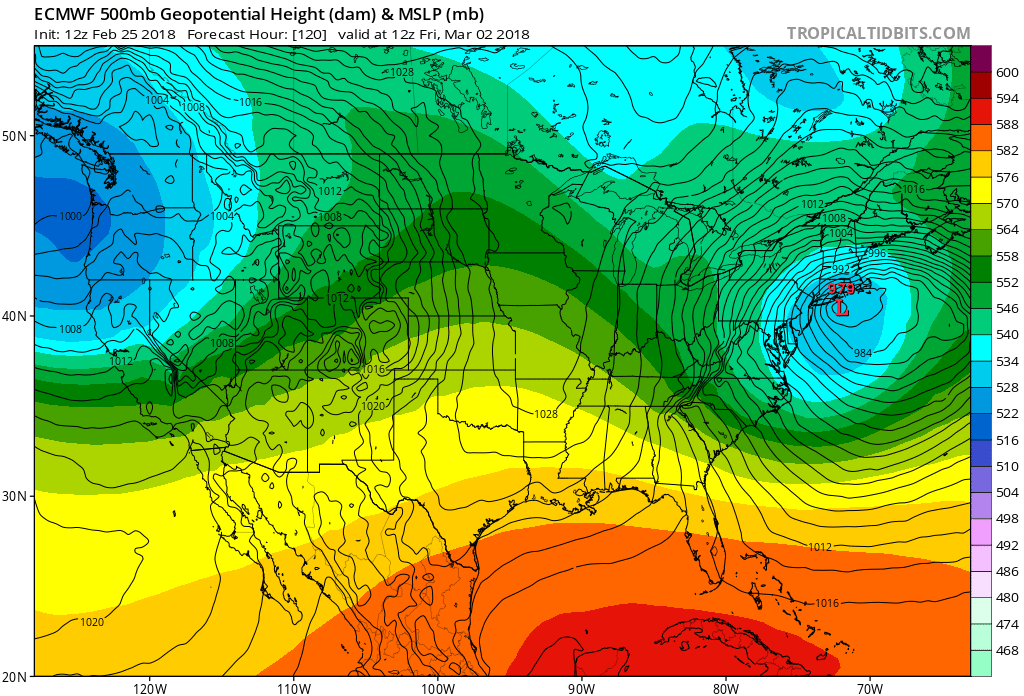
While all of this is going on, the upper level winds are about to undergo a major change. This shift will lead to a stormy and colder regime as we enter March. This upcoming scenario is going to evolve into what's called a blocking pattern. When this occurs, storms can develop along the east coast and move very slowly. This can lead to late winter storms, which produce a lot of precipitation.
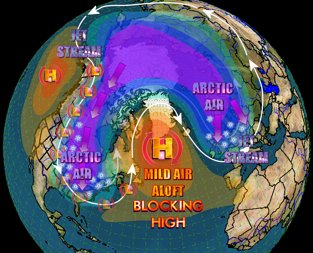
There's a lot of uncertainty with how a storm system will evolve at the end of the week. There's little doubt that a storm will form, but the exact track and the temperature profile is still questionable.
This means we could see anything from a lot of snow to a lot of rain or the whole thing could slip out underneath New England. If the storm does affect us we would see travel delays and the potential for coastal flooding with astronomically high tides occurring later this week.
Stay tuned to latest forecast and enjoy the wonderful weather we have over the next few days.
You can follow my updates here and on Twitter @growingwisdom.
Monday: Developing sunshine and mild. Highs around 50.
Monday Night: Clear and cool. Lows around 30.
Tuesday Sunshine, pleasant. Highs around 50.
Wednesday: Quite mild with sunshine. Highs 55-60.
Thursday: Mild, but not as warm. Sunshine dominates, with some clouds. Highs 48-54.
Friday: Rain is possible. Highs within a few degrees of 40.
