Advertisement
Forecast: March Arrives Like A Lion
The final day of the month and the final day of meteorological winter will certainly lend your thoughts towards a warmer season. There will be a lot of sunshine and temperatures this afternoon will be well into the 50s.
This will continue the slow green up of some lawns and the early spring bulbs will continue to poke through the ground. All is not perfect, however, as we have a nor'easter to contend with later this week.
Coastal Storm
I've been writing about the uncertainty of this storm for several days and there's still some questions. What we do know is that the storm will become very strong and will end up passing south of New England.
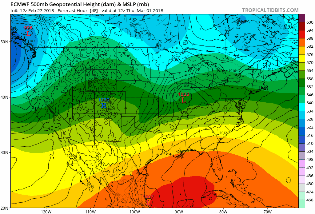
This particular track will bring a strong easterly fetch of wind, high seas and rough surf for several days, perhaps lasting up to four tide cycles. This means that the greatest threat from the upcoming nor'easter is actually coastal beach erosion and coastal flooding.
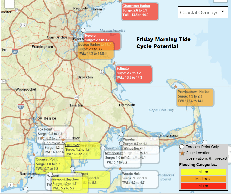
The map below shows the flooding potential for the Friday morning high tide. Notice the areas in red do have the potential for major flooding. This could be similar to the event we saw in January when parts of downtown Boston had water in the streets. We'll have a better idea of this later today and tomorrow. These things can be a bit tricky to forecast so I'll tend to err on the side of caution.
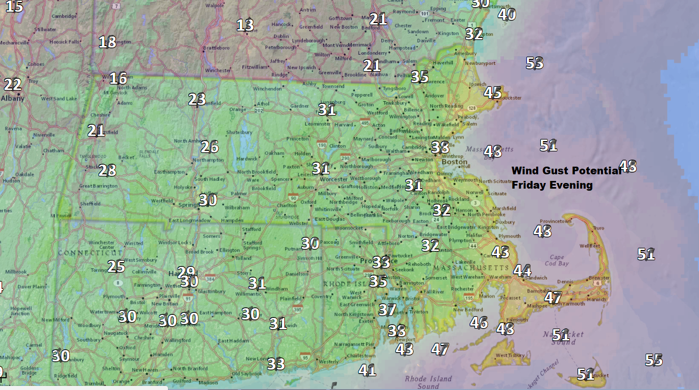
Winds will be increasing as well, with gusts more than 30 miles an hour along the coastline. In some places over Cape Cod, the wind could approach 50 miles an hour. If the storm tracks a little closer to the coast, than those wind forecasts will increase. This means there's the potential for power outages.
In terms of precipitation, the heaviest rain and snow will likely be south and west of Boston, but again with a storm so large and in close proximity, the forecast can change. If we are going to see precipitation the most likely time would be tomorrow night into Friday.
Friday night the rain may change to heavy wet snow, especially inland. This means an additional risk for power outages. I will have more on this treat Thursday.
It is going to be colder starting Friday and temperatures will be seasonably chilly as we enter the month of March. This means no more 50s for awhile, so enjoy the sunshine and spring-like temperatures for today.
You can follow my updates here and on Twitter @growingwisdom.
Wednesday: Quite mild with sunshine. Highs 55-60.
Wednesday Night: More clouds, may shower late at night. Lows 37-41.
Thursday: Mild, but not as warm. Sunshine dominates, with some clouds. Highs 48-54.
Friday: Rain is possible. Highs within a few degrees of 40. Windy.
Saturday: Cloudy, some early showers or some wet snow. Highs 38-43 Windy.
Sunday: Partly cloudy, chilly. Highs around 40.
This segment aired on February 28, 2018.
