Support WBUR
Today's Weather: Wind Chills Below 0 For Many Parts Of Greater Boston
The snow squalls last evening ushered in an arctic air mass that will be with us through Friday morning. It's been awhile since we've had snow squalls of that intensity and some places like Fitchburg had two inches of snow in a very short period of time.
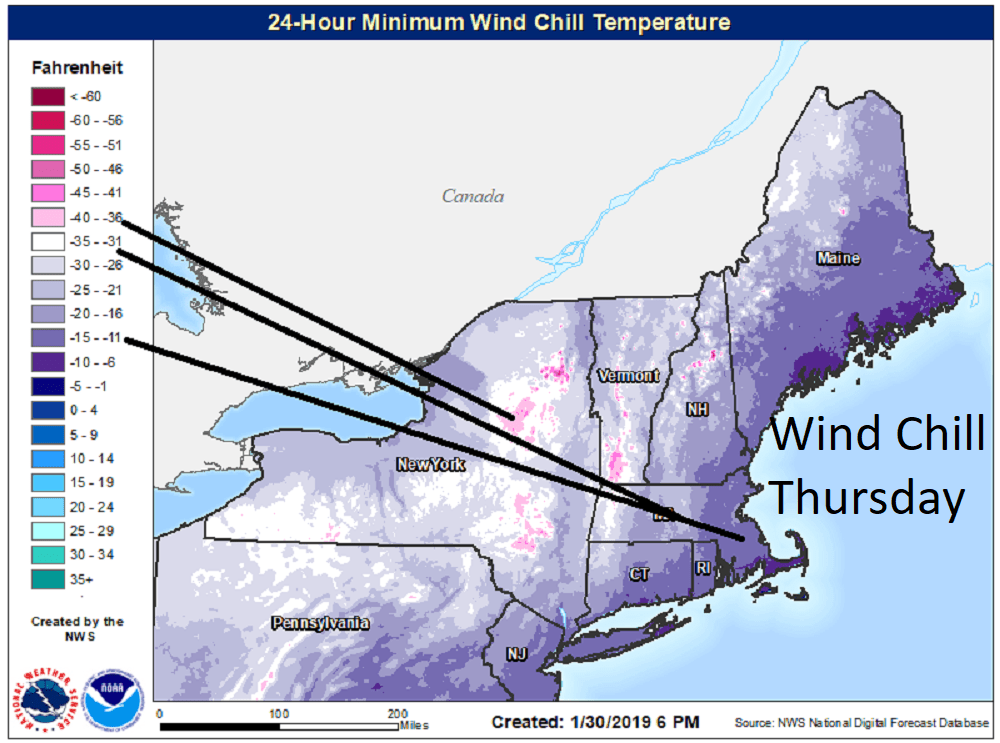
The arctic air is bringing in some extremely cold wind chills, ranging anywhere from 10 to -25, especially during the first half of the morning. It's nowhere near as bad as it is in Chicago and the rest of the Midwest — yesterday was the coldest Jan. 30 on record in the city.
Temperatures this afternoon will rebound toward the double digits and it's likely that Boston will get warm enough so we don't set a record for the day. I also don't think that this cold snap will break the previous one we saw about two weeks ago.
No Snow
Dry weather will continue tomorrow as well as into the weekend and the temperatures will gradually increase. Readings will just reach the 20s for Friday, around 30 degrees for Saturday and perhaps even approaching 40 on Sunday. This will set us up for a very mild start to next week, with a period of rain showers and readings getting into the 50s. Some places will be 50 degrees warmer Tuesday afternoon then this morning.
I still don't see any significant snow in the foreseeable future. The unfortunate thing is that winter might kick in at a time when we're all ready for spring. Although it's nice to have temperatures that are mild in the middle of the winter it's better if we have a more typical pattern and start warming up in March instead of cooling down.
You can follow my updates here and on Twitter @growingwisdom.
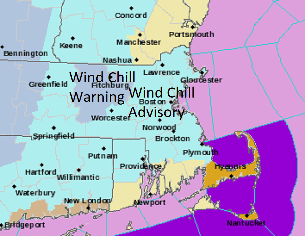
Thursday: Very cold and sunny. Highs 5-15. Wind chill 10 to -25, coldest over the Worcester hills.
Thursday night: Clear and cold. Actual temperatures 0-10.
Friday: Sun and clouds. Highs in the low 20s.
Saturday: Sunny and cold. Highs in the mid to upper 20s.
Sunday: Sunshine and not as cold. Highs 33-38.
Monday: Sun and clouds. Highs 45-50.
