Support WBUR
Will Boston Get Hit With A Cold, Hard Winter? Let's Check The Signs
Sometime during the late summer or early fall, when we have that first cool morning, I always get asked the question, "What's the upcoming winter going to be like?"
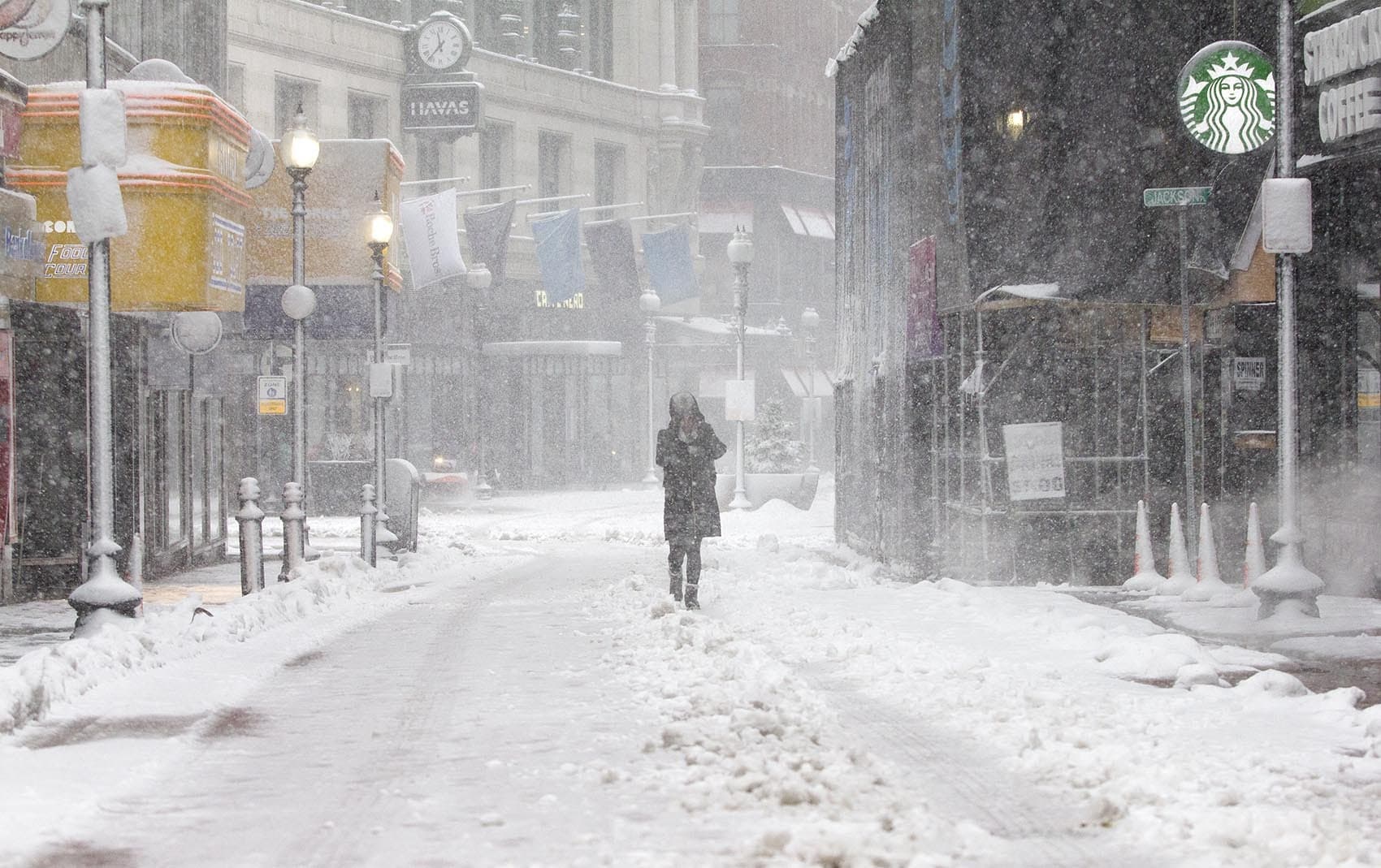
My sarcastic answer is always the same: There will be days filled with darkness, some snow and cold weather.
Every winter is different, and answering these questions can be difficult. Last year, Massachusetts saw most of our snow in the second half of the winter, while February broke records for warmth. In 2015, nearly all of the snow came in a six-week period.
Forecasting the winter season is not highly accurate. We can look at different variables, and make some assumptions about how the upcoming winter will turn out, but there will still be some surprises.
At this point, though, probabilities do favor a colder and snowier winter. As long as you keep in mind that it's always best to make plans by looking at a forecast a few days before any storm, there are a few patterns meteorologists observe ahead of winter.
Have We Seen These Conditions Before?
Winter patterns are driven primarily by what's going on with the oceans. Water covers 71% of the planet's surface, and the varying temperatures of different bodies of water can have a great impact on seasonal weather. Forecasters look at the current state of the oceans and compare it to past years, which are called analogs. For example, if in 2019 the ocean temperature pattern resembled 1972, we might deduce the winter ahead could be similar.
Analogs are important because there's a domino effect between what's going on in the oceans and what happens with pressure patterns around the planet. And these patterns move weather.
What's Happening In The Oceans?
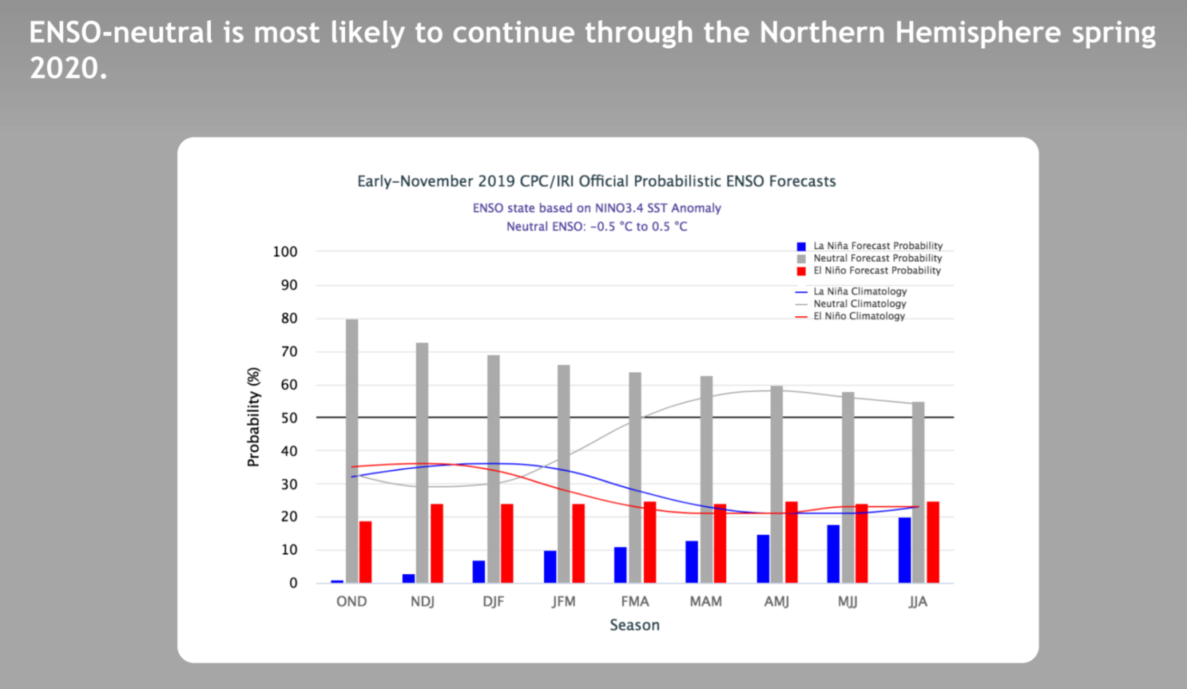
One of the primary drivers of the winter weather is the El Niño Southern Oscillation, or ENSO. This is the oscillation between periods of warmer surface temperature (El Niño), cooler surface temperature (La Niña) and the neutral state of the Pacific Ocean. This year, we are looking at a neutral state, which means that other drivers of the climate will tend to take precedent.
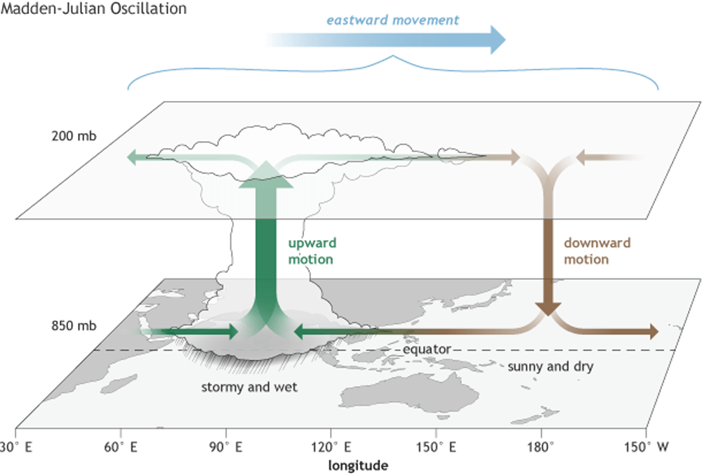
Along the equator in the Pacific and Indian oceans, there are ever-present thunderstorms that spread eastward. The position of these storms is known as the 'Maiden Julian Oscillation.' Depending on where the thunderstorms are located can lead to warmer or colder weather across the United States and other parts of the globe. In the immediate future, the MJO is predicted to remain in the colder phases.
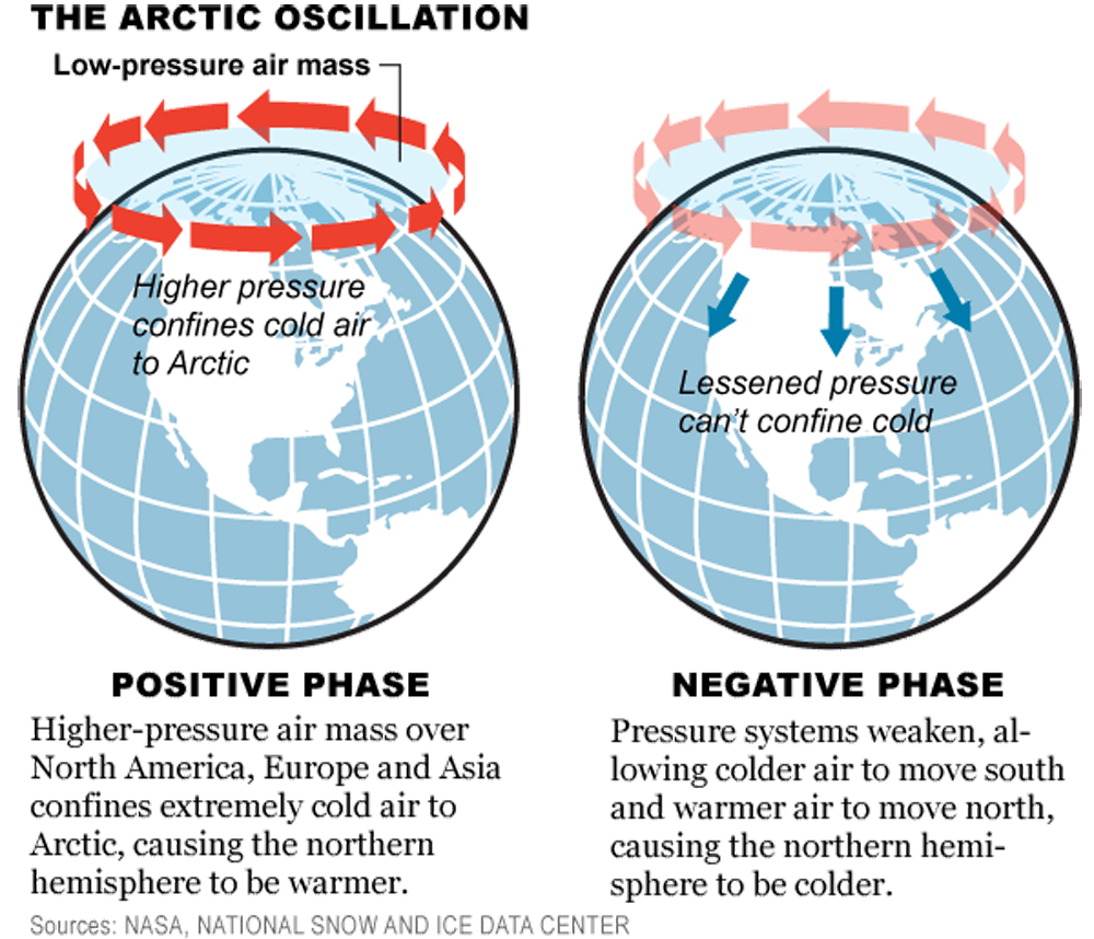
The Arctic oscillation, which measures the strength of the polar vortex, can be in a positive or negative phase. When we find it in the negative phase, the winds tend to relax in the polar regions, and allow the cold air to spill southward.
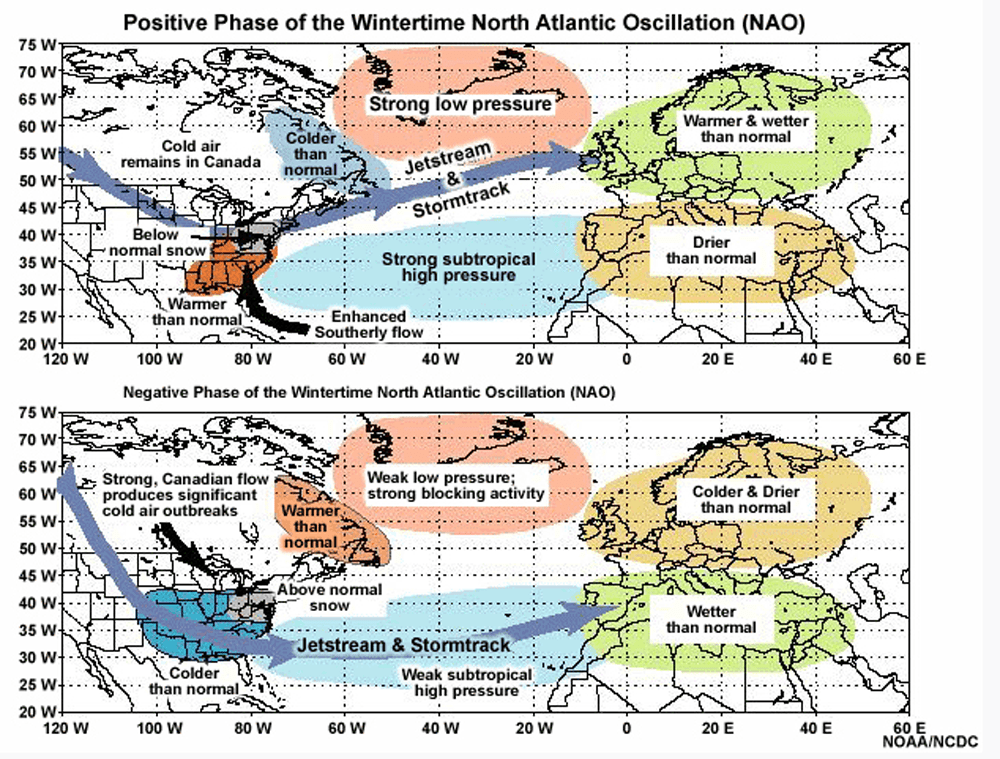
In the north Atlantic Ocean, oscillation between high and low pressure off Greenland and the Azores is a good indicator of jet stream position. If this phase ends up negative, we can experience stormy and colder weather.
What Are Some Other Variables To Check?
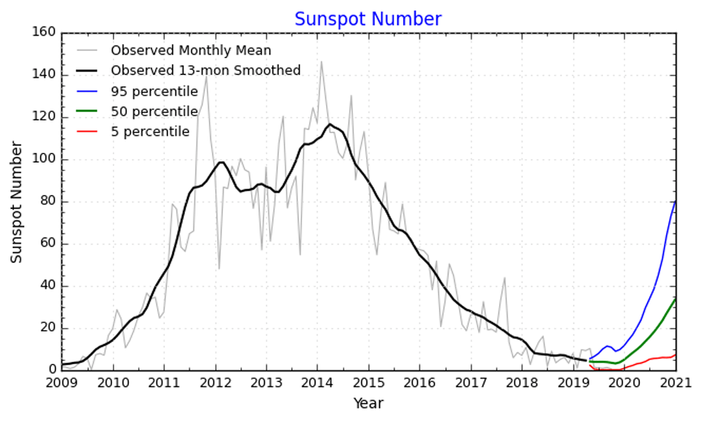
The sun will also be a major player this winter. The amount of solar radiation is not constant from year to year, and we are near the historical minimum. Less energy from the sun can lead to a cooler winter.
The cold this month is an important key in the winter forecast, because there's a moderate correlation between a cold November and a colder-than-average winter.
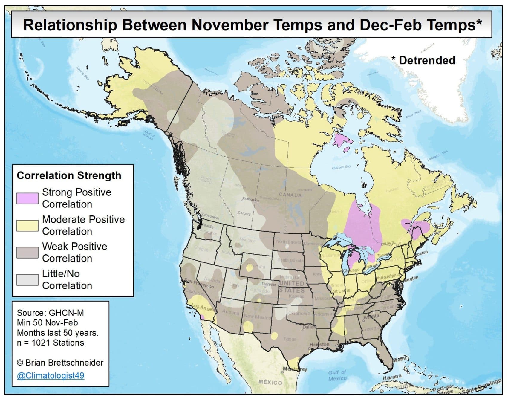
It's possible that this winter could be colder than average. But a colder-than-average winter doesn't mean that there will not be mild weeks or that every storm would fall as snow.
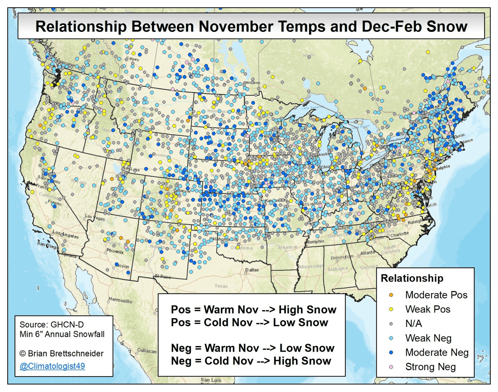
It's the same thing with snowfall. Look at the map above. The map shows how cold Novembers are correlated to heavier-than-average snowfall from December to February. This year, I believe snowfall will be higher than last year’s 27 inches. How much higher the snowfall will be is difficult to predict, but 45 to 60 inches would be an educated guess. It is worth noting that this year is a lot like 1954, and that year produced significantly less snow than average.
How the snow falls — and over what time period the snow falls — makes a big difference.
Our collective perception of the coming winter will ultimately come down to how it affects you. If the week you plan on going skiing there's no snow, winter may seem like a bust. If our snow storms come on the weekend, or late at night and don't impact travel, it can seem like the winter wasn't so bad.
And yet, if all the snow storms come in the middle of a Wednesday afternoon or it's the third time in two weeks you're digging out from a foot of snow, winter can feel quite long.