Support WBUR
Heat Wave Continues, Bringing Another Day In The Upper 90s
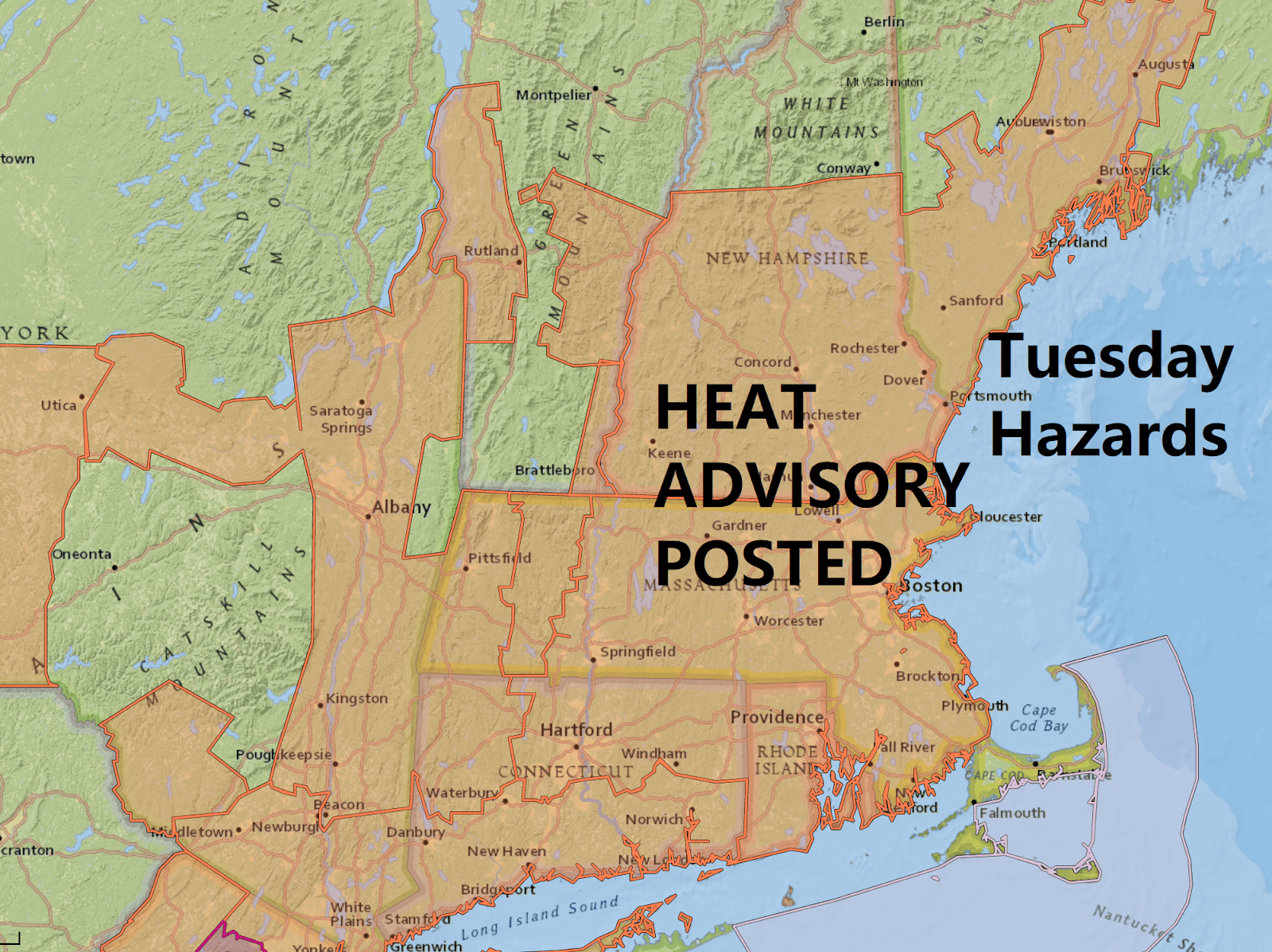
Day two of the heat wave is underway, with temperatures quickly scheduled to rise through the 80s and into the 90s during the late morning and early afternoon.
High pressure off the southeast coast will continue to pump hot and humid air into the region through Wednesday. Temperatures will top out in the mid- to upper 90s and when you combine the effects of the humidity, it will feel in the low 100s this afternoon.
The chances of showers and thunderstorms are quite small Tuesday, but will dramatically increase for late Wednesday, again Thursday night and into Friday morning. A line of storms will likely approach the area later Wednesday and move through during the evening.
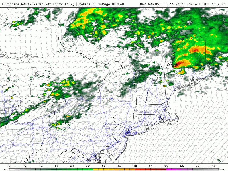
There are some important differences between each of the next three days. On Wednesday, there will be blazing hot sunshine for the first two-thirds of the day, before showers and storms move in from the west. Those showers and thunderstorms could be strong to severe and will contain some torrential downpours. Before the rain arrives, it will reach the 90s for our third day of the heat wave.
On Thursday, it won't be as warm, with temperatures in the 80s. It’s not going to be pleasant, however, because of lots of humidity and a few downpours — and maybe the rumble of thunder, especially developing late in the day and overnight. The potential amount of moisture in the air will be so high that any rain will be heavy.
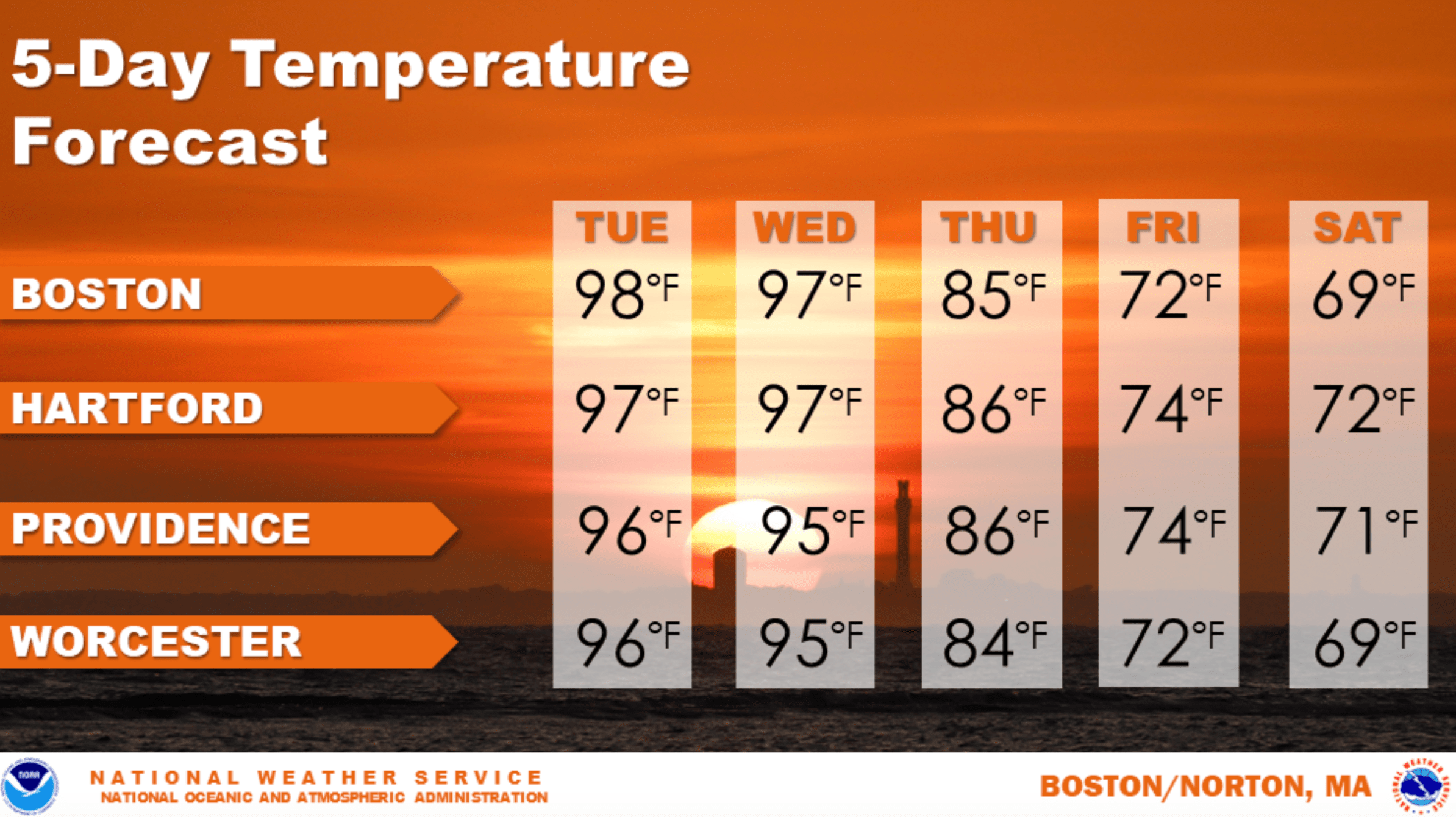
On Friday, rain is likely for the first part of the day, with much cooler temperatures and less humidity. The bulk of the rain will fall early enough in the day that you could get outside in the afternoon, but it won’t be sunny.
The start of the weekend looks unsettled with clouds, cool weather and a couple of showers for Saturday. Temperatures could be so cool that a few areas don't even reach 70 degrees that afternoon.
The better part of the weekend forecast comes for Sunday, the Fourth of July. Expect a blend of clouds and sunshine, with a small risk of a shower. But temperatures will be back into the 70s, and right now, Monday's looking like a nice warm day — good for the beach.
This segment aired on June 29, 2021.
