Support WBUR
Snow, sleet this weekend after brief reprieve of warmth
The saying, “if you don’t like the weather in New England, just wait a few minutes” is more than a little apropos for this weekend. After one of the mildest December nights here, colder weather will slowly move into the region later Friday and set the stage for a mixed bag of weather on Saturday.
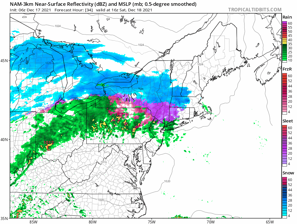
Low pressure is going to bring snow, sleet and freezing rain — as well as regular rain — to all of southern New England late Saturday morning into the first part of the night. The contrast between mild air to the south and cold air to the north means that a rain-snow line will be moving north, eventually crossing the Mass. Pike Saturday evening and finally ending up somewhere toward the New Hampshire border.
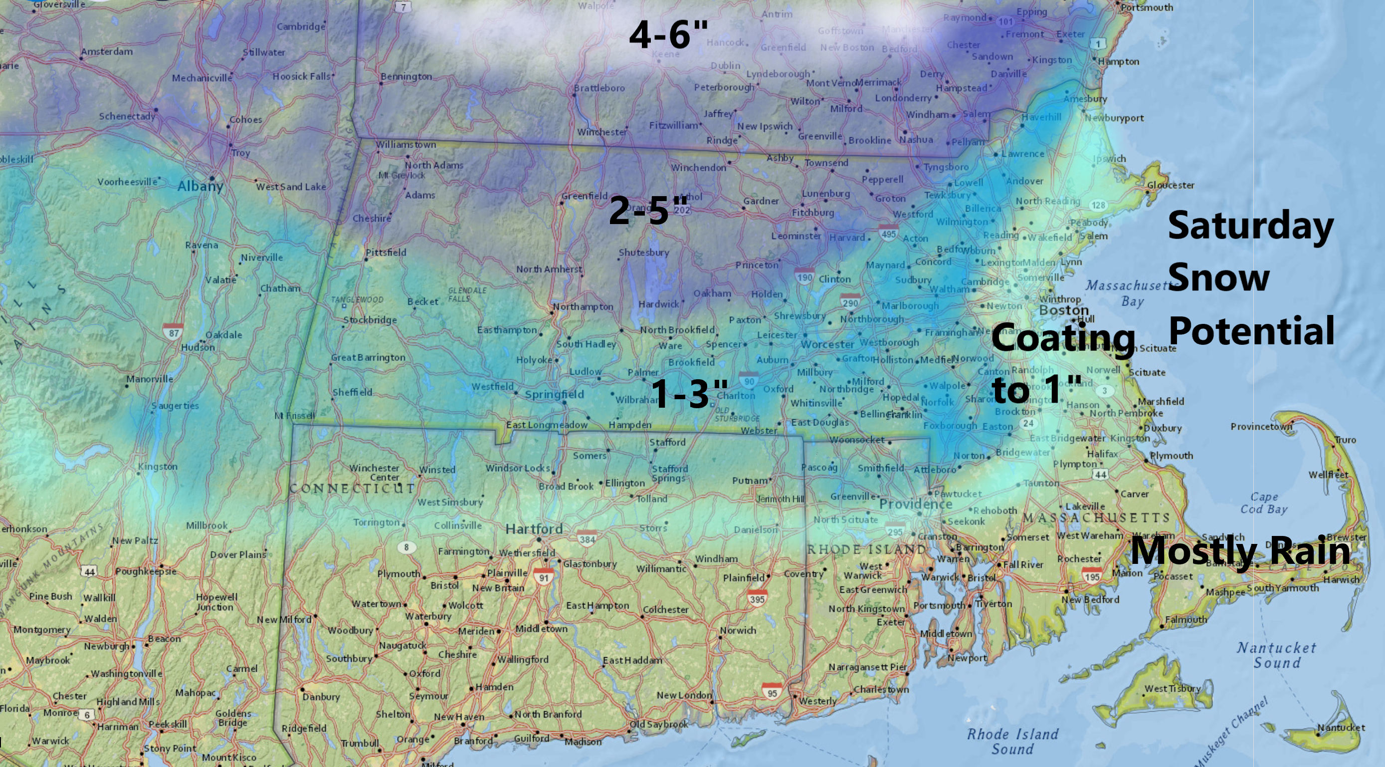
Before the transition takes place, we'll see anywhere from a coating up to 5 inches from the coastline northward. The snow will be falling at a moderate rate before the changeover, and the timing of the change will make a huge difference in whether or not you see a coating or a few inches.
A later change over would increase the amounts; an earlier change will decrease them. The snow begins west to east, from 11 a.m. to 3 p.m. and then changes to the mixture mid-evening from about 8 p.m. to 11 p.m. Saturday. It is in this window most of the snow will fall.
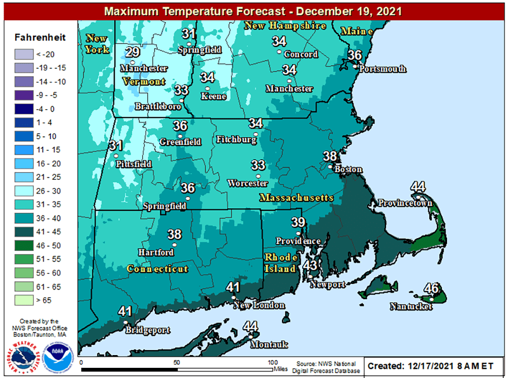
As the system pulls north Sunday morning, there may be a brief change to snow, and then skies will become partly sunny. It will be breezy and chilly, with the high staying in the 30s. This colder weather pattern is going to be with us until Christmas. On Monday morning, most of us will see temperatures in the teens — significantly colder than the 60-degree morning on Friday.