Support WBUR
Forecast: A sugar coating of snow will greet us this holiday weekend
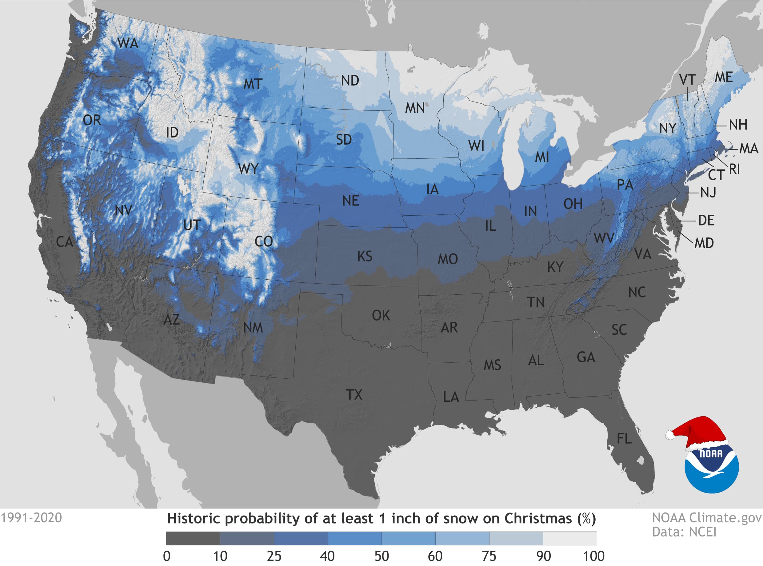
Snow on the ground for Christmas is the stuff of songs and magical stories, but in reality, at least here in southern New England it's pretty difficult to get.
This year, however, a sugar coating of snow will take us into the Christmas Eve festivities. Though there may be as little as just a few flurries to a dusting, or perhaps as much as an inch in some higher elevations, the snowflakes are Mother Nature's way of treating us to a little meteorological magic as we head into the holiday weekend.
A weak weather system will dive across southern New England early Christmas Eve morning. Any snow that does occur will end by mid-morning or just a bit afterwards. I don't expect travel to be impacted, but there might be a couple of slippery spots in places that see more significant snow showers.
Generally, all areas can expect a dusting of snow to perhaps an inch or two in some higher terrain. The roads are cold, so what falls will stick. Temperatures will be in the 30s all day.
It should be a picturesque sunset on Christmas Eve as skies are partly cloudy. Interestingly, the sun is setting later than it was just before Thanksgiving as we continue to gain a little time second by second in the afternoon. Midnight temperature readings will fall to the upper 20s.
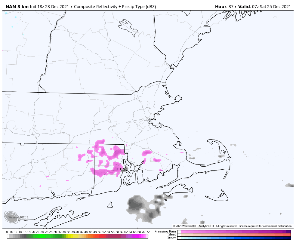
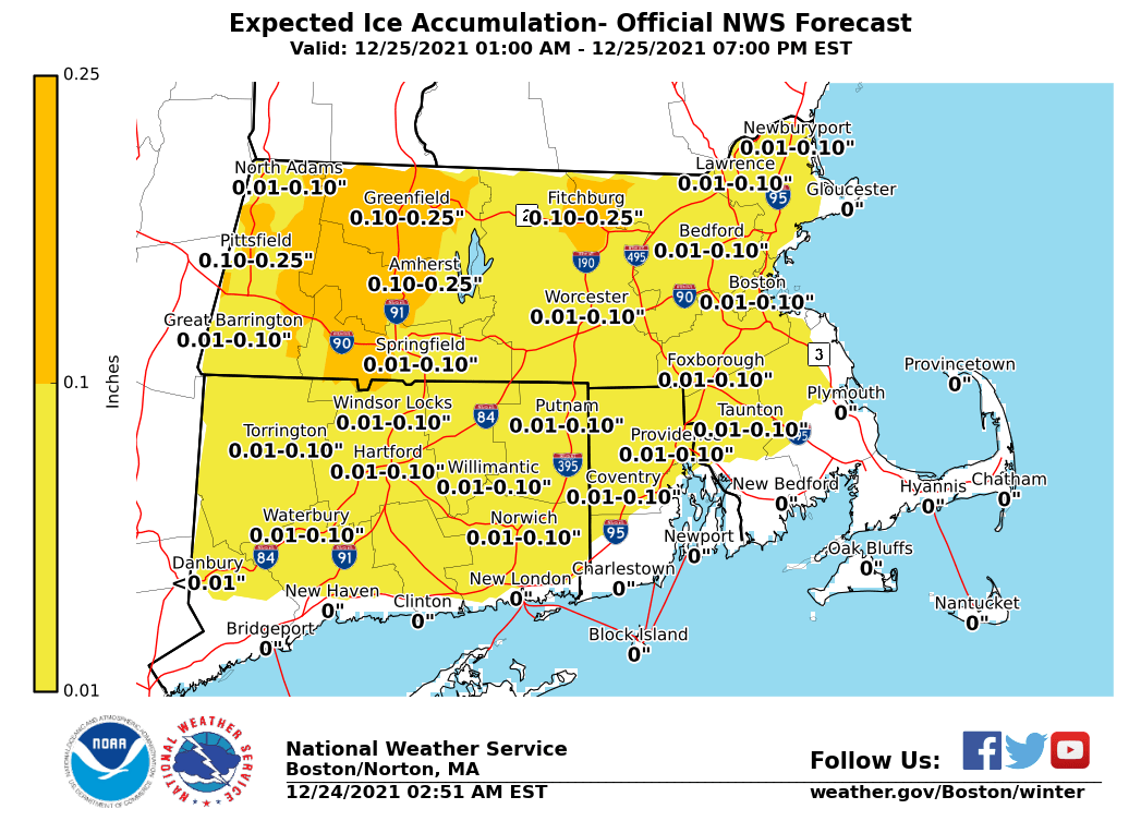
Another weather system arrives for Christmas morning. If you're expecting to wake up to snowflakes I think most of us will be disappointed, as temperatures should be too warm. The precipitation that does fall early Christmas will be in the form of rain and freezing rain. There could be some very icy travel for a time a few hours either side of sunrise Christmas morning.
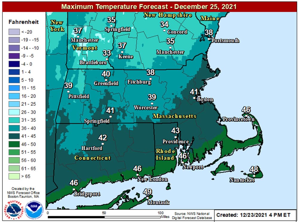
Highs will be around 40 degrees by Christmas afternoon, though, and that means there shouldn't be any problems on the roads.
The weather system remains active Christmas night with some rain likely falling for the first part of the night.
Skies will clear during Sunday, with highs in the lower 40s. There could be more active weather early next week, but there don't seem to be any significant snowstorms or big dips in temperatures in sight. Happy holidays!
This article was originally published on December 23, 2021.