Support WBUR
Winter on hiatus as we ring in 2022
The murky weather continues as we close out 2021, with Friday morning's fog dissipating to reveal lingering clouds. A southerly air flow will keep temperatures above average into the new year.
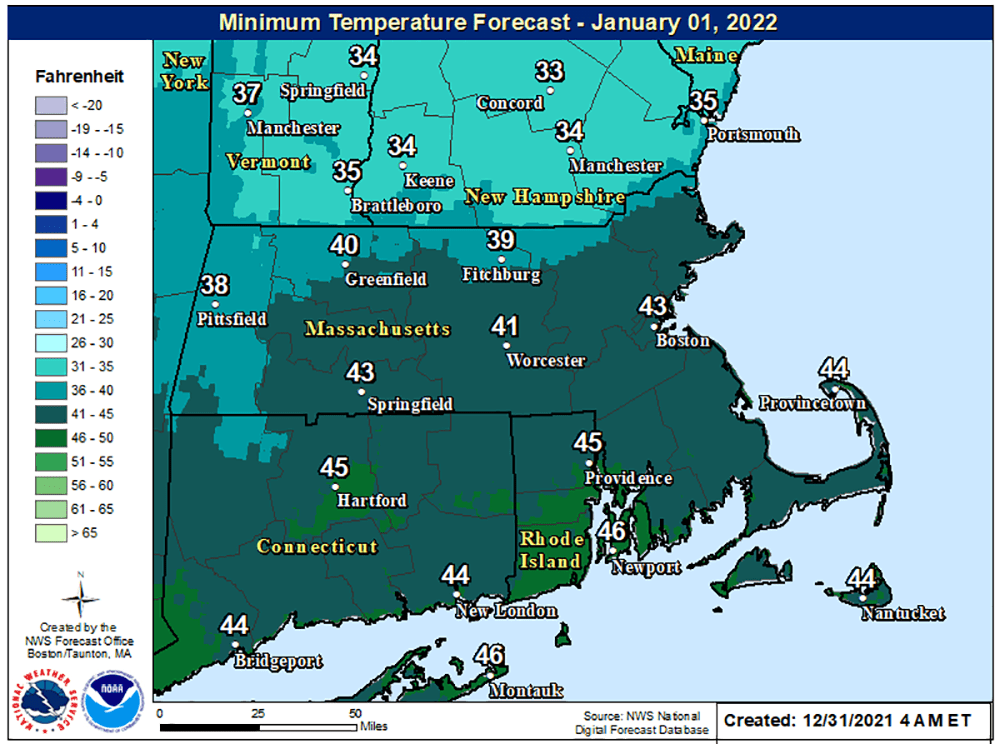
There's a chance for a few light showers or some drizzle during this New Year's Eve evening. Any rain will be short-lived, though, and temperatures will be quite a bit above average, staying in the low 40s all night.
I would wear a jacket or coat that can handle dampness, but you shouldn’t need gear for downpours or steady rain. The predicted radar loop below shows small patches of rain (denoted in green) New Year's Eve into early New Year's day, but more organized rain moves through Saturday afternoon into early Sunday.

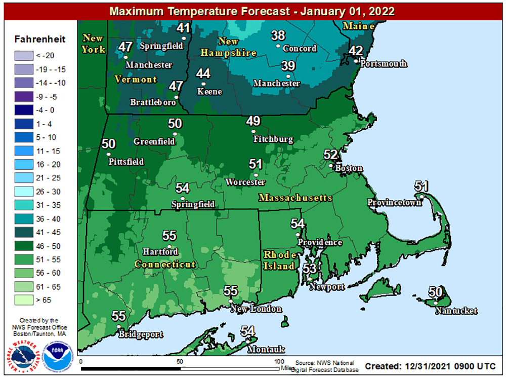
An area of low pressure will move toward New England during Saturday afternoon, bringing steady rain and temperatures in the lower 50s. That rain continues for the first half of Saturday night. There's virtually no chance of any frozen precipitation, with temperatures 10 degrees above freezing.
There may be a little bit of rain shower activity Sunday, but the steadiest and heaviest will have already ended. Temperatures will bump up into the 50s before a cold front pushes the mild air out to sea.
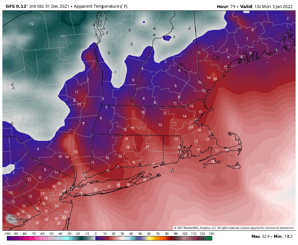
Things turn clear, blustery and cold by Monday morning. Highs will stay under freezing and windshields will be in the teens. That cold won't last; we'll be back to seasonable temperatures for Tuesday with a return to the mid-40s by Wednesday and Thursday.
Looking ahead, it looks as though cold air will then once again return for the following weekend. Whether or not there's any sustaining power to the cold —or if it'll be accompanied by snow — is still unknown.
This winter has not brought us our first snow storm, and we're definitely going to have to wait a little while longer for that to occur.
This segment aired on December 31, 2021. The audio for this segment is not available.