Support WBUR
1st snowstorm closes schools and slows travel, dumps 10 inches and more around Boston
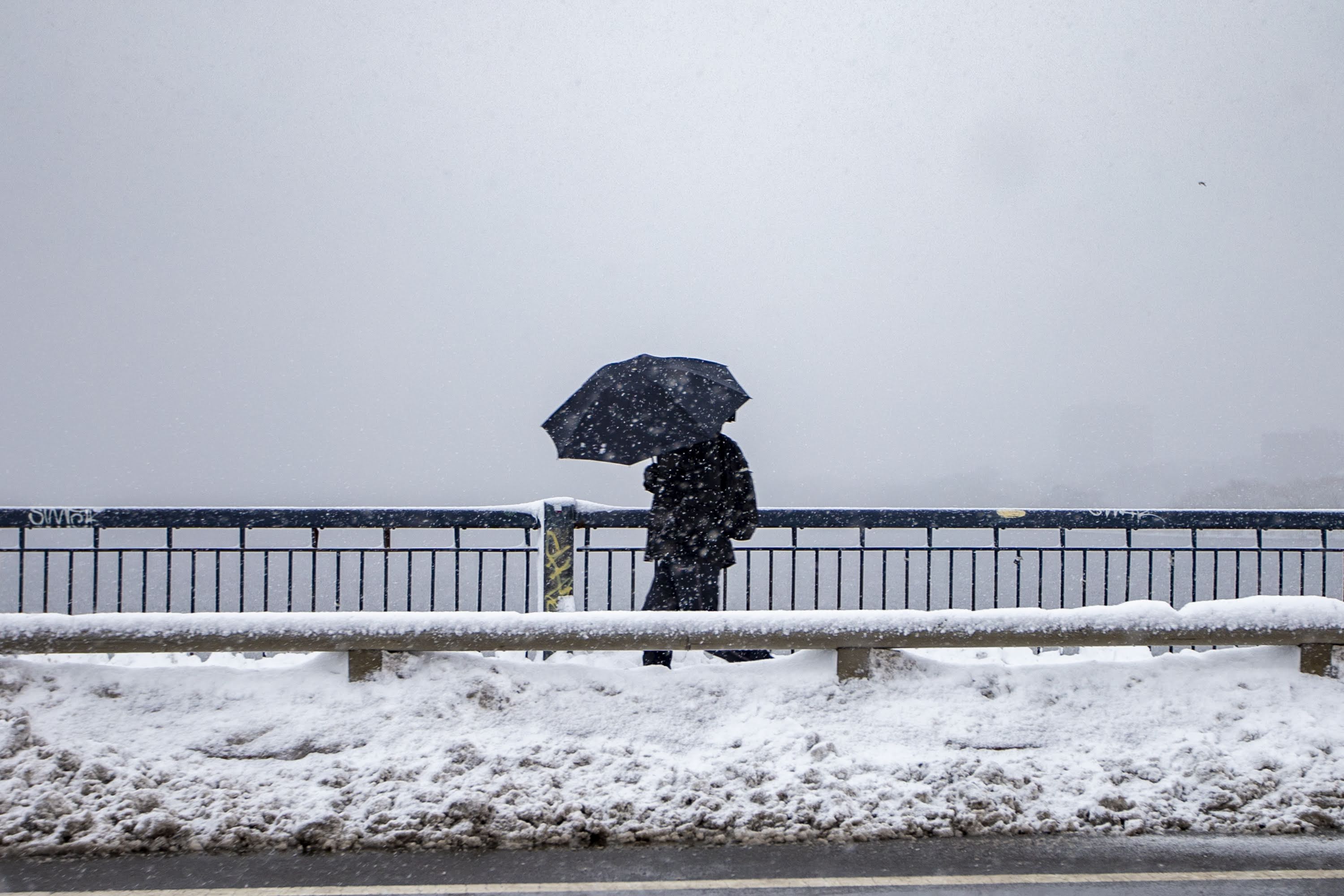
In the first real snowstorm of the season, flakes began to fall across the area in the wee hours of Friday morning and will continue to accumulate quickly before noon, with some lighter snow in the afternoon.
Overall, most areas in eastern Massachusetts will see 5 to 9 inches of snow.
However, it's not out of the question that there's some pockets of 10-plus inches. These would be more localized and not as widespread.
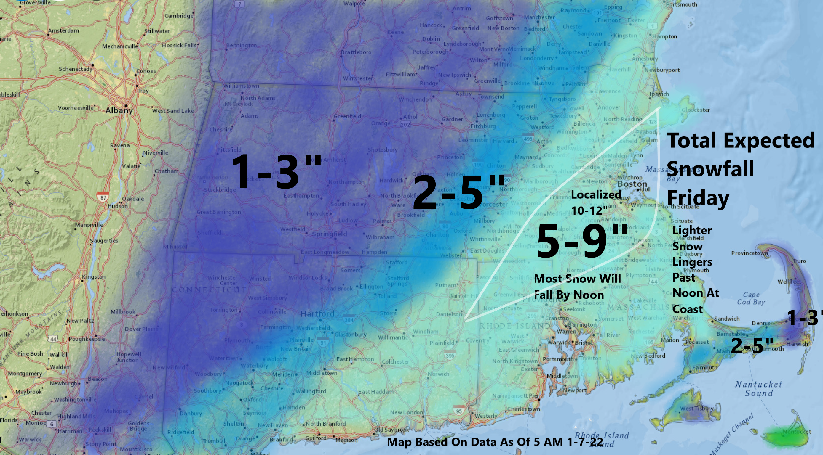
A winter storm warning for the city of Boston, most of eastern Massachusetts and Rhode Island, lasts through 7 p.m.
"Please avoid going out on the roads if you can," Boston Mayor Michelle Wu said. "I know we are in a hybrid world in many ways, and we want to make sure that if you have a choice to stay home, you could stay off the roads, stay inside."
The radar loop below gives a general idea of where the heaviest bands were moving early Friday morning — showing up here as yellow streaks. This area of heavy banding will be over by the middle of the morning.
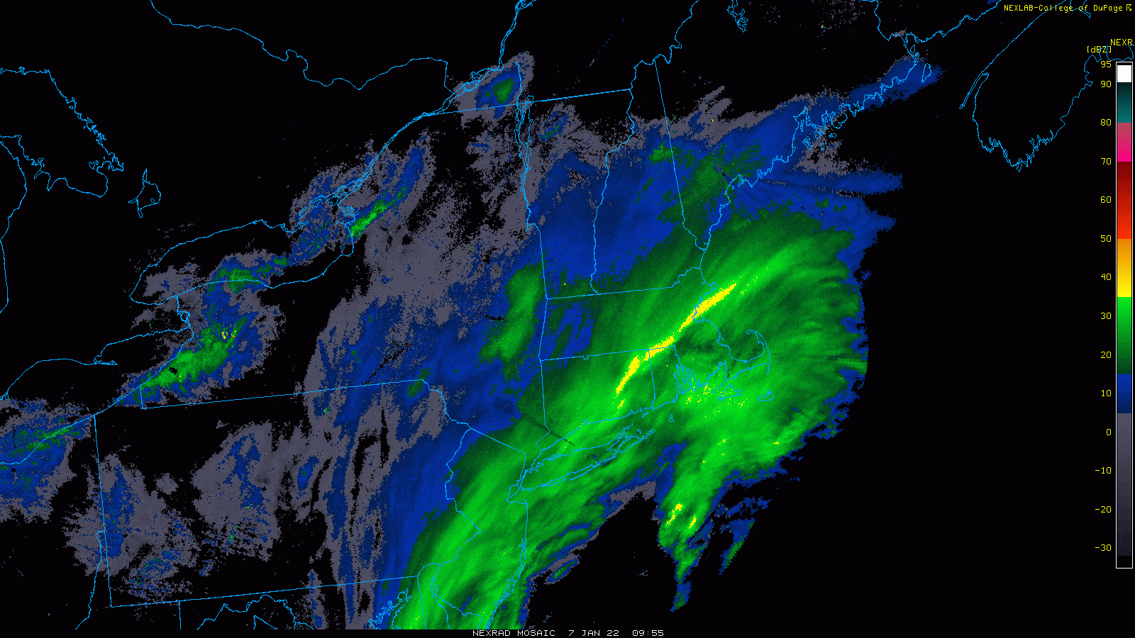
The storm responsible for the snow continues to develop off the southern New England coastline, and will head up into eastern Canada later Friday. This is a fast-moving storm. Between noon and about 3 p.m., there will be some lighter snow — especially along the coastline. This is when we will get our final coating up to an inch of snow.
Temperatures are cold enough that the snow is generally light, fluffy and easy to move. The exception to this is the outer tip of Cape Ann, as well as most of Cape Cod and the islands, where it'll be a mix of snow and rain depending on location.
The state Department of Transportation says nearly 2,500 pieces of equipment were out clearing the roads Friday morning.
State Highway Administer Jonathan Gulliver says drivers should expect roads to be treacherous throughout the day, and some icing Friday night.
"Expect some icing tonight," he told WBUR. "I know crews across the state as well as local DPWs are definitely going to have crews out putting salt down, but it is still a risk people should be aware of."
Wu says the staffing levels of snow plow drivers in Boston is OK at the moment. "We feel comfortable about our staffing levels today," she told WBUR.

The storm caused dozens of school districts across Massachusetts to close Friday, including Boston. (For a full list of closures, see here.)
Wu urged people to check on their neighbors during the storm and "make sure your whole community is OK."
She said the city has opened more shelters and are doing direct outreach to make sure people get into warm shelters during the storm. "If you see someone in distress, if you see someone who is out, unsheltered in the cold, please call 9-1-1," Wu said. "We'll make sure EMS does a wellness check and connect anyone to services and housing."
It turns breezy later Friday afternoon, as the storm intensifies out to sea. Look for some blowing and drifting of the snow at times. Highs will be within a few degrees of freezing, and those areas on Cape Cod with rain will notice a change to snow before the storm ends.
Winds are not going to be particularly strong during this storm, but they will be blowing at 20 to 30 mph at times.
As of 10 a.m. on Friday, the state's emergency management agency said there were around 1,200 power outages.
There won't be coastal flooding, as the system is moving too fast. It's also not that intense, and the tides are not astronomically high.
It will be sunny and bright Saturday, with temperatures just under the freezing mark.

A small weather system brings the potential for a little slippery travel Sunday afternoon over the interior and northern parts of New England before it clears for Monday. The coldest air of the season is going to be here Tuesday, when temperatures may remain under 20 all day, with morning lows in the single digits.
This article was originally published on January 06, 2022.
This segment aired on January 7, 2022.
