Support WBUR
A major snowstorm is coming for eastern Massachusetts on Saturday
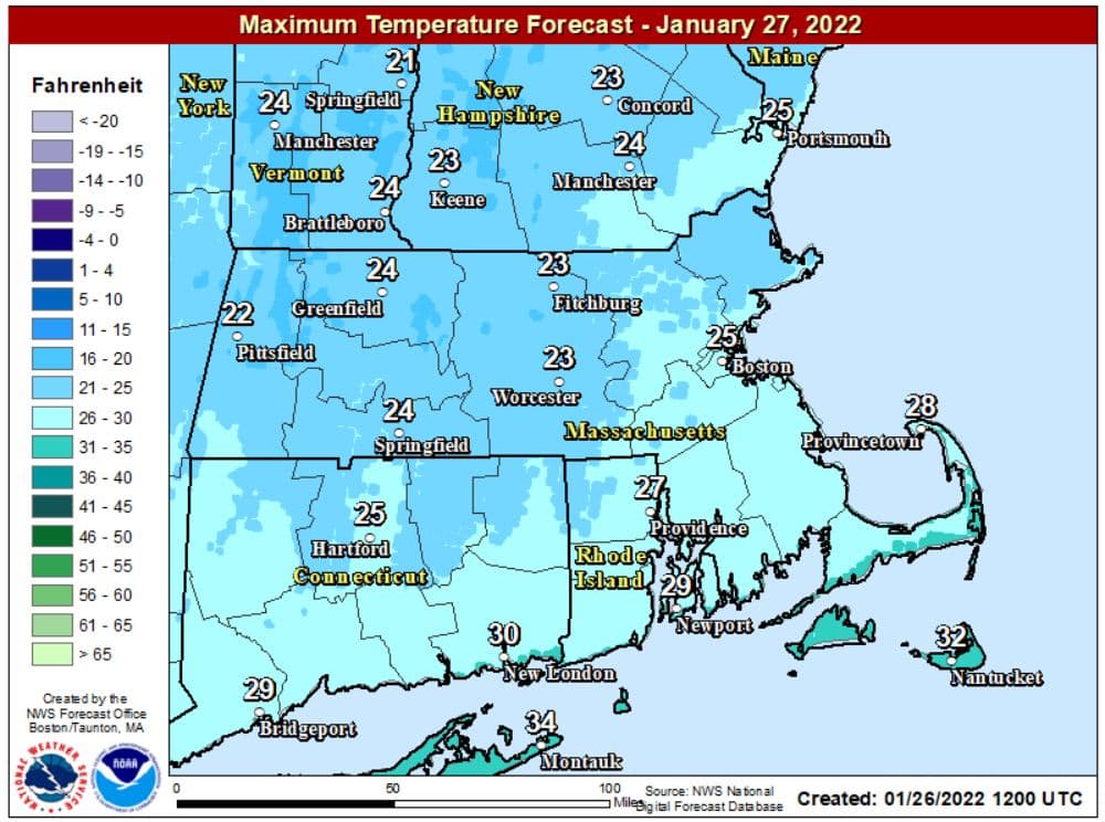
Arctic air arrived overnight Tuesday into Wednesday and that will play a significant role in the storm this weekend.
The next couple of days provide plenty of sunshine, along with chilly but tolerable conditions.
All eyes will be on a developing storm coming Friday.
Skies will become increasingly cloudy during the day Friday and I'm expecting snow later in the afternoon or evening. It's likely there won't be any significant problems until after midnight. The bulk of the snow will fall Saturday during the day, into the first part of the evening, with snowfall rates of 1 to 3 inches per hour in some portions of southern New England.
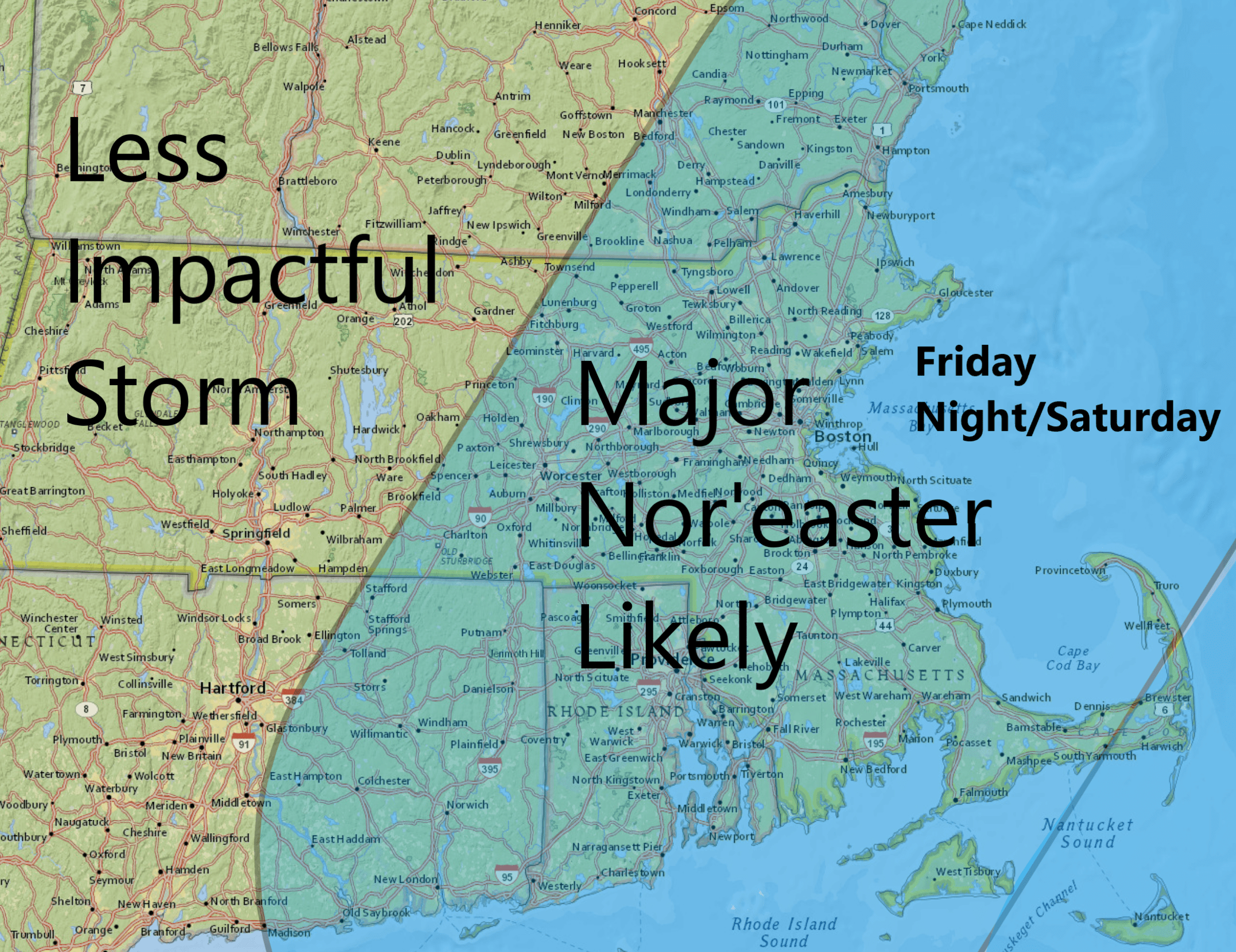
Who sees the most snow is still in question, depending on the exact track and strength of the storm. However, it does look like there's a significant possibility many areas in eastern Massachusetts will see a foot or more of snow.
Winds will be strong and gusty, potentially producing blizzard conditions at times. The label "blizzard" is just a visibility warning; it has nothing to do with the amount of snow.
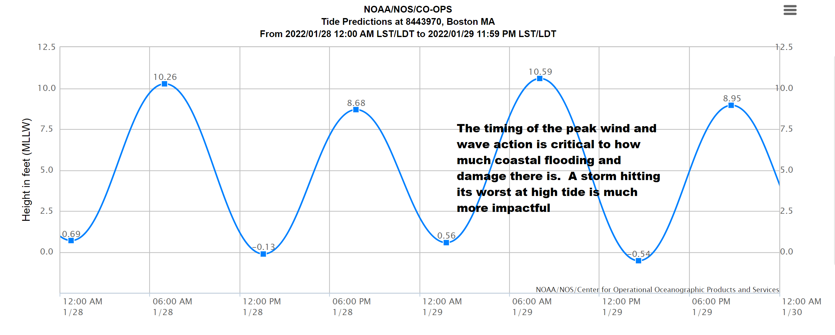
If the storm reaches full strength during the time of high tide Saturday morning we could see moderate to major coastal flooding, but if it holds off until later in the day, flooding will be less significant. This is certainly something that needs to be monitored in the coming days.
Logan Airport will likely be significantly impacted. Since the storm will be coming up from the south, other airports such as LaGuardia, will also be impacted. This means flights for Saturday and Sunday could be canceled before the first flakes even fall.
With the strong winds, ferries are also likely to be canceled starting Saturday into early Sunday.
The snow is likely to be on the lighter side with temperatures in the 20s during the storm. It will pile up faster, but be easier to move.
Sunshine is back for Sunday along with cold temperatures.
There will be a moderating trend as we get into February and I do expect some melting in that first week.
