Support WBUR
Cold front moves into region, bringing chill after unusually warm Feb. day
A strong cold front crossed the region overnight that will cause temperatures to drop throughout the day on Friday.
On Thursday afternoon, Boston tied the record high of 61 degrees set back in 1981. The winds, which brought the warm air, will also gust as high as 60 miles per hour, especially along the coastline. This could create scattered power outages and some tree damage although I don't expect it to be widespread.
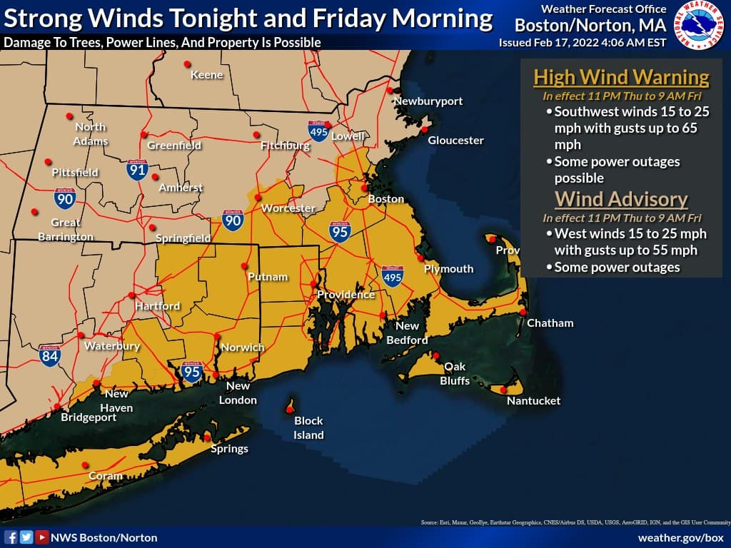
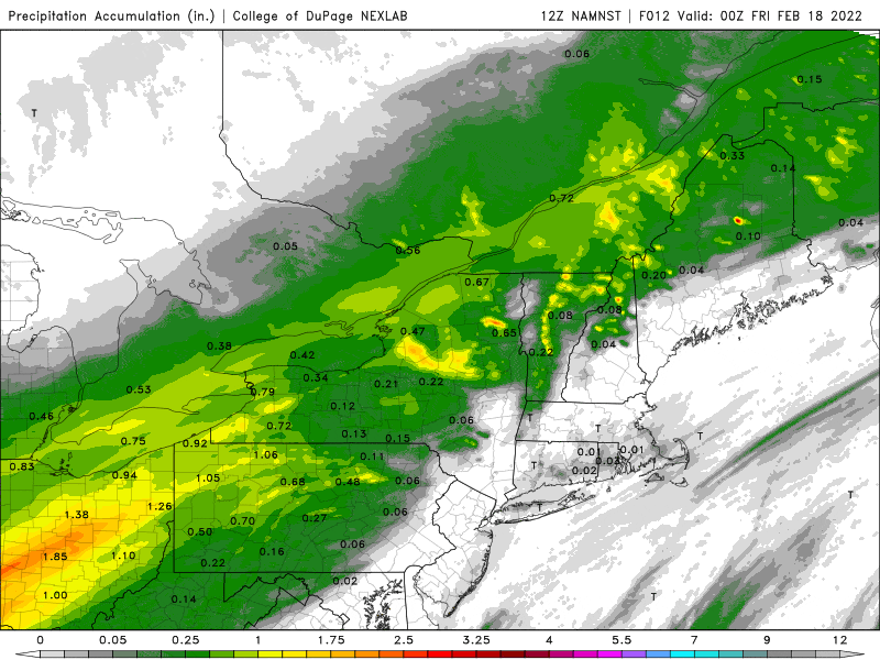
The winds peaked between 11 p.m. Thursday and 5 a.m. Friday. This was also when an area of rain will move through with some heavy downpours and perhaps even some thunder. This weather system is what we call progressive; in other words, it's steadily moving along so rainfall will not be any greater than an inch or so and most areas will remain under that mark.
Skies will partially clear in the afternoon. It will still be breezy, but not as windy as temperatures fall back down into the 30s.
On Saturday, a weather system will bring a quick snow shower or even a snow squall. Highs will be in the upper 30s and it will also be breezy. Sunday gives us some sunshine with highs back near 40 degrees. It turns milder for President's Day. Highs will be near 50 and then it turns somewhat unsettled with rain later Tuesday or Tuesday night.
There could be some more wintry weather at the end of next week, but that is still a long ways away.
