Support WBUR
The drought in Mass. is worse than in 2016
With little to no rain over the last week, it's no surprise that drought conditions have intensified and expanded across the region.
The latest weekly update from the U.S. Drought Monitor shows that all of Massachusetts is now experiencing drought, with 94% of the state seeing severe or extreme conditions. For reference, the map identifies general areas of drought and labels them by intensity. D1 is the least intense level and D4, the most intense. From last week, we saw a jump from 24% to 39% in the severe category (D2), and 31% to 55% in the extreme category (D3).
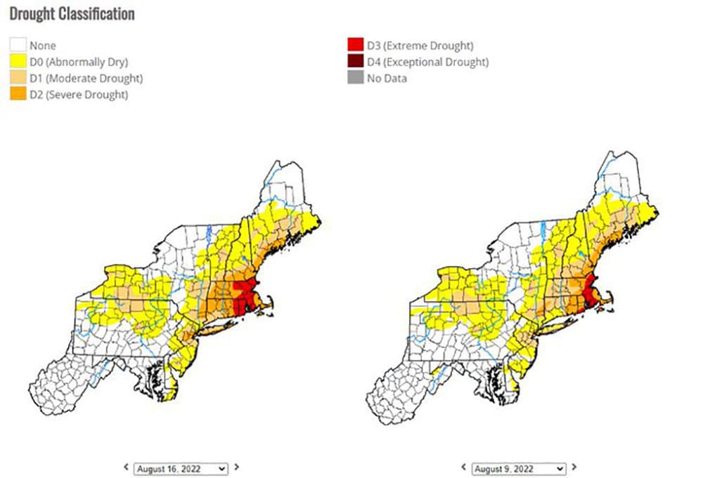
Extreme Drought pushed westward across Rhode Island and toward central Massachusetts and easternmost Connecticut. The Drought Monitor states that extreme drought mean "major crop losses and widespread water shortages or restrictions."
To date, this is the driest summer ever recorded in Boston. The city's gotten 10.03 fewer inches of rain than average. In fact, February was the only month that recorded above-normal precipitation. For now, that makes this the fourth-driest year ever in Boston, and the driest we've been in 27 years.
Unfortunately, there's very little chance of rain over the next several days. Tuesday does bring a threat for showers and downpours, but what we really need is a steady rain for several days.That's difficult to get in August. Usually, we see quick hitting storms in summertime, not longer duration rain events.
Unless, of course, we get a tropical disturbance to head our way. It's been a quiet start to hurricane season thus far, but we're climbing towards the climatological peak of the season on Sept. 10. That's not to say we want a direct hit from a tropical storm or hurricane, but a feed of any tropical-type moisture could benefit us.
Until then, the drought rolls on. As seen in the map below, it's worse in terms of coverage compared to 2016.
That being said, the USDA has the region classified as "S" on the national map, meaning short-term impacts — typically less than 6 months —are likely.
