Support WBUR
Storms will bring heavy rain, wind overnight into morning commute
Heavy rain and winds will move into Massachusetts Thursday night, bringing some much needed relief from the state's ongoing drought.
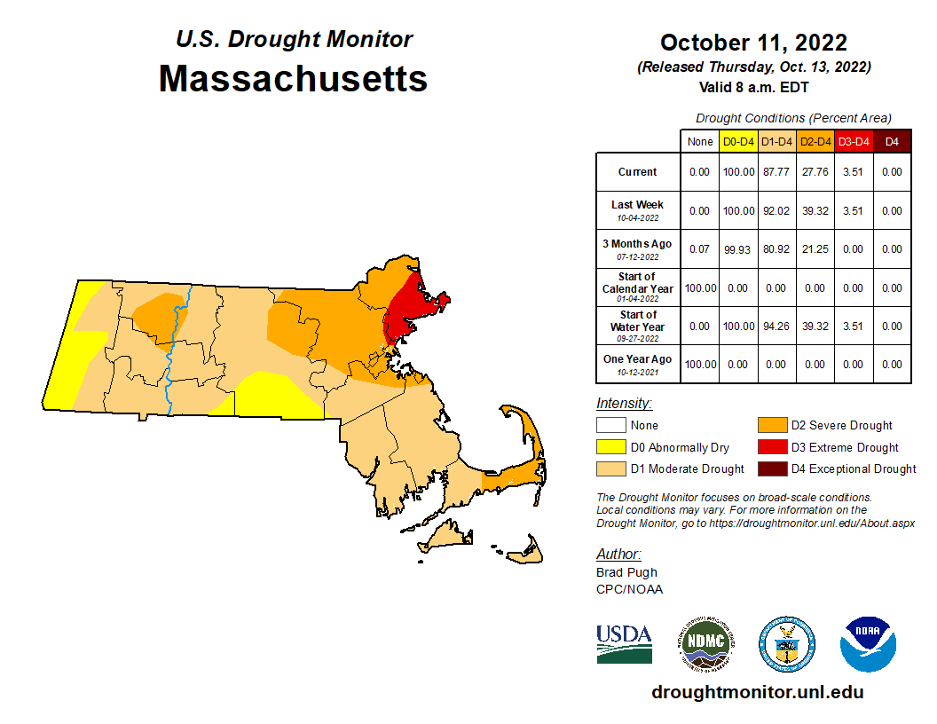
It has now been 11 consecutive weeks of portions of the state experiencing extreme drought, and this morning's weekly update shows a small part of northeast Massachusetts (3.51%) remains in that category. Many communities are still in the moderate to severe category, and Boston is in a deficit of over 11 inches for annual precipitation.
Bottom line? We need more rain. And Thursday night into Friday morning, we will get a decent dose of it.
While there will be some hit or miss showers and downpours around during the day, there will be plenty of dry times Thursday afternoon too. Expect more scattered action to break out during the evening commute, and heavier rain from the Worcester to Boston corridor from 7 to 9 p.m.
Downpours and embedded thunder will swing through from west to east overnight, so don't be surprised if you wake to some rumbles. The rain will linger into the morning commute Friday. You may want to plan accordingly and budget some extra time for your drive.
While the worst of the rain will exit by late morning, I do anticipate some pockets of lighter rain to linger until lunch time to early afternoon from inland areas to the coast respectively. It's certainly a day to bring the wet weather gear.
So how much rain should we expect? This will be a widespread 1-to-2-inch event, though some locally higher totals are possible, mainly outside of I-495. Some will end up with less — mainly over Cape Cod, where just half an inch to an inch is more likely.
While there will be some localized poor drainage flooding, ponding of water on the roads and big puddles, this system is progressive enough that the threat for flash flooding or widespread issues is fairly low.
The wind associated with this system is cause for some concern. Ahead of the front, southeast gusts of 25 to 35 mph will be common Thursday afternoon and evening – certainly noticeable, but not damaging. Our trees in New England aren't quite as used to a southeast wind as a northeast or northwest wind.
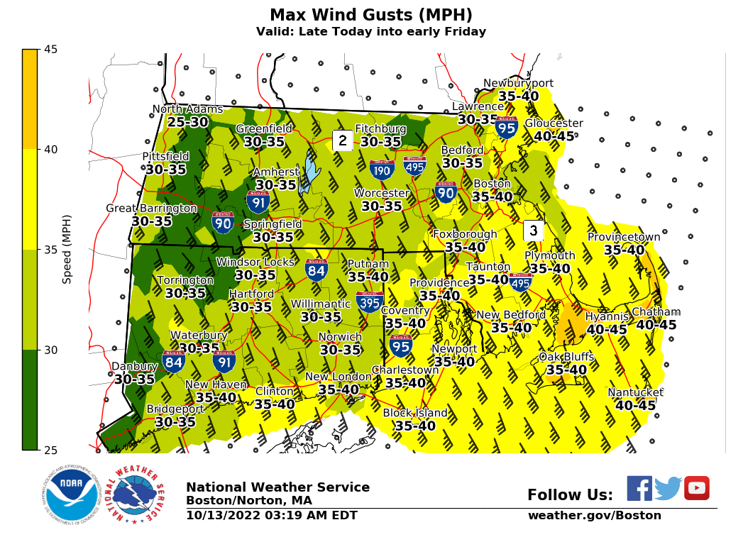
As the main line of downpours moves through overnight into predawn, that will allow strong wind just above the ground to be transported to the surface. The result will be gusts up to 45 mph and isolated pockets of wind damage and outages, with the highest risk of that along the immediate coast to Cape Cod.
Behind the rain, the wind subsides dramatically and shifts around to the west then northwest tomorrow afternoon.
Meanwhile, our weekend is still looking great: mostly sunny Saturday, and sun and clouds Sunday, with highs near 70 both days.
