Support WBUR
Rain and damaging gusts could knock out power for some
Steady rain will fill into New England Wednesday afternoon, with the heaviest downpours expected to impact the evening commute. This is the same system that produced severe weather over the southern U.S.
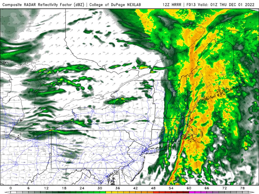
I don't expect widespread thunderstorm action, though there may be a few rumbles, particularly between 7-9 p.m. An isolated severe storm cannot be ruled out.
The back edge of the rain will move in rapidly between 9-10 p.m. with clearing skies to follow. Rainfall totals will generally run either side of a half-inch for many of us, with a few locally higher amounts.
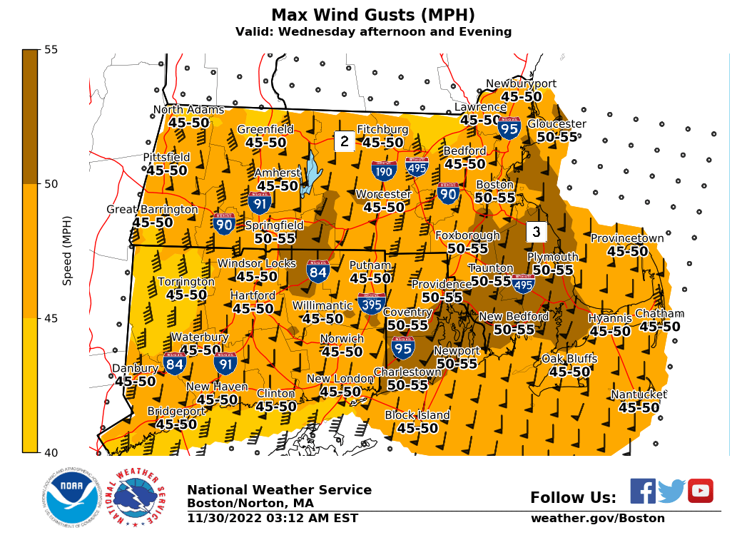
Meanwhile, the wind will have the biggest impact on us. Southerly gusts between 40-50 mph will occur across the region; in fact, all of New England is under wind advisories or warnings. Some peak gusts of 55 mph are possible along the coast and on Cape Cod.
The strongest gusts will coincide with the heaviest rain, from late afternoon until about 10 p.m. The wind will ease just slightly overnight, before kicking back up tomorrow, this time out of the west (behind the front). Gusts around
45 mph will be common, with isolated 50 mph gusts in a few communities.
The result will be tree damage and widely scattered power outages this evening, and more pockets of outages tomorrow. Secure those holiday decorations now while you can and do yourself a favor and hold off on bringing your barrels out if it's your trash day.
Cooler air moves in tomorrow, and with the gusty wind factored in, wind chill values will be in the 20s to around 30 at the warmest time of the day.
This segment aired on November 30, 2022.