Support WBUR
Something frigid this way comes
Coming off of a top-five warmest January for all southern New England climate sites, including Boston, the intense cold set to move into the region will certainly be a shock for many of us. In fact, this may be the coldest air we've seen in seven years.
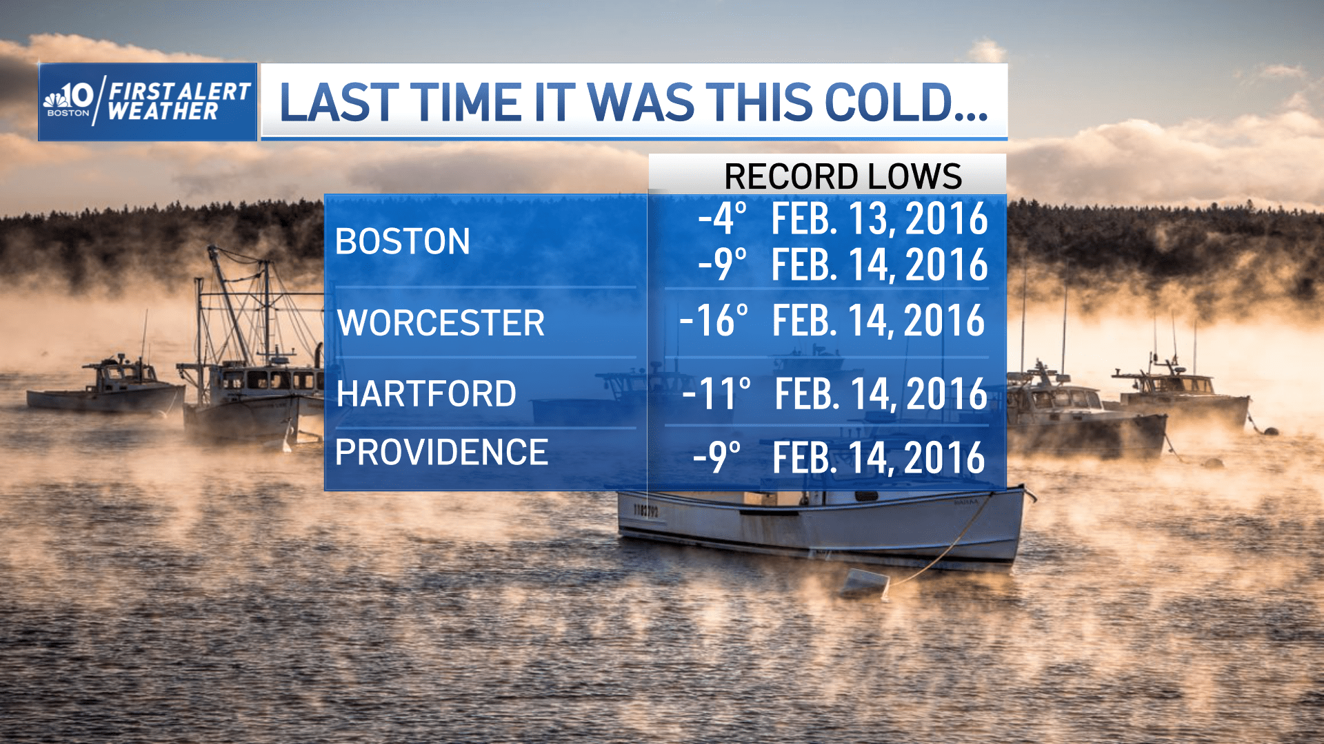
Boston and Worcester dropped to a record breaking -9 and -16 degrees, respectively, on Feb. 13-14 of 2016, which were the coldest temperatures at both sites since 1957.
So far this winter, our coldest daytime high and overnight low were back on December 24, when we were 20 degrees during the day and 11 overnight. That's downright balmy compared to what's coming. The National Weather Service has issued several cold weather and wind chill warnings for the region.
The last time we were below zero in Boston was on Jan. 7, 2018 (-2). Over the last decade in Boston, we've dipped below zero just six times.
The leading edge of the arctic air is still back to our northwest and will surge in Thursday night as the cold front blasts through. The front will be accompanied by a few snow showers and squalls, which may drop a quick coating of snow in a few communities here and there.
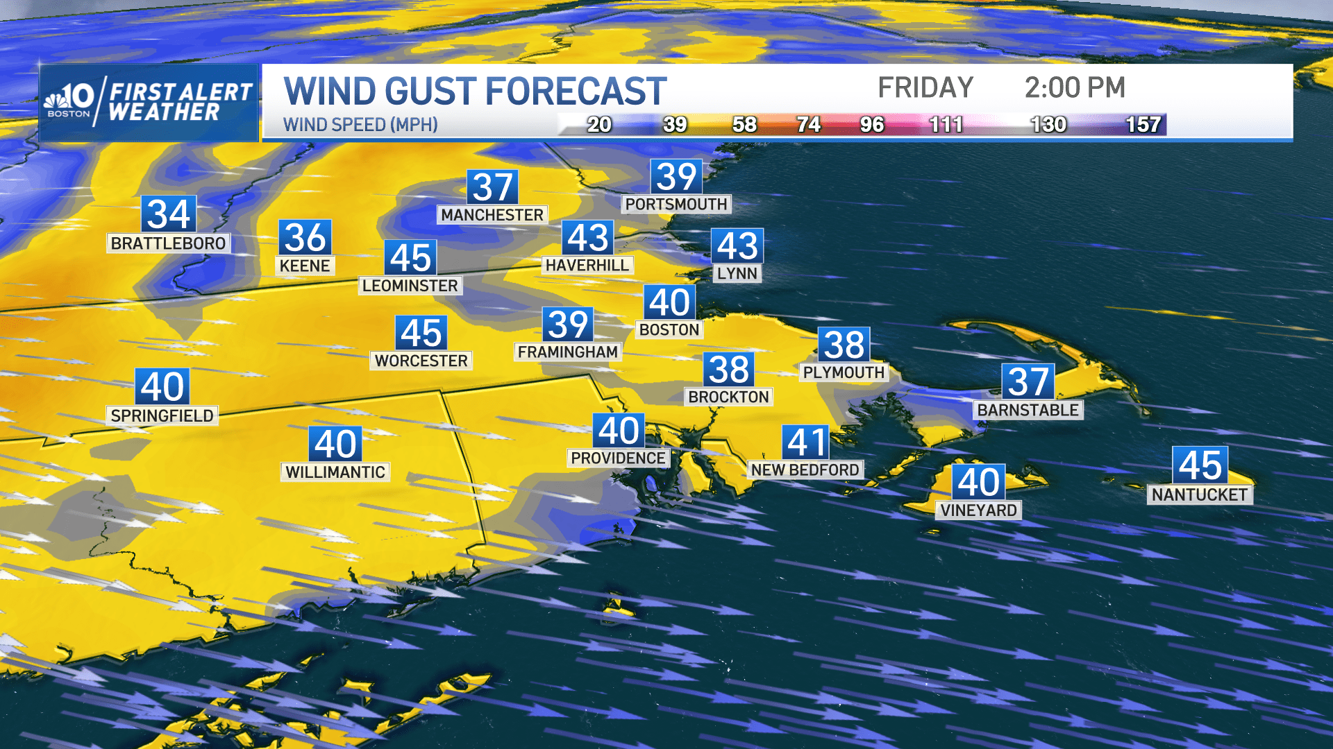
The northwest wind will pick up, too, with numerous gusts 35-45 mph and isolated gusts to 50 mph into Friday night, resulting in pockets of damage/outages and creating the dangerously cold wind chill values.
Temperatures Thursday night will fall through the 20s into the teens by Friday morning, and we won't get out of teens for the rest of the day. The core of the cold air moves overhead Friday night, with overnight lows forecast to drop to -6 in Boston. If that happens, we would break the old record of -2 set back in 1886! On Saturday, our highs won't get out of the teens again.
Wind chill values plummet into the single digits by tomorrow morning, and sub-zero by late morning. They'll continue to drop from there, bottoming out in the -20 to -30 degree range from Friday evening through late Saturday morning.
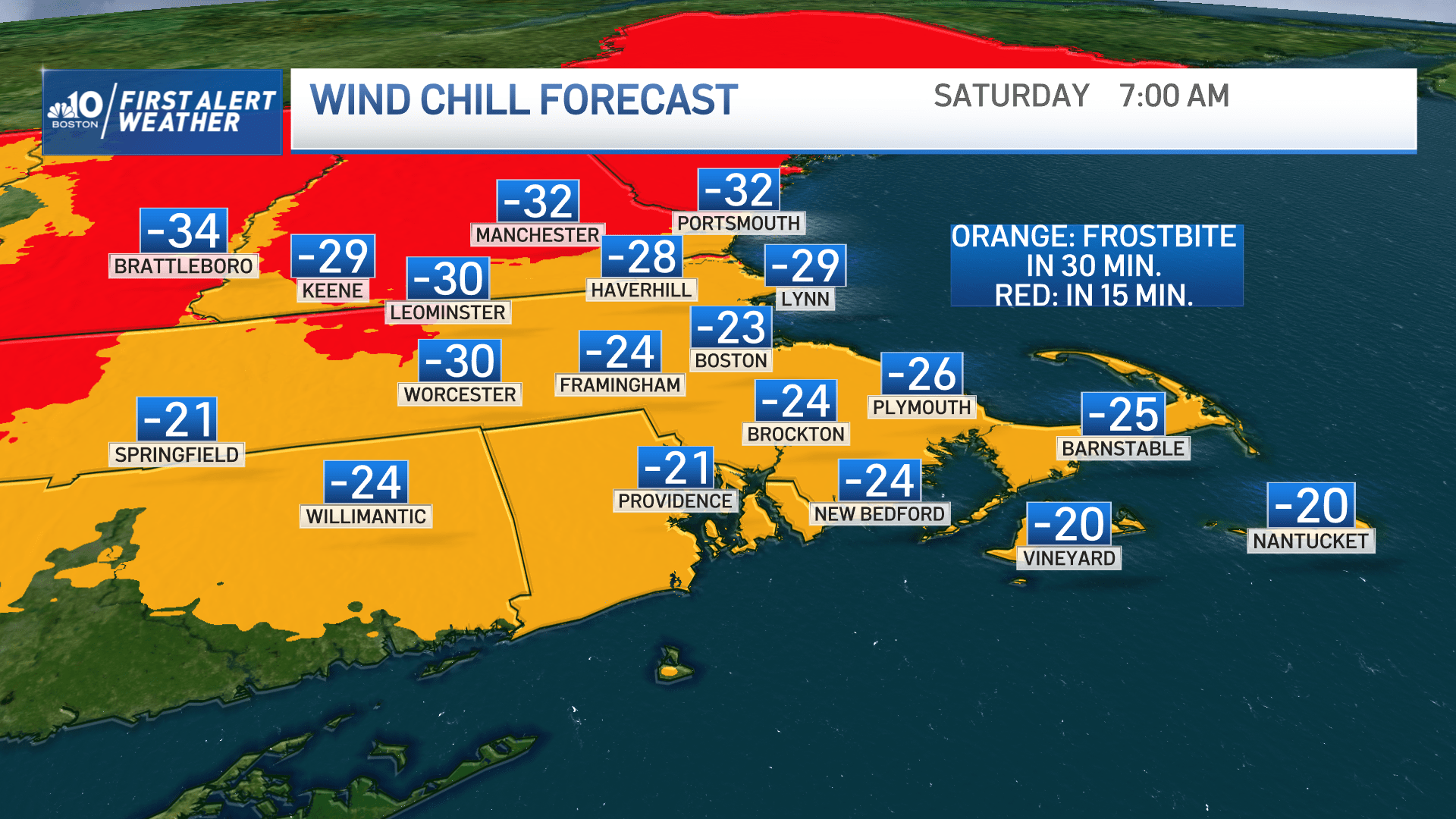
Wind chill values this low may result in frostbite on exposed skin in as little as 15 minutes.
The wind will ease somewhat by later Saturday, so wind chill values won't be as dangerous by Saturday evening into Sunday morning. Wind chill warnings are in place from Friday morning through early afternoon Saturday.
This brutally cold air isn't sticking around long though; in fact by Sunday, we'll see an impressive rebound into the lower 40s.
This segment aired on February 3, 2023.
