Support WBUR
Sloshy weather and slippery roads in New England
The latest round of wintry weather that moved in Wednesday afternoon and overnight has created slippery roads throughout New England Thursday morning.
Because of the weather, the speed limit on the Mass Pike was reduced to 40 miles per hour.
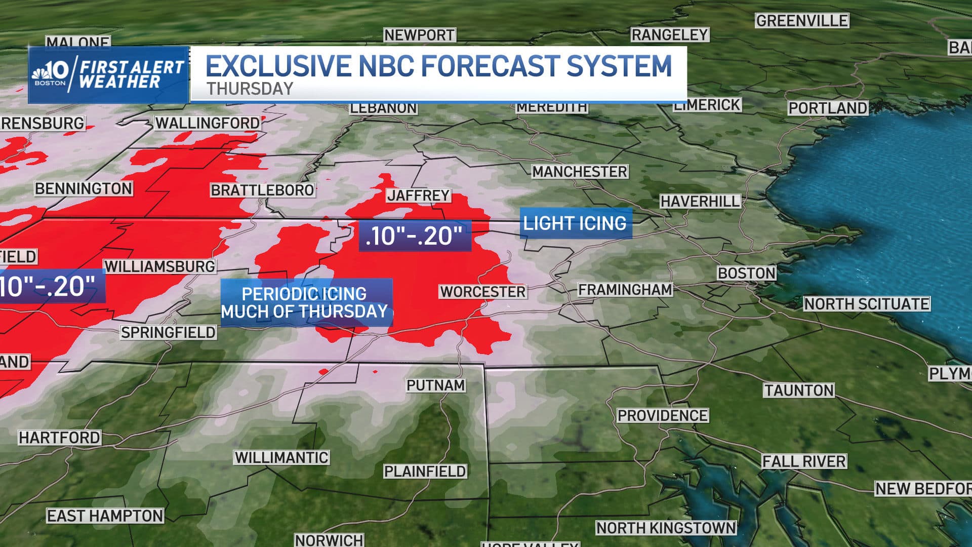
A combination of sleet and freezing rain were projected to accumulate at amounts ranging between a few hundredths to a tenth of an inch for many areas. All it takes is a trace of this type of precipitation to create slippery travel on untreated surfaces, so drivers should expect some tough travel at times on Thursday, especially north and west of town.
The bottom line? Take it slow on the roads and keep a close eye on your car's thermometer — if it's around 32 degrees and the roads look wet, the surface may actually be icy.
Wednesday
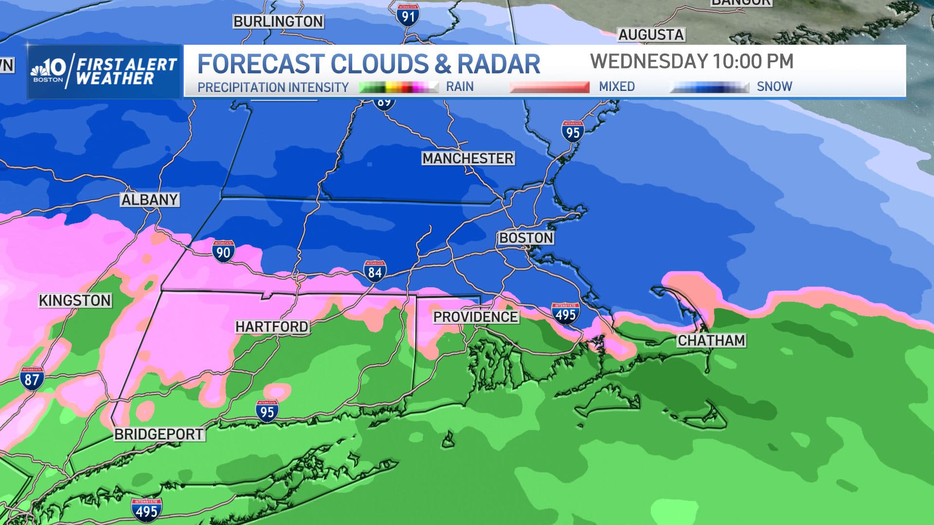
On Wednesday, a burst of snow mixed with some raindrops was expected to change over to all snow between 6 p.m. and 8 p.m. — with the exception of the South Coast and Cape Cod, where any brief snow changed to rain quickly. The steadiest snow was expected to come down between 8 p.m. and 11 p.m. from Boston to Metrowest, and points north and west.
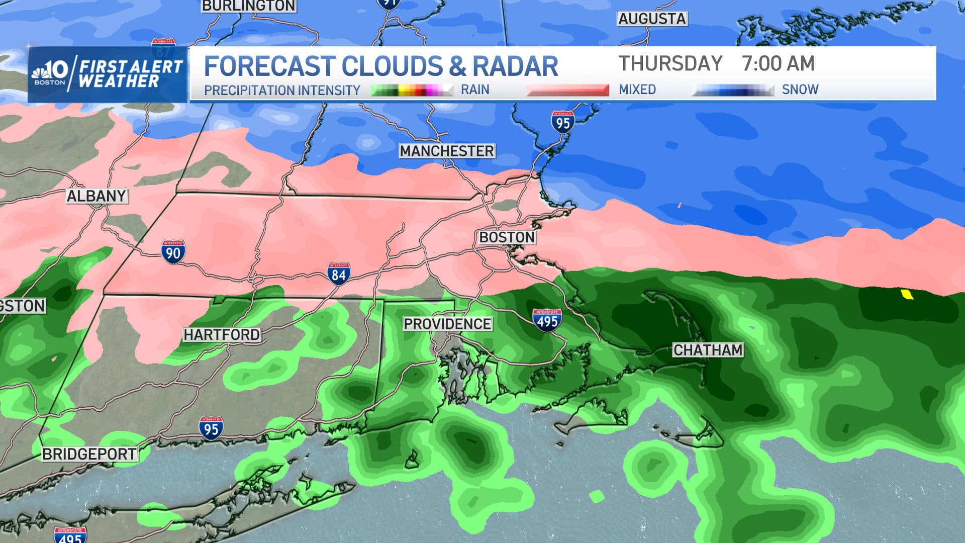
The rain-snow line made northward progress late Wednesday evening and overnight, allowing for a flip to sleet and pockets of freezing rain for many cities and towns. The steadier precipitation will wind down by midday Thursday, though low level moisture is likely to hang around.
Thursday
Some light snow or freezing drizzle may linger into Thursday evening before ending overnight. Continued road treatments will be necessary.
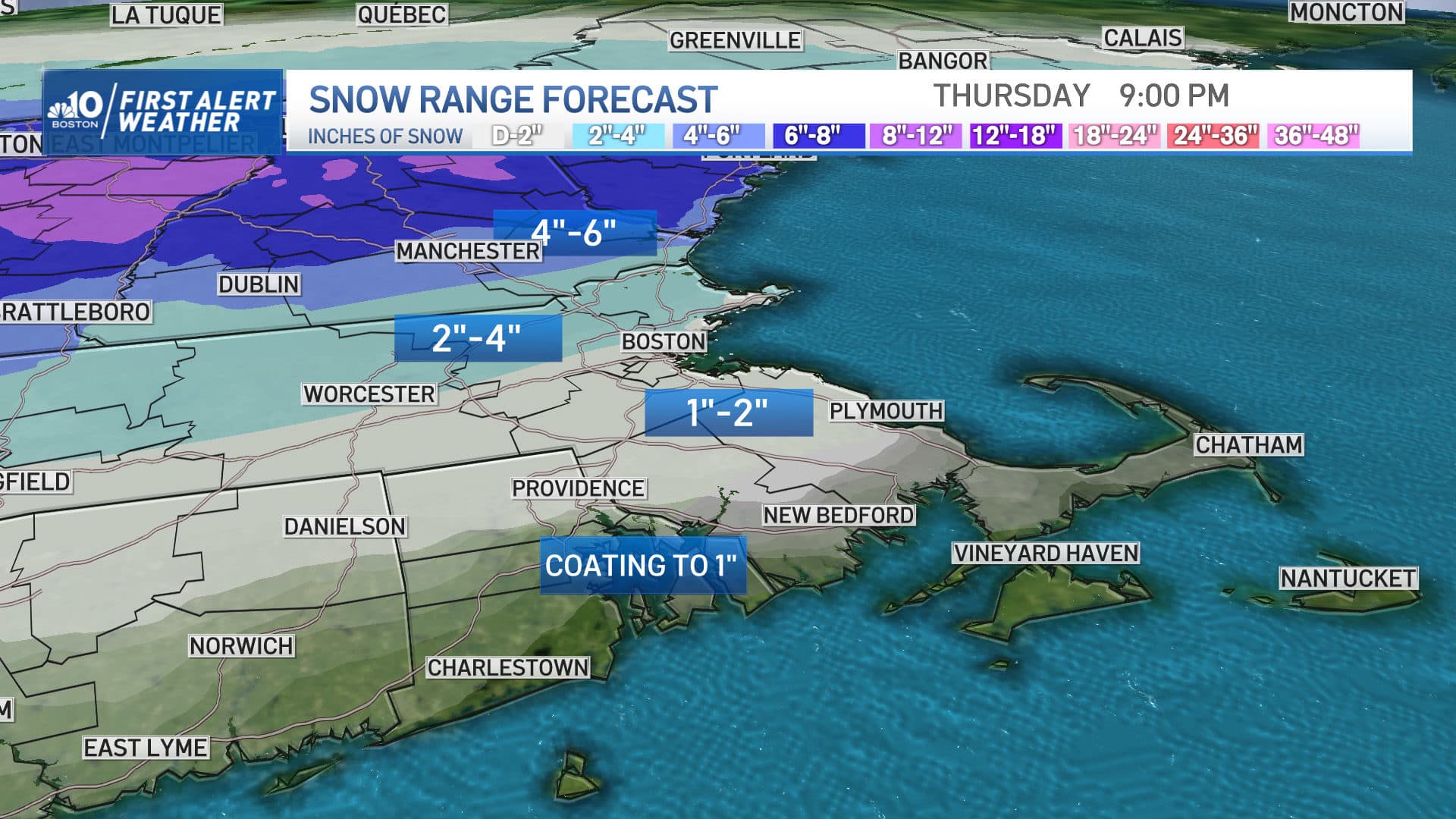
Snowfall totals will generally range from a coating to an inch or so for Boston, down to the South Shore and west to Worcester. North of Boston and over the border to southern New Hampshire, it'll be more like 2 to 4 inches, with amounts increasing the farther north you go into central and northern New England, giving a nice boost for ski and snowmobile country.
Friday
Colder, drier air works into the region on Friday, with highs temperatures starting in the 30s and 40s before dropping rapidly into the teens and 20s by evening.
We won't get out of the 20s on Saturday, with wind chill values in the single digits and teens. Any limited sun in the morning will fade behind rapidly increasing clouds — a sign of milder air trying to make a comeback for second half of the weekend. As that transition occurs, some scattered snow showers are likely on Saturday and perhaps again on Sunday, dropping a coating to 2 inches of additional snow by the end of the weekend.
Our active pattern isn't going anywhere with yet another possibility of some wintry weather late Monday into Tuesday and again on Thursday of next week.
