Support WBUR
Sometimes snow-covered, sometimes slush: Winter storm slows morning commute
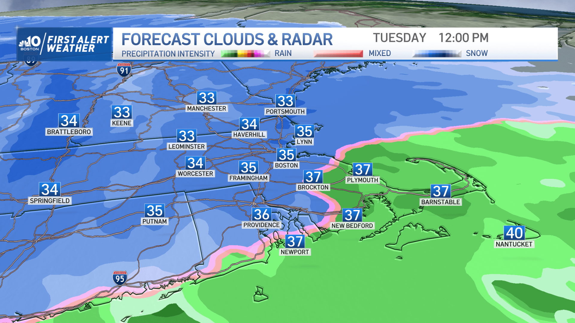
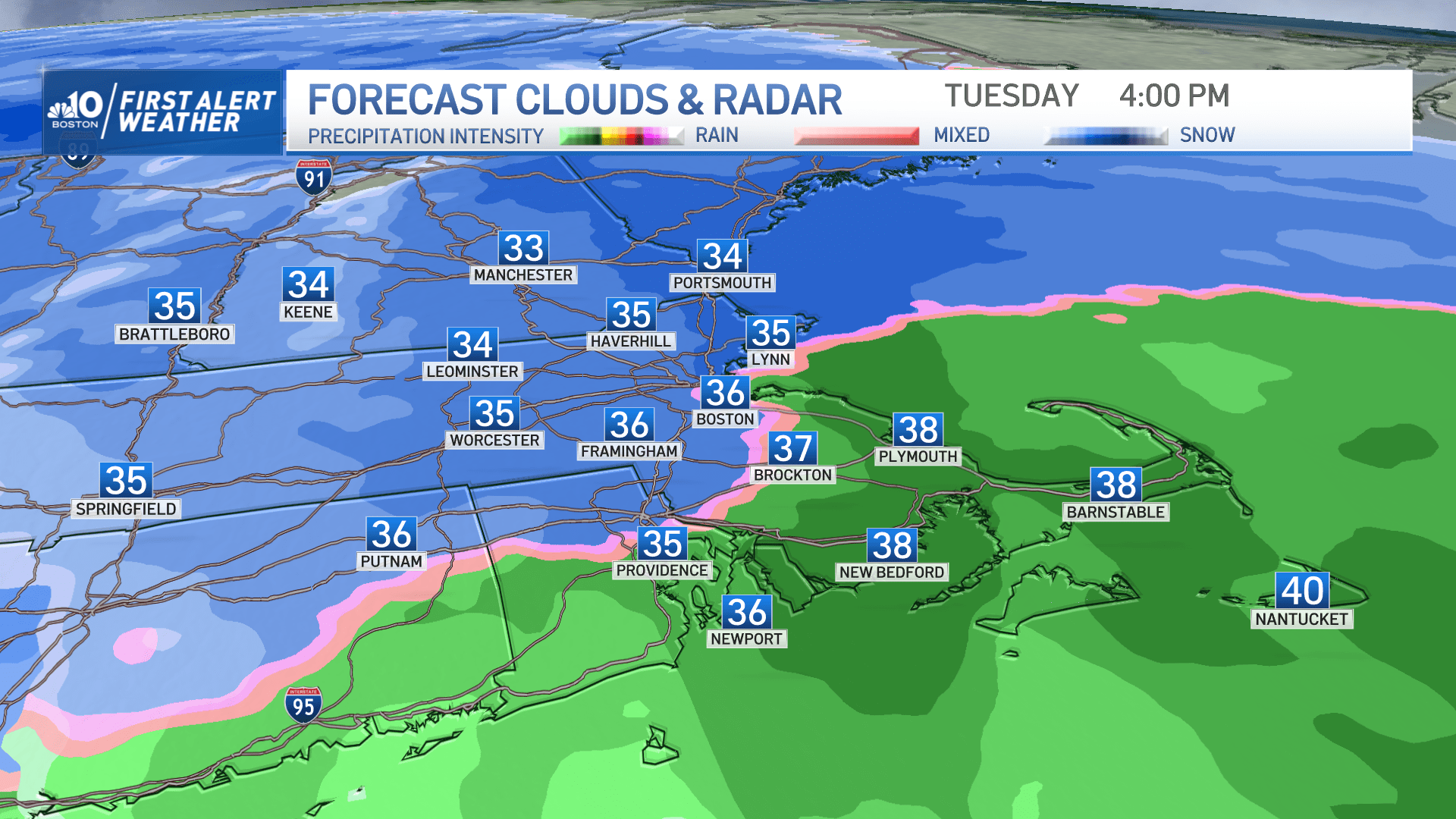
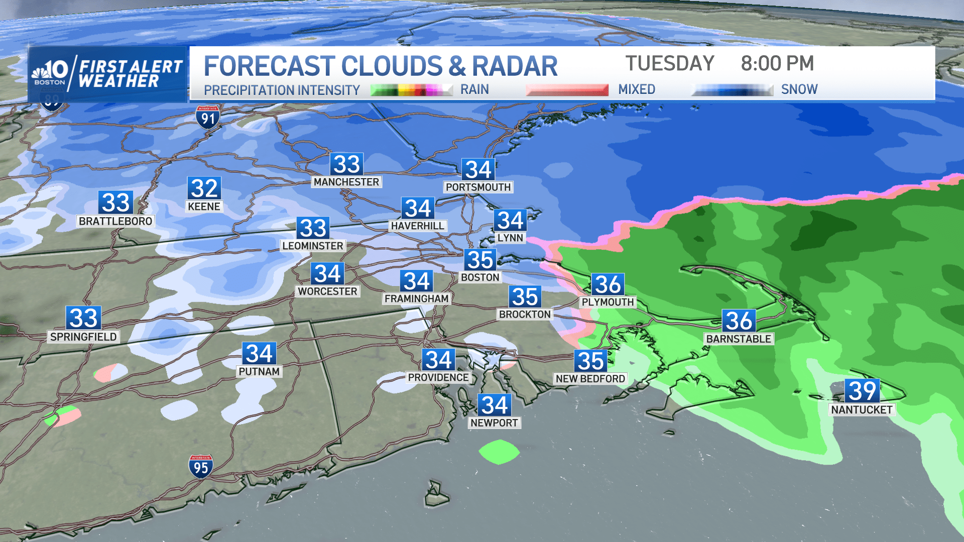
Snow has been flying across the region all of Tuesday morning. And it will continue through much of the day before winding down from west to east sometime between 7 p.m. and 9 p.m.
The intensity of the snow will vary throughout the day, meaning road conditions will vary as well — from totally snow-covered at times to slushy slop. There may even be bare pavement Tuesday afternoon, which will likely be the case on highways and interstates that were chemically treated.
We will see a changeover to rain on Cape Cod and far southeast Massachusetts Tuesday afternoon. The rain-snow line may even creep into Boston briefly later today.
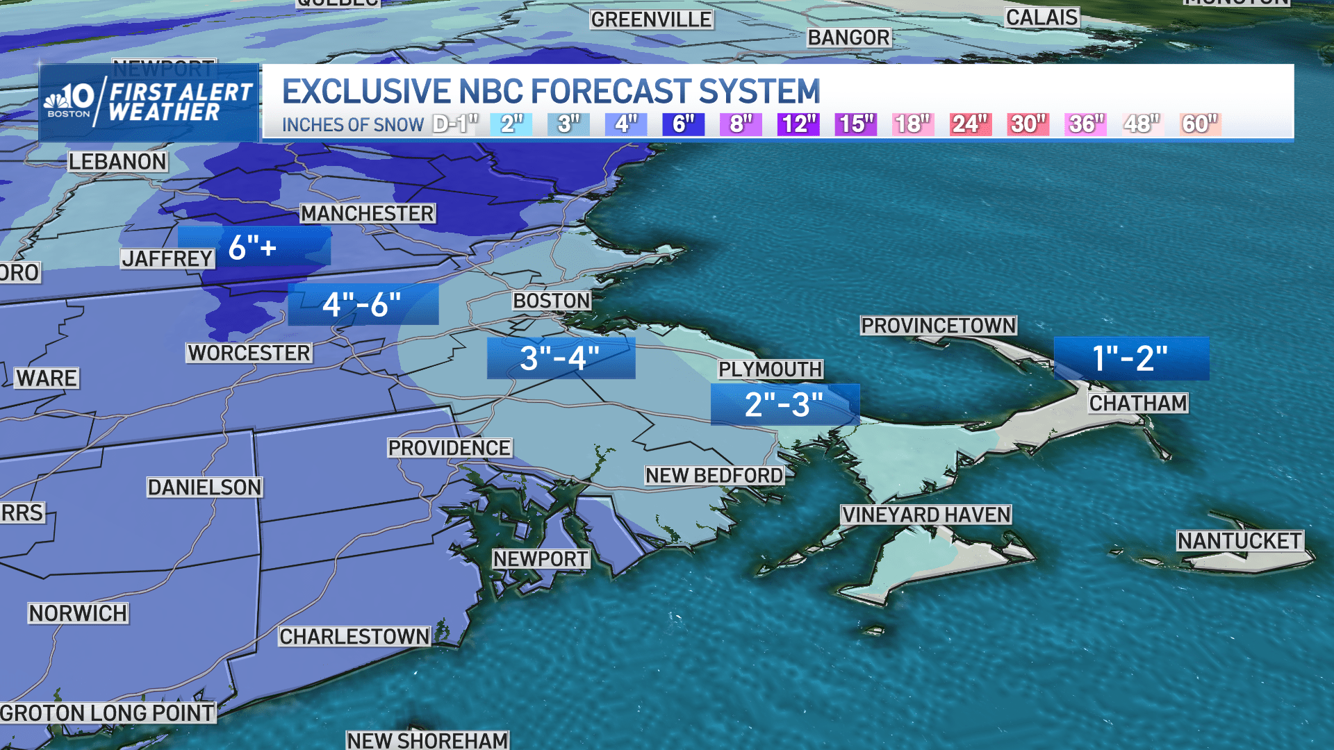
So how much snow are we talking?
In general, this will be a 2-6 inch event, with the lightest amounts on Cape Cod (1-2 inches), around 3 inches for much of eastern Massachusetts, and the "jackpot" of 4-6 inches in central Massachusetts and southwest New Hampshire.
Thankfully, this is pretty much a straight-up snow event: no wind or coastal concerns as of Tuesday morning.
Tuesday morning commute: 'Be pretty gentle on that gas and brake'
The snow was expected to fall at a rate of up to 1 inch per hour Tuesday morning. This, combined with the accumulation overnight, impacted road conditions.
The roads will be snow-covered roads and there will be reduced visibility to 0.5 mile at times. And drivers can expect slippery travels to last through Tuesday afternoon before the snow comes to an end.
With 1,800 state crews out plowing, conditions should improve gradually during the afternoon so that the evening commute will be impacted less — though there will likely be some variable road conditions, especially on secondary roads.
AAA Northeast spokesman Mark Schieldrop said it is best that people stay off the roads if they can. And if they can't, to take it easy.
"Reducing your speed is the best thing you can do. You're going to have more traction at lower speeds. And if you do have to slow down or stop, you're much less likely to lose traction," he said. "We urge people to be pretty gentle on that gas and brake pedal. You want to accelerate, decelerate slowly."
Gov. Maura Healey and Lt. Gov. Kim Driscoll thanked the state crews who have been plowing and pretreating the roads and highways since Monday night.
"We know how important it is to make sure people can get to where they want to go, whether it's a local road or a major highway," Driscoll said at a MassDot press conference Tuesday morning. "We've got folks who have been on long shifts whether we have a big storm or a storm that is just going to be a nuisance all day — a little bit more like this one is."
Healey said state crews are expected continue working until 11 p.m. Tuesday night.
More on Tuesday's snowfall and temperatures
There may be a brief lull — or at least lighter snow for a time — around midday Tuesday. Afterward, snow fills back in and continues through the afternoon. The snow should wind down by 9 p.m.
Temperatures will be in the 20s when the snow begins and stay in the 20s through early Tuesday morning. Then, the highs should gradually rise a few degrees to between 30-35 degrees Fahrenheit by Tuesday afternoon.
Looking ahead to Wednesday
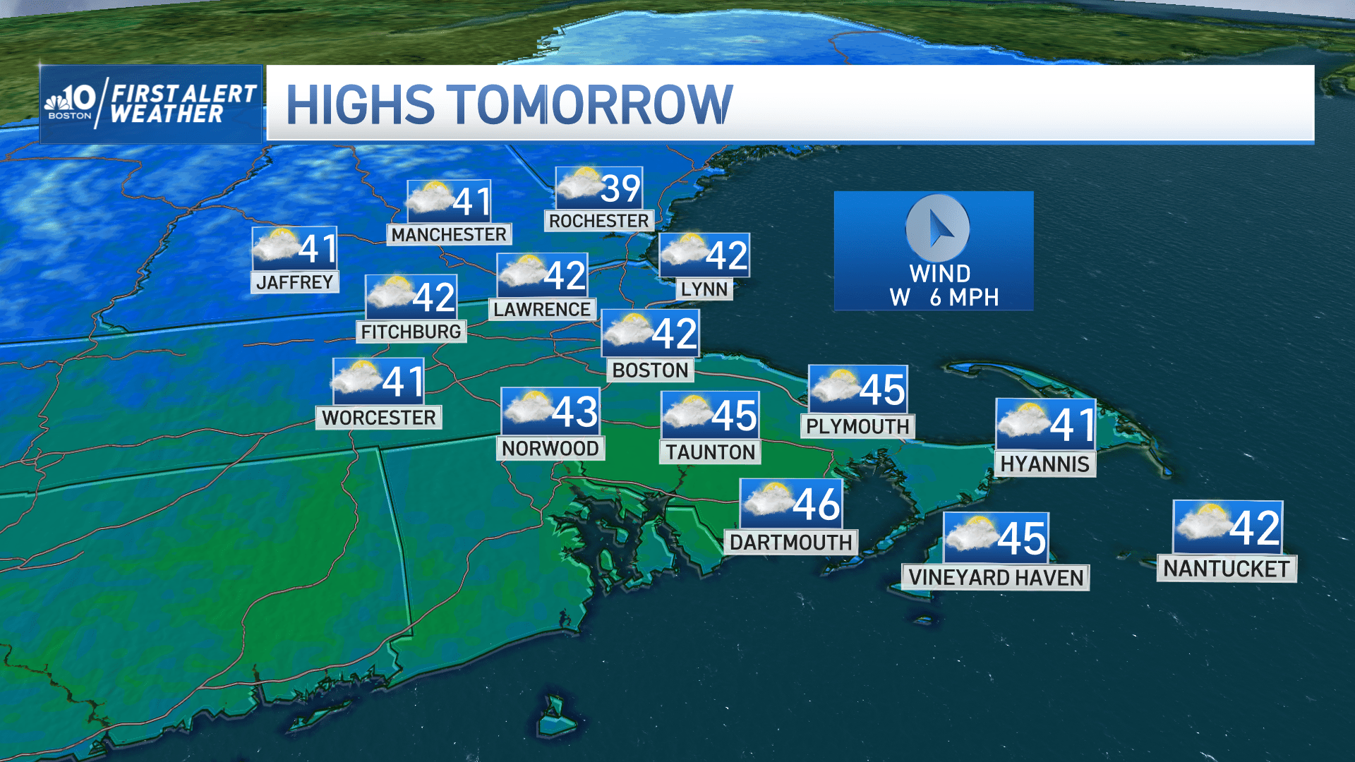
Skies will gradually clear overnight Tuesday and temperatures will fall into the upper 20s for many, and around 32 in Boston, so untreated surfaces will still be slick early Wednesday morning. We'll get some melting Wednesday afternoon as temperatures climb into 40s.
A late day rain shower Wednesday will linger into Thursday morning as another progressive disturbance moves through, so you may want the umbrella handy. It'll be mild again on Thursday afternoon with highs 45 to 50 degrees Fahrenheit.
Another storm this weekend
The next storm will approach the region later on Friday. This many days out, it's too early to say with certainty how this event will unfold, but there is continued agreement that a burst of snow is likely as the precipitation moves in Friday evening.
Just like so many storms this winter, a rain-snow line will be involved with pockets of sleet and freezing rain in between. The "height" of the storm would be overnight Friday into early Saturday, perhaps ending as a bit of snow for everyone on the tail end as the precipitation moves out. Right now, the highest chance of a plowable snow event would be north and west of Boston, and north of the MassPike. Stay tuned for more details in the days ahead.
And for some snowy perspective: Last year in Boston we ended up with 54 inches of snow for the season, which put us just above a typical climatological winter (average snow is 49.2 inches). This year — not including today — we've received 10.7 inches of snow in Boston. And the last time we had a storm with over 4 inches of snow was Feb. 25 last year.
How this storm started Monday
Monday started off quiet with temperatures in the 20s. Aside from a few early inland flurries, I expected the sun to peek out at various points in the late morning.
Clouds were expected to increase and thicken throughout the afternoon. The first snowflakes were set to arrive between 11 p.m. and 1 a.m., moving from Worcester to Boston. The intensity of the snow should have been light to moderate, although some heavier bursts Tuesday morning are possible.
With reporting from WBUR's Amy Sokolow.
This segment aired on February 27, 2023.
