Support WBUR
It's a race against the rain this weekend and Marathon Monday
Enjoy the last bit of warm weather on Friday because conditions are about to turn cooler and wetter starting on Saturday through Marathon Monday.
This has been a big week of spring weather milestones in Boston. The city eclipsed 70 degrees Fahrenheit for the first time on Tuesday, which was a little bit later than when we normally hit that mark (April 2).
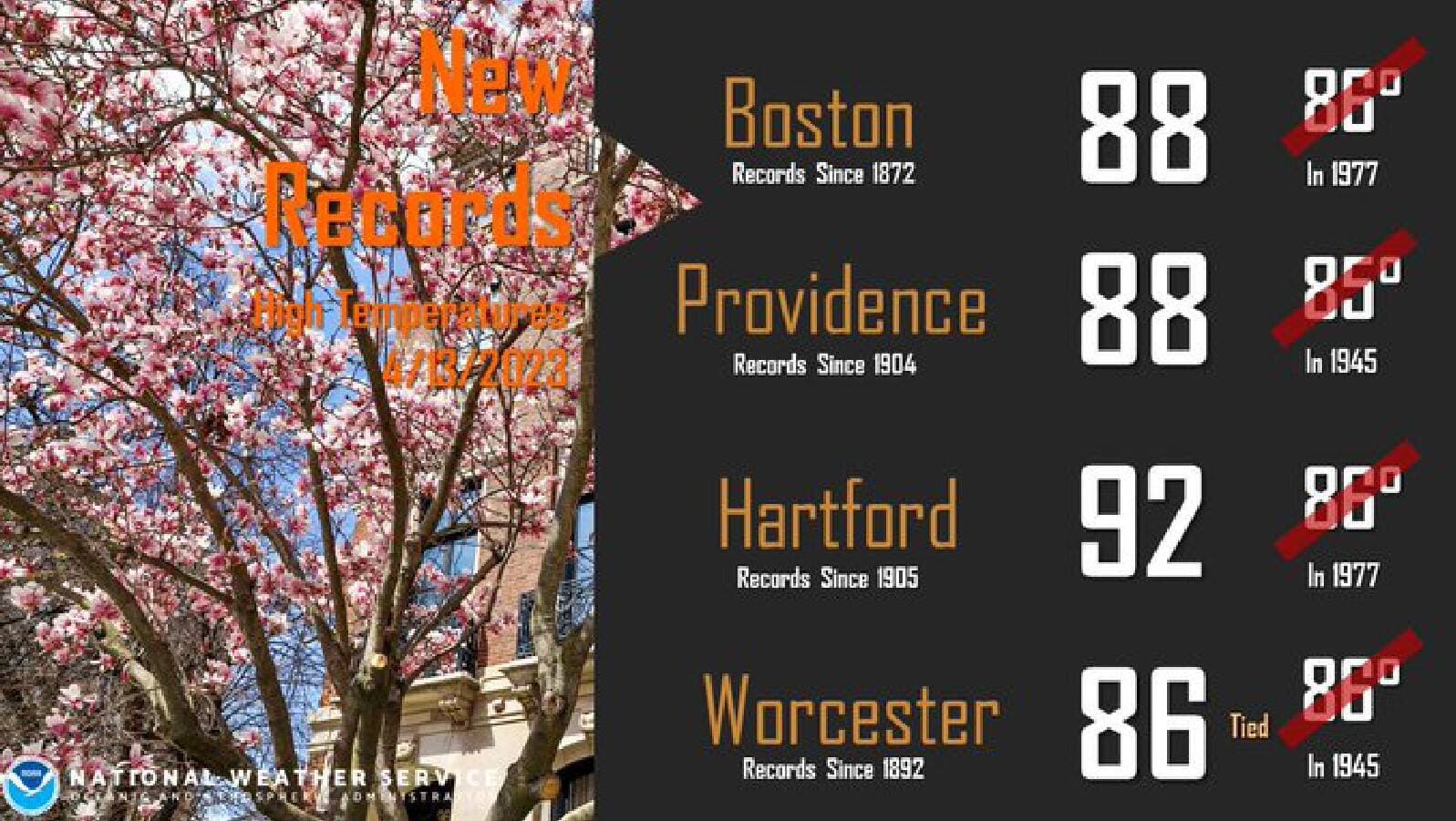
The city also also had its first 80-plus- degree reading on Thursday, which typically doesn't occur until the first week of May. In fact, we hit 88 degrees Fahrenheit at Logan Airport Thursday evening, breaking the old record of 86 degrees Fahrenheit set back in 1977. That was when a feeble seabreeze shifted to a land breeze, allowing for the temperature to jump up by a few degrees. It really is all about the wind direction, particularly this time of year.
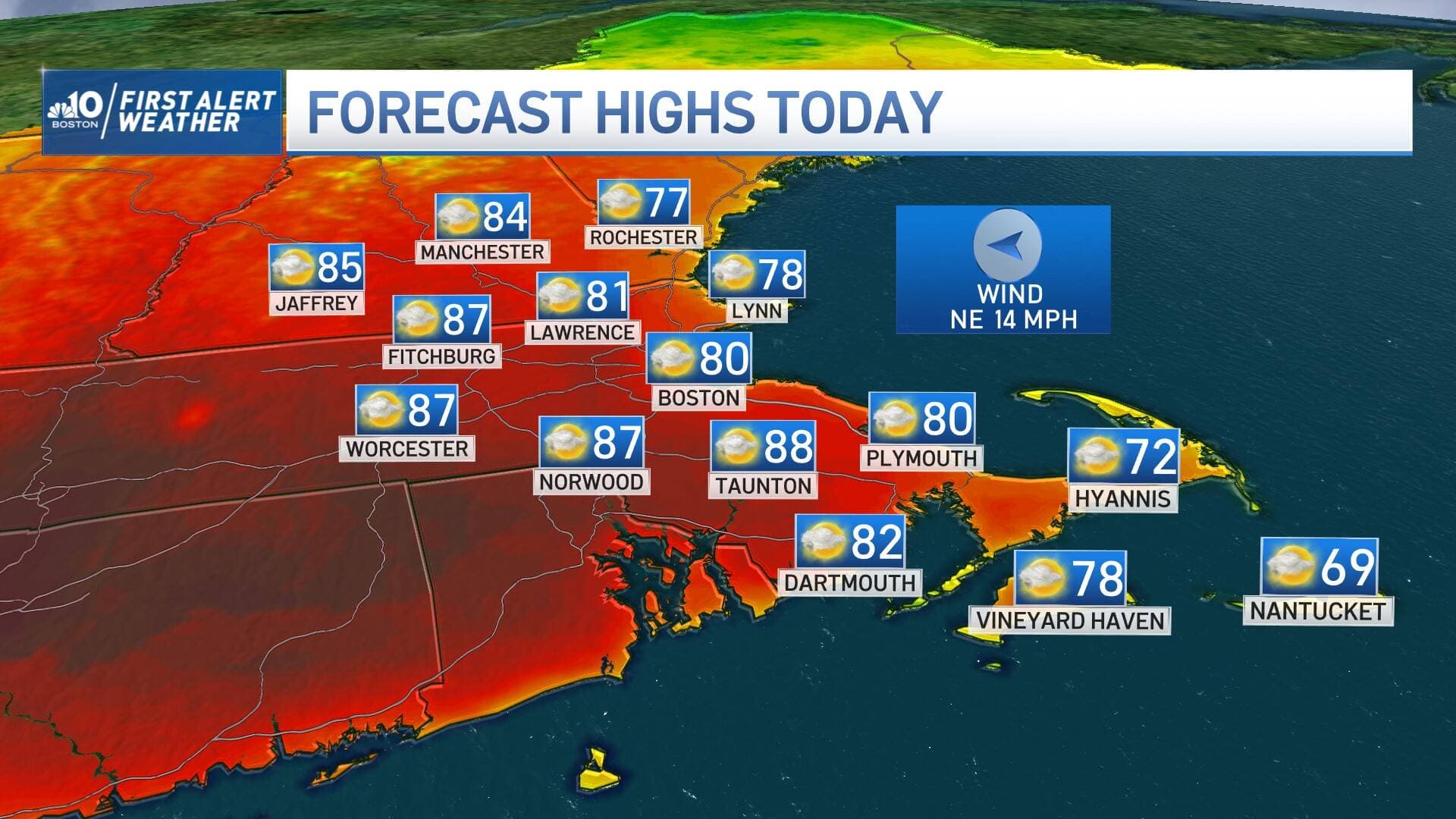
Friday
On Friday morning, we beat the record temperature for this time of year of 81 degrees Fahrenheit. But the warmth won't linger long.
At the coast, a backdoor front will slide through, shifting the wind to blow in off the ocean. This will substantially cool off the areas in and around Boston. Temperatures should rapidly fall through the 70s and into the 60s by early afternoon. Then they should drop to the 50s by the evening.
The day should stay relatively warm inland.
In general, expect sunshine mixed with some wispy clouds at times, without any rain to worry about.
For allergy sufferers, the drippy nose, sneezing and itchy eyes are letting us know pollen season is in full swing. The pollen count will remain high for weeks, except when a good heavy rain events arrives to wash out the allergens out of the air and trees. There won't be a soaking rain this weekend, but there is some wet weather heading our way.
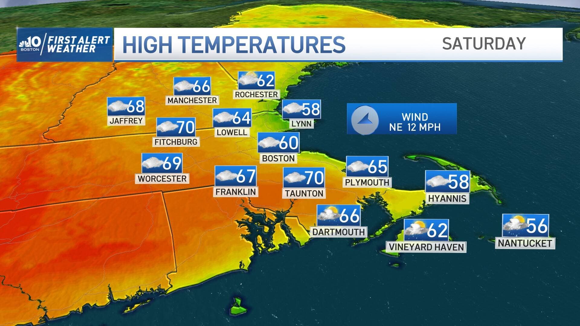
Saturday
Saturday will feature mostly cloudy skies, and a sprinkle or two. That means outdoor activities are still good to go. The temperature will be cooler — around 60 degrees Fahrenheit at the coast and 70 degrees Fahrenheit inland.
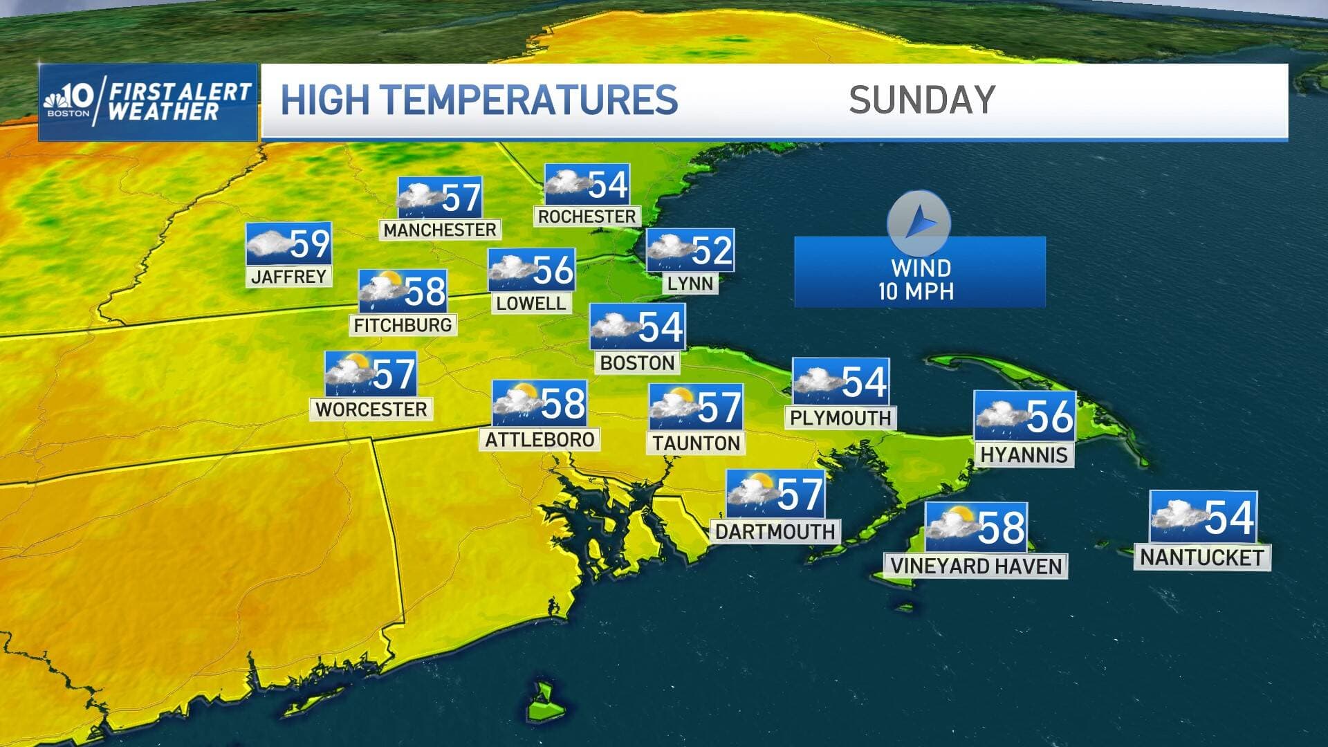
Sunday
Expect to dodge some raindrops, though it doesn't look like a washout by any means. Scattered light showers are likely from time to time, so you'll want an umbrella or raincoat if you're going to be outside for an extended period of time. You'll also want to dress for a cool feel; highs are only going to be in the 50s inland and hover right around 50 degrees Fahrenheit in Boston.
Monday
Now for the all important Marathon Monday forecast.
Temperatures
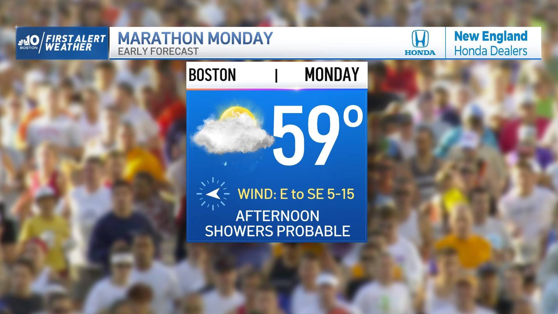
It's not looking perfect, but it could be much worse. Temperatures will likely start in the upper 40s early Monday morning and gradually rise into the mid-50s by the afternoon. For spectators that may seem a bit cool, but for runners, that's actually pretty ideal, especially if we can hold off the steady rain. The key word is if.
Risk of rain
As a system approaches from the west, there will be increased risk of showers as the day goes on. Steadier rain is likely to sweep through during the afternoon. The difference of a few hours is huge in these types of scenarios for the thousands of runners and spectators counting on a good forecast.
For now, if you're planning on lining the streets of the Boston Marathon to cheer the runners one, plan on carrying an umbrella or wearing a raincoat or hoodie. There is reason to be cautiously optimistic that pockets of heavier rain may wait to arrive until late in the day.
Wind
There will be a headwind around 5 mph in the morning that shifts to a quartering headwind during the afternoon. Then, the wind is expected to increase a bit to around 10-15 mph.
Next week
The energy driving the showers Sunday into Monday will carry a sufficient pool of cool air to reshape the jet stream configuration next week. A trough develops over the Northeast, making for a much cooler school vacation week, when highs will generally be in the 50s. The greatest risk of showers will be Tuesday and Friday of next week.
