Support WBUR
Hard rain and high winds set to batter New England Tuesday night into Wednesday
Monday's quiet weather is welcome as parts of the region continue the clean up from the weekend storm. The high temperature will top out in the 30s this afternoon with ample sunshine and light winds.
Meanwhile, our future rainy weather is causing a dangerous situation in the Gulf Coast states, where people are contending with severe thunderstorms and the risk of tornadoes. That storm is slated to move up the eastern seaboard Tuesday and arrive in New England in the evening.
Once it arrives, the storm will bring damaging wind gusts, a burst of interior snow, heavy rainfall and localized flooding, along with coastal concerns.
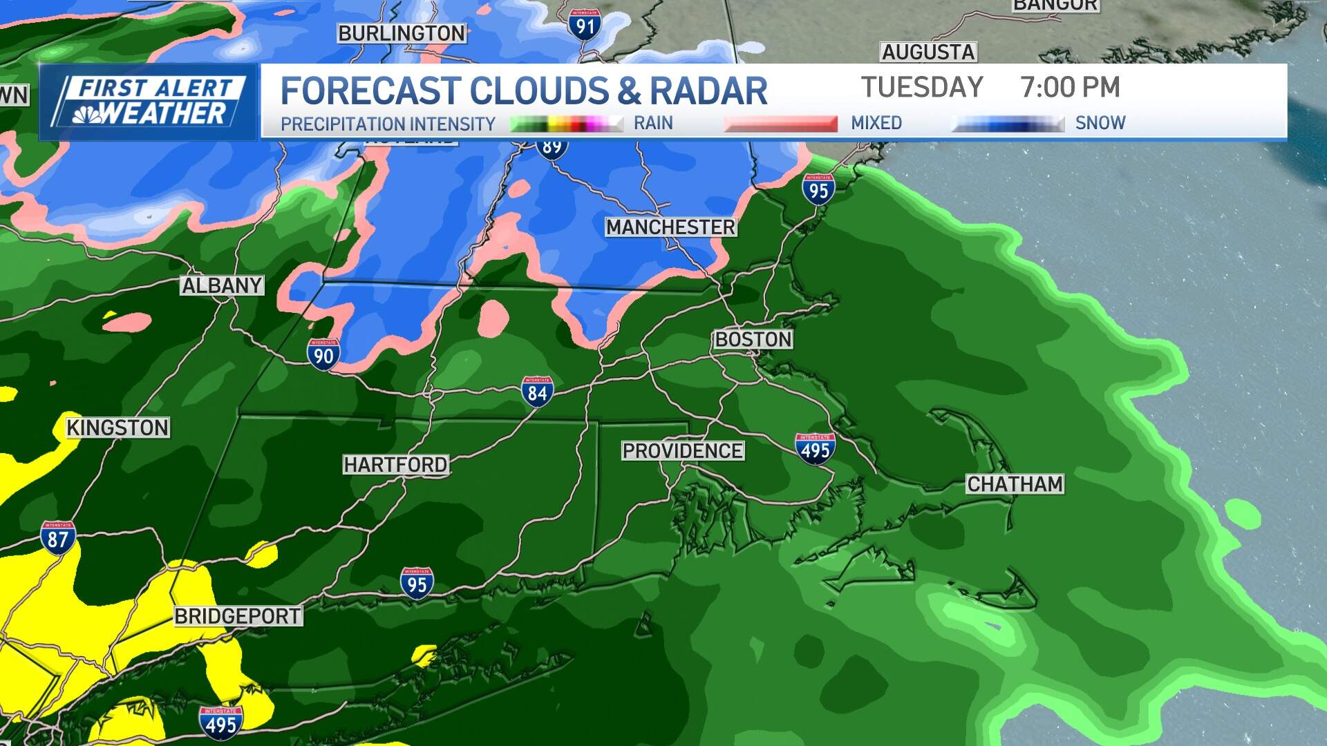
Rain and snow will arrive in southwestern New England by mid-afternoon Tuesday, and spread east generally through 6 p.m. A period of snow will be confined to inland locations Tuesday evening before flipping over to rain as mild air moves in.
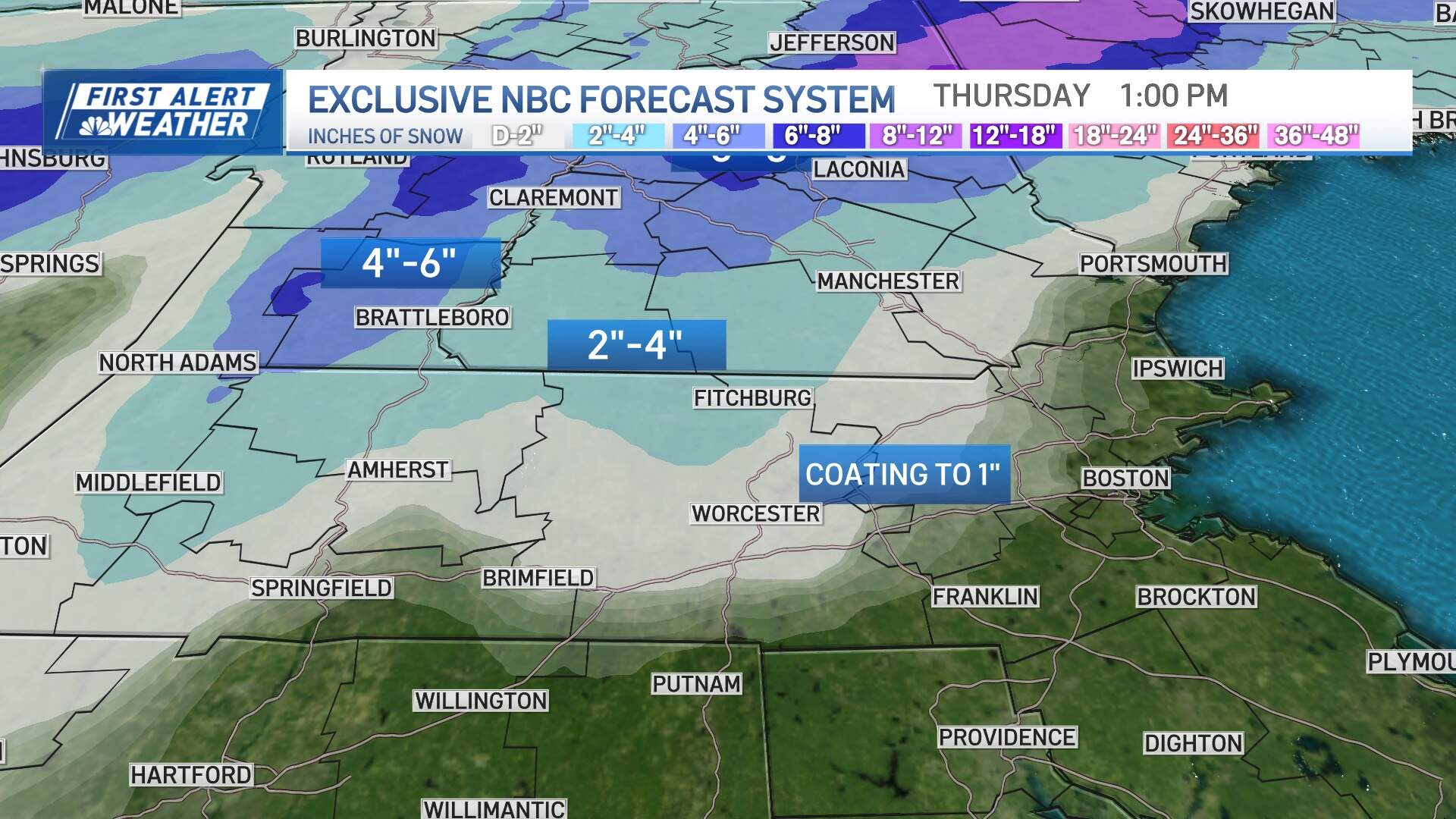
Before the changeover, a few inches of snow should accumulate in interior southern New England (outside of I-495), with amounts ramping up across central and northern New England where the snow will linger longer before the changeover.
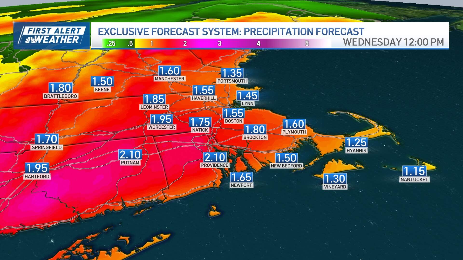
The rain will fall — and fall hard — Tuesday night into Wednesday morning, with 1 to 2 inches of rain and isolated thunderstorms expected. The combination of the snowpack, rain amounts and melting with mild air will mean significant drainage issues and a spike into minor flood stage for many of our rivers and streams.
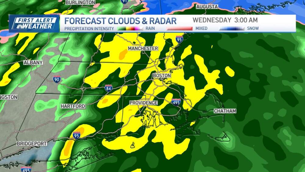
The back edge of the rain will come between 6-8 a.m. on Wednesday, with some leftover showers after that and temperatures falling through the 40s after reaching the 50s briefly.
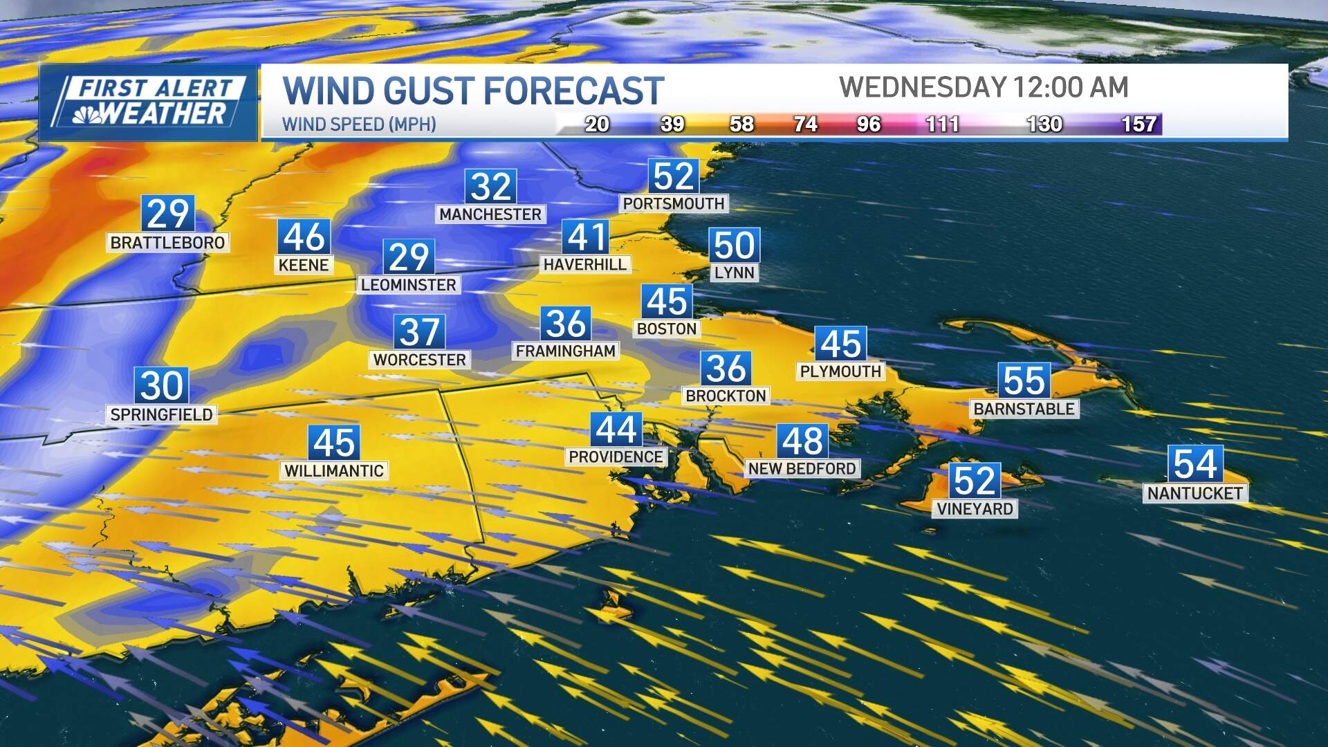
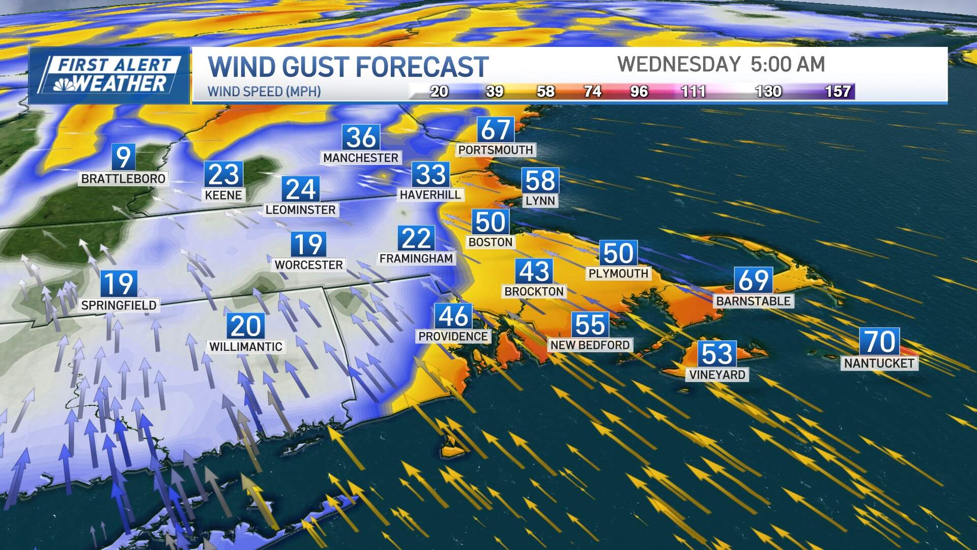
Meanwhile, the wind will howl out of the southeast; numerous gusts of 40-60 mph are likely in much of eastern Massachusetts, especially inside of 128. The strongest wind will blow from midnight until 6 a.m. Some isolated gusts 60-70 mph are possible on Cape Cod pre-dawn Wednesday. The wind will ease substantially by mid morning Wednesday.
Amtrak canceled Trains 186 and 67, which run through Boston and along the Northeast, because of the storm.
After that, the weather quiets again, with clearing skies Wednesday afternoon and highs in the 40s Thursday and Friday.
Another storm will arrive Friday night and last into Saturday ,and may be very similar to this next one; a multifaceted event with a burst of snow changing to rain and damaging wind gust potential. Stay tuned for updates this week.
