Support WBUR
More rain raises coastal flooding concerns Saturday
Once again, we find ourselves bracing for another powerful storm.
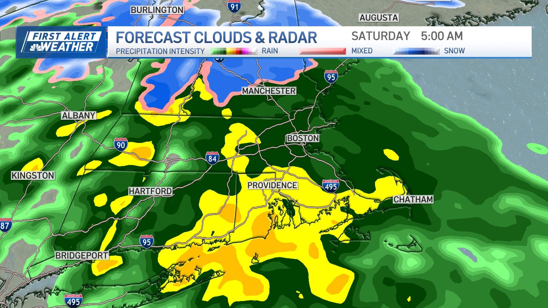
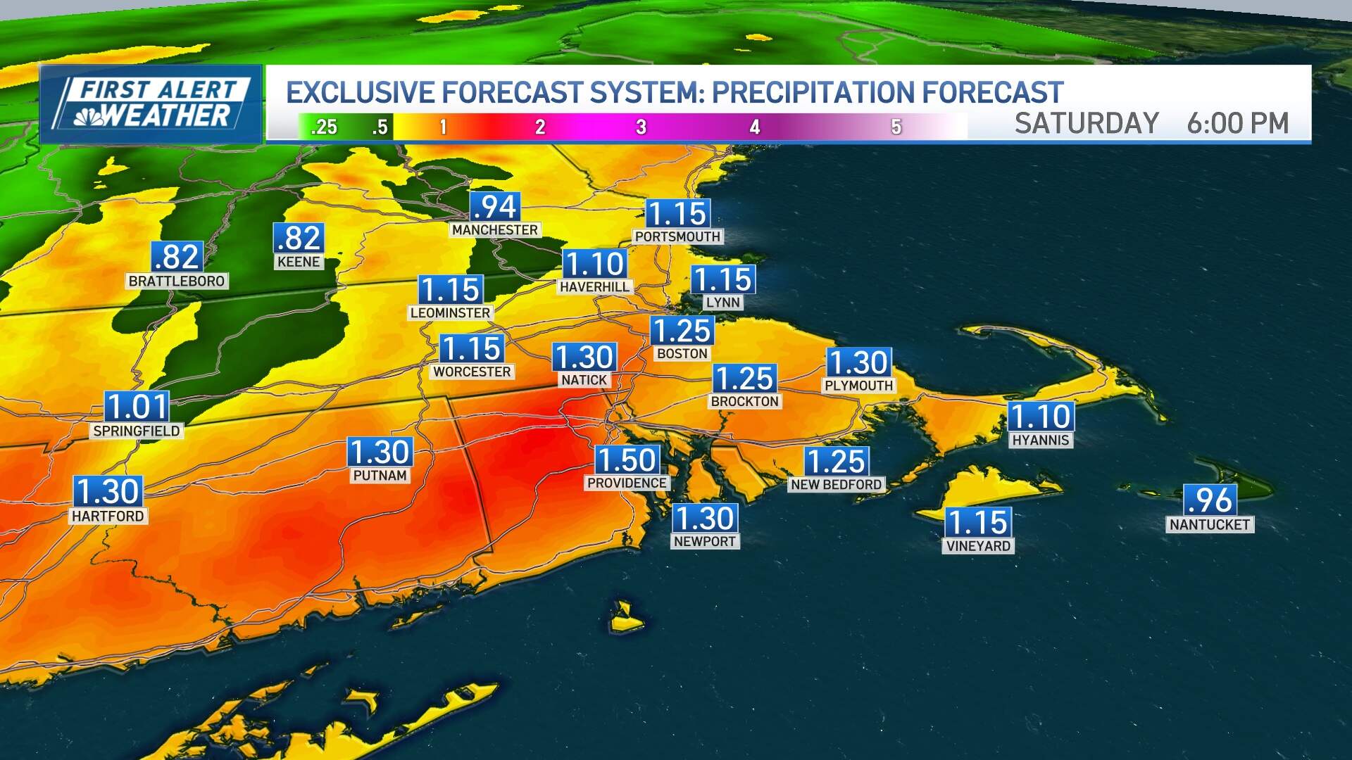
This storm system is moving rather quickly and won't bring an excessive amount of rain. A widespread 1-2 inches of rainfall is expected, with localized street flooding potential, mainly from 3-7 a.m. Saturday.
While there are similarities to the last system, there are some notable differences as well. Coastal flooding will be a significant concern, particularly due to the current new moon cycle. Expect widespread minor coastal flooding, with more intense pockets in some spots during a couple hours either side of high tide, around midday Saturday.
Hampton Beach, which dealt with significant flooding during Wednesday's storm, can expect another round of moderate to potentially major issues. Other areas like Revere, Scituate, Provincetown and the south side of Martha’s Vineyard will experience minor to moderate flooding.
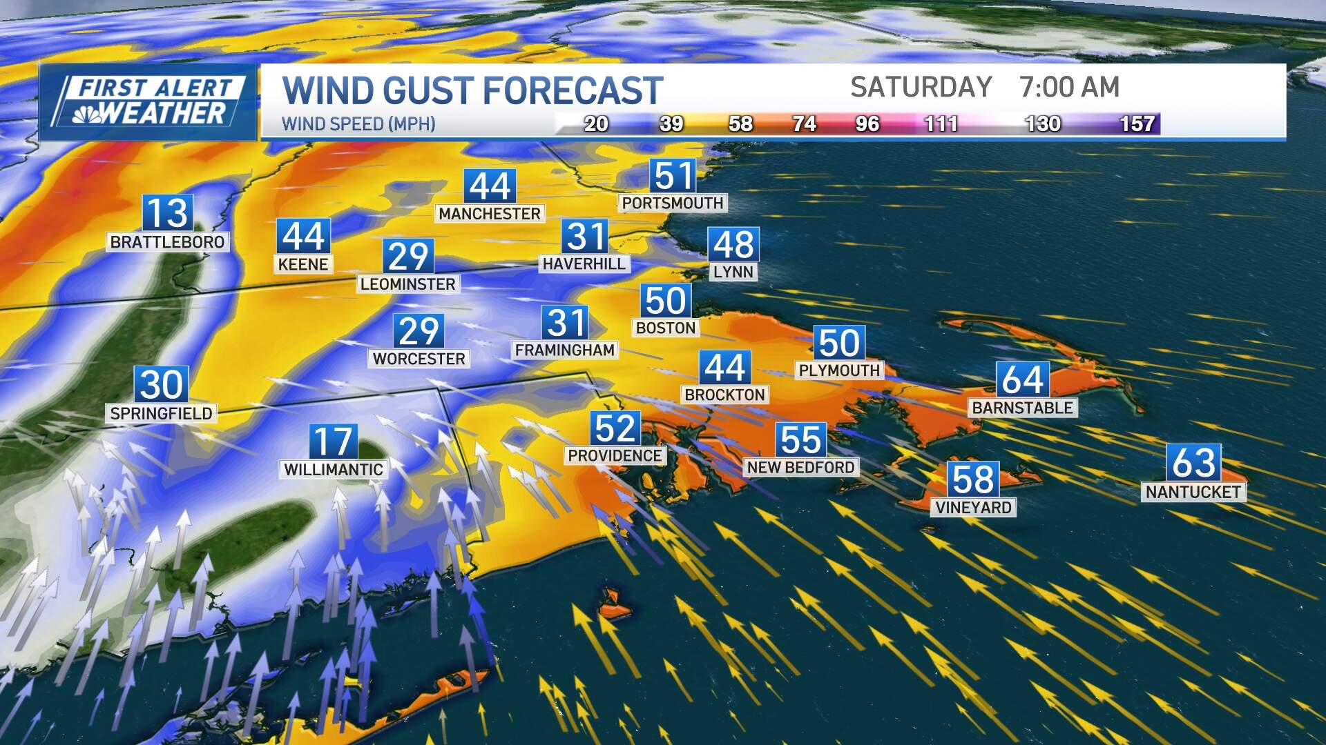
Southeast facing beaches are particularly vulnerable due to strong southeast winds persisting through the night and into Saturday morning. Expect very high seas, battering waves, and subsequent beach erosion during the morning and early afternoon on Saturday.
Rivers and streams will have a whole lot of water in them through the early next week due to the added precipitation, and will remain in minor flood stage for several days.
It won't be quite as gusty as Wednesday's storm. Peak wind speeds may reach 50-60 mph on Cape Cod, with the rest of the coastline experiencing winds of 40-45 mph, occasionally reaching 50 mph. Inland areas can expect winds in the 35-45 mph range. Isolated pockets of damage/outages will result.
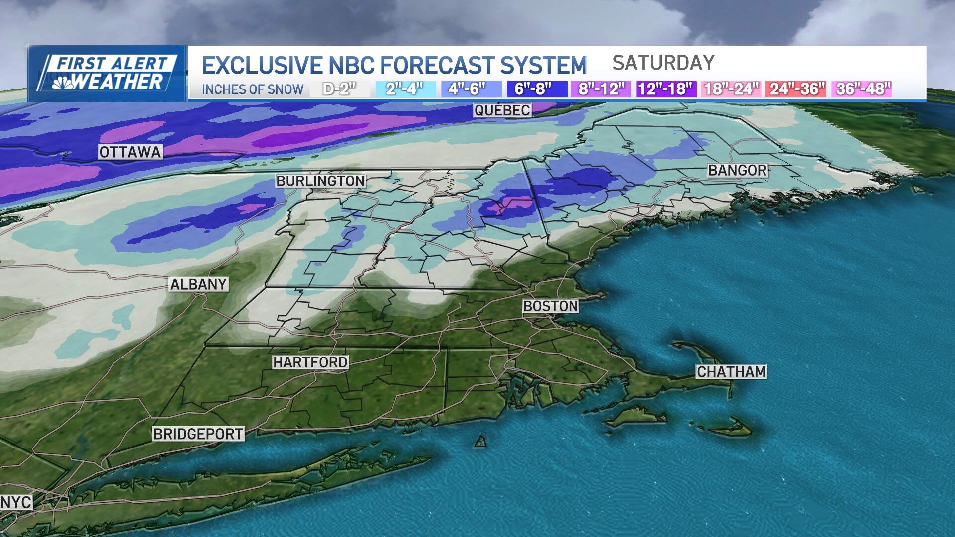
Meanwhile, this system will dump several inches of snow in portions of northern New England before changing over, which is welcome news for winter sports enthusiasts and snow lovers.
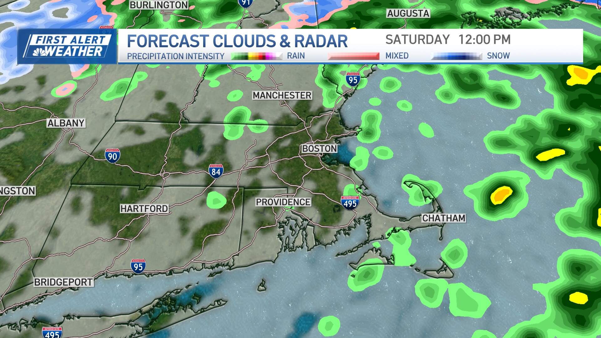
Things will dry out quick Saturday morning: the back edge of the steady rain will come in west to east 6-8 a.m., with a few lingering showers until midday. Breaks of sun should emerge as early as late morning, and the afternoon will be mainly dry and mild.
A cold front sweeps through on Sunday, marked by some passing snow showers that could coat grassy surfaces and open the door to chilly air. Temperatures should be in the 40s Sunday before a noticeable change on Monday with highs only in the low 30s.
That cold air sets the stage for our next potential storm late Tuesday into Wednesday. There's considerable uncertainty this many days out, but right now it looks like this would be mainly a snow event with some potential mixing on Cape Cod. More details to come in the days ahead.