Support WBUR
What to expect as a coastal storm brings snow to the region
The next round of snow is on the horizon as an area of low pressure coming out of the Tennessee River Valley heads in our direction.
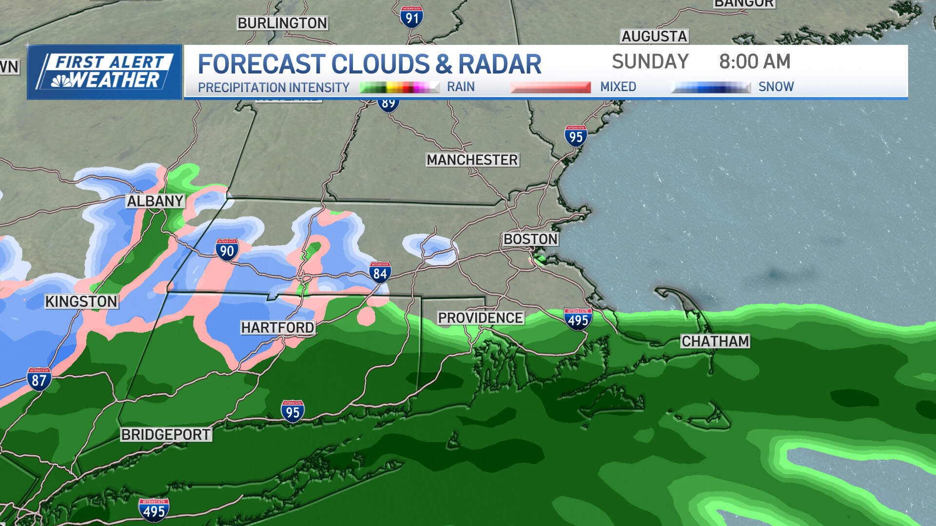
Clouds are expected to thicken by Sunday morning, with the possibility of a few rain or snow showers early. The steadier precipitation moves in during the morning hours — as snow over higher terrain and far inland; and as rain in eastern Massachusetts. Some wet snowflakes may mix in from time to time, though with temperatures at or above freezing — and pavement temperatures a few degrees above that — road conditions should be wet as opposed to white through early afternoon for most cities and towns.
Precipitation continues into the afternoon and evening, pushing into central New England as well as portions of northern New England. Precipitation is expected to continue throughout Sunday night into the Monday morning commute before tapering off during the afternoon Monday.
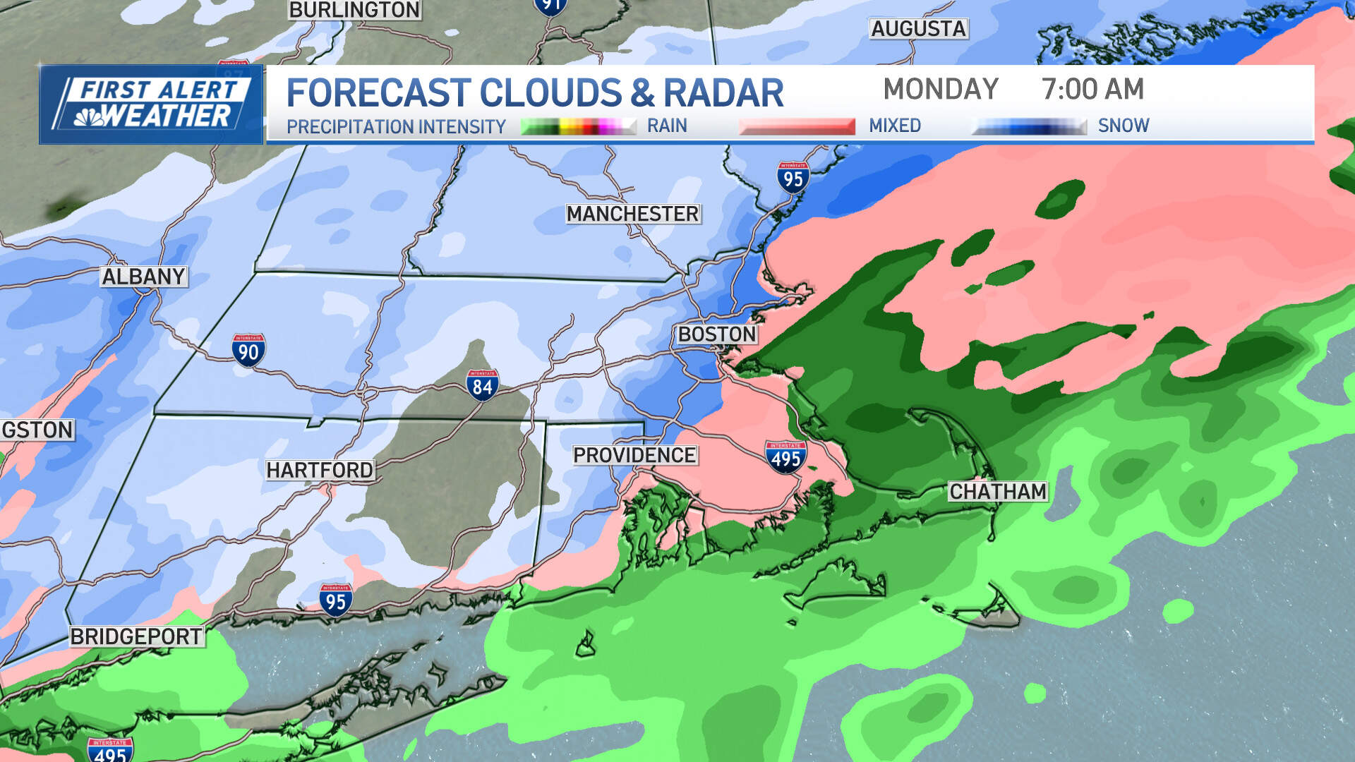
The bulk of the snow accumulation is expected Sunday night into Monday morning. The trickiest part of the forecast is timing out the switch over from rain and wintry mix to all snow as our storm system slowly pulls away and slightly colder air funnels back into the area.
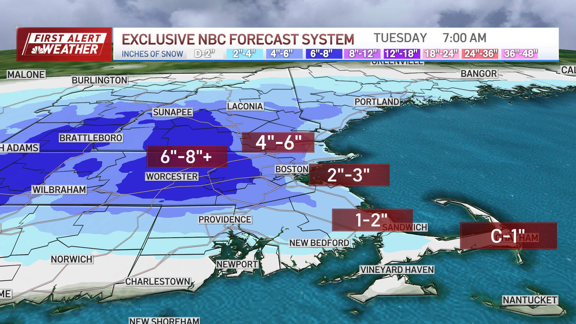
In terms of accumulation:
- Interior southern New England (including Worcester Hills and southwest New Hampshire) will see mostly snow, with 6 to 8 inches anticipated.
- North and west of Boston (along 128 to 495), expect 4 to 6 inches, with 2 to 3 inches along the coast, including for Boston, Cape Ann and the South Shore.
- A coating to 2 inches of snow on Cape Cod, where it takes the longest to make the transition over to snow.
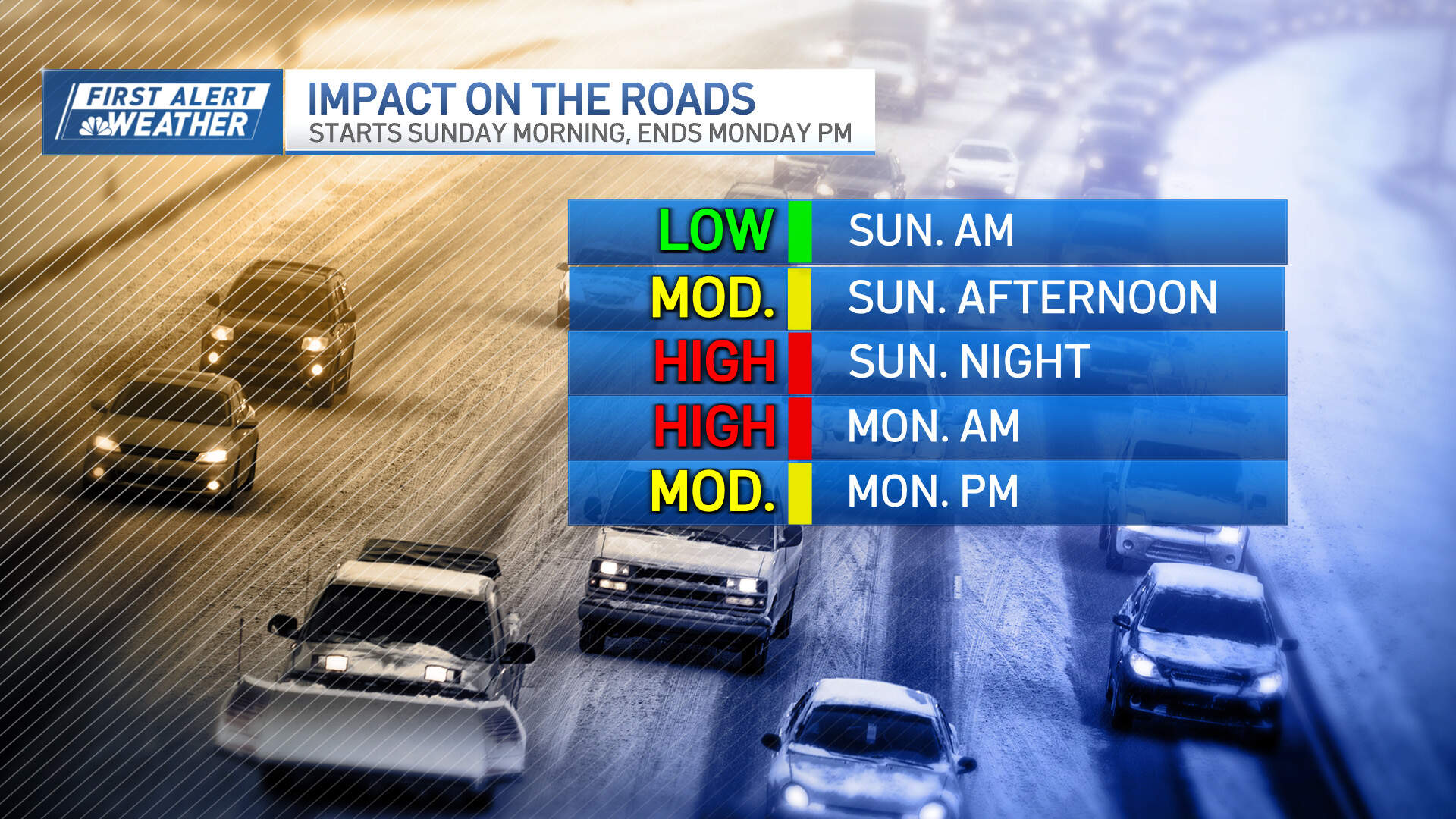
The "height" of the storm will be Sunday night into Monday morning with areas of reduced visibility, slippery travel and variable road conditions. The big question is: Will there be a snow day Monday? The answer depends on where you live. The greatest chance of snow day potential is north and west of Boston — but I always say, do your homework anyways.
There isn't much concern about the wind with this system, though gusts out of the east/northeast could hit 40-50 mph across the Cape and Islands, 30-40 mph along the immediate coast and 20-30 mph inland Sunday night into Monday morning. Thankfully, with the storm track off shore and not a significant duration of intensity of wind or waves, there aren't any coastal issues anticipated.
This article was originally published on January 27, 2024.
