Support WBUR
Forecast: Heat wave arrives in Boston, bringing possible thunderstorms
New England is in the grip of another heat wave this week, with multiple disturbances moving through the northern tier of the United States. While relief is on the horizon with a meaningful cold front bringing cooler and drier air by the end of the week, we need to navigate through some intense heat and potential severe weather first.
High temperatures will climb into the 90s on Monday, and a few pop-up storms are possible in the afternoon and evening. Combined with the humidity, the heat index will soar over 100 degrees. A heat emergency is in effect in Boston from Monday through Wednesday.
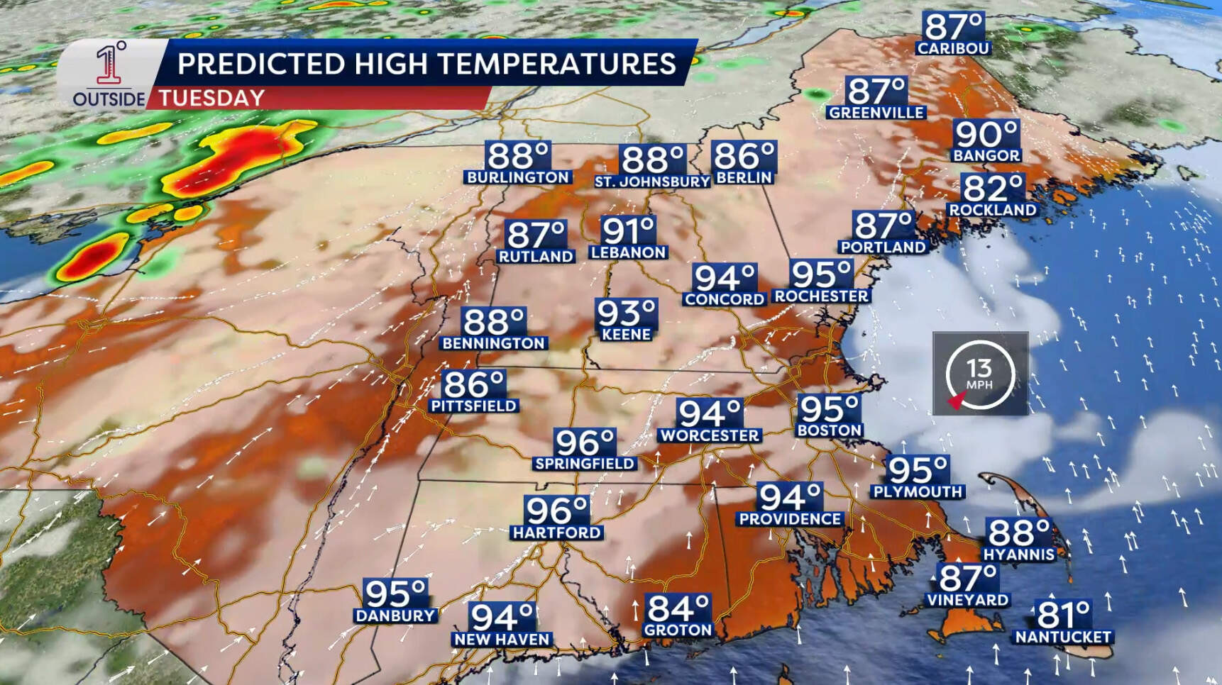
On Tuesday, a few morning showers will be possible, followed by a mix of sun and clouds with oppressive humidity throughout the day. Temperatures will rise into the 90s, with a heat index reaching over 100 degrees for many areas. The chance of storms increases in the afternoon and evening, with potential storms lasting into the early night, accompanied by warm and muggy overnight lows.
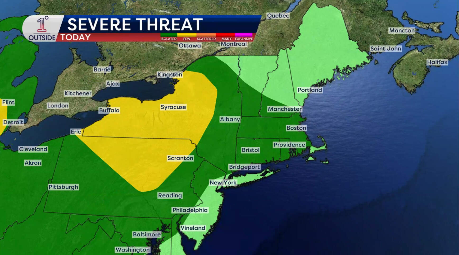
Wednesday will see temperatures reaching into the 90s. Sound familiar? A cold front will approach later in the day, triggering scattered thunderstorms, some of which could become strong to severe. This spells relief from this extended humid stretch that Massachusetts has been in.
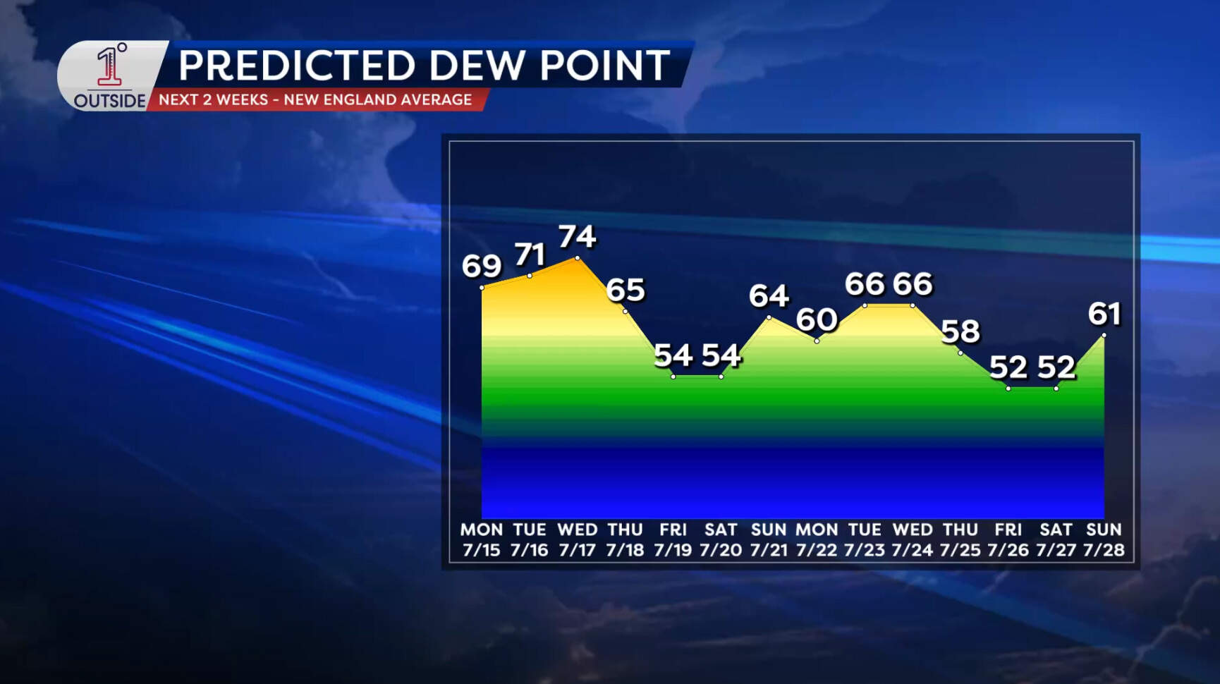
On Thursday, dew points will drop significantly and you'll feel the difference! High temperatures will be lower, in the 80s, with morning clouds clearing out. Overnight lows will drop into the 50s and lower 60s, providing a refreshing change. Friday will be a comfortable and pleasant day, with low humidity and seasonable temperatures in the low 80s.
Until the heat wave breaks, it's crucial to stay hydrated by drinking plenty of water throughout the day. Limit outdoor activities and avoid strenuous tasks during peak heat hours, typically from late morning to early evening. If you must be outside, take breaks in the shade to cool down and wear lightweight, loose-fitting and light-colored clothing. Pay extra attention to children, the elderly and those with preexisting health conditions, as they are more susceptible to heat-related illnesses.
With the possibility of thunderstorms these next few days, it's essential to stay informed and be ready to seek shelter indoors should you need to. Have a plan and identify a safe place in your home or building to take shelter if a severe storm hits.