Support WBUR
A mid-week storm system brings snow, wind and a blast of cold to Mass.
A fast-moving storm system will sweep across New England late Wednesday into Thursday, bringing a mix of snow, rain and gusty winds.
While this system is quick and doesn’t carry much moisture, it will still create travel challenges and usher in an arctic blast by Friday. Here's what to expect:
Timeline for Boston and beyond
Wednesday evening:
Light rain and snow showers may develop by late afternoon or early evening. The steadiest precipitation arrives between 8 and 11 p.m., from west to east. In Boston, expect mainly rain with perhaps a brief period of wet snow mixing in overnight.
Thursday:
The storm's peak intensity occurs overnight into pre-dawn Thursday. Precipitation rates may briefly cool the atmosphere enough to flip rain to snow in Boston and the immediate suburbs, particularly in the early hours of Thursday. While roads in Boston will remain primarily wet, a light coating of snow could develop on grassy surfaces and car tops.
The back edge of precipitation moves out mid- to late-morning. Lingering rain and snow showers will taper by midday.
Be mindful of slippery travel. Slick roads are likely outside of I-495, especially in areas that received accumulating snow. Inside I-495, rain or light snow may make surfaces wet but less hazardous.
A partial clearing develops in the afternoon, but scattered snow showers may persist in the hills and mountains. A colder, drier wind starts ramping up by evening.
A freeze-up is likely as the cold air blasts in. Any leftover moisture, particularly on untreated surfaces, will refreeze. Watch for icy patches on the roads, even where rain was the primary precipitation type.
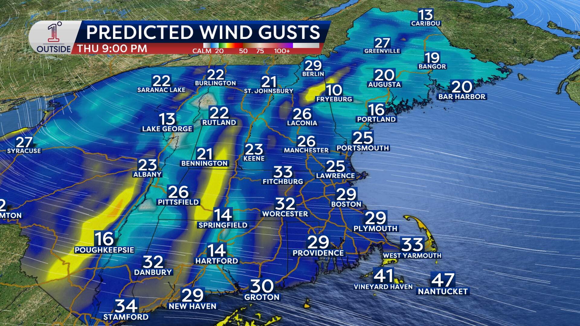
Winds will increase as the system departs Thursday evening into Friday, shifting west to northwest. Gusts of 30 to 40 mph are in store for most of New England, with isolated gusts up to 50 mph on Cape Cod. Some isolated pockets of wind damage will result.
Friday and the weekend:
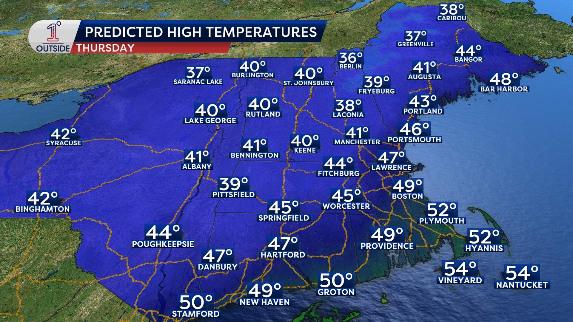
An arctic blast takes hold, with high temperatures in Boston struggling to hit the low 30s. Wind chills will make it feel like it's in the teens for many.
The wintry chill continues into Saturday with high temperatures in the upper 20s to low 30s. A bit less wind is expected, but the cold will linger.
Snow totals
Boston and inside I-495:
Expect a coating to 1 inch of snow, mainly on grassy and elevated surfaces. Roads should remain wet due to mild surface temperatures, but be cautious of icy spots Thursday evening as temperatures plummet.
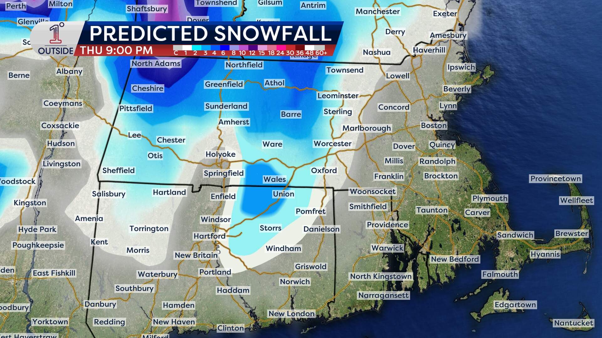
Central Massachusetts and higher elevations:
Expect 1 to 3 inches of snow, with some locally higher totals.
Northern New England:
Most areas will see 2 to 4 inches, but higher terrain in northern Vermont, New Hampshire and northwestern Maine could see anywhere from 4 to 10 inches. The jackpot zone lies north of Lincoln, Maine, with totals as high as 10 inches in elevated spots.
Cape Cod:
Rain dominates, with about 0.5 to 1 inch of precipitation possible.
