Support WBUR
Mid-week storm to bring damaging wind, heavy rain and warm air to Boston

A powerful storm system is set to bring significant weather impacts to Boston Tuesday night into Wednesday. Heavy rainfall, gusty winds and a surge of unseasonable warmth will blow through New England before cooler air returns. Here’s what you need to know:
Heavy rain and flooding concerns
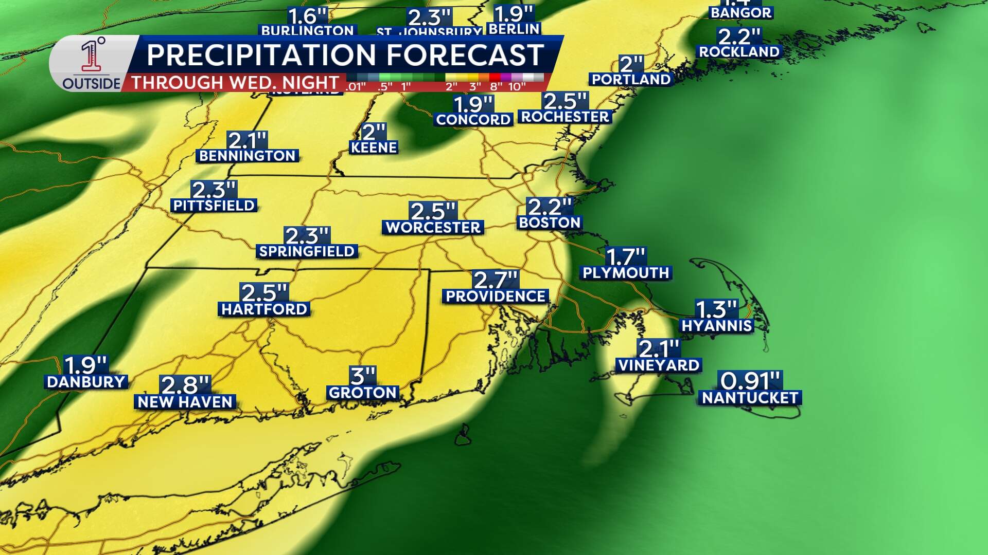
Boston will see around 2 inches of rain from late Tuesday into Wednesday evening. Much of the area will see 2 to 3 inches of precipitation, with localized amounts around 4 inches possible.
While this will provide a boost to water levels and help mitigate drought conditions, it also raises the risk for urban and poor drainage flooding, especially in areas where leaves are clogging storm drains.
If you’re out and about, plan for ponding water and reduced visibility during the heaviest downpours. There may even be a few rumbles of thunder embedded in some of the heaviest rain.
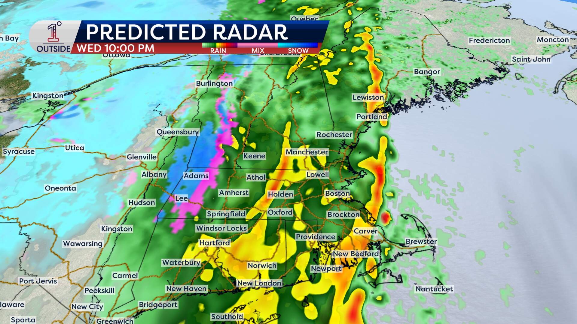
In terms of timing, some spotty showers are possible Tuesday evening, turning to steadier pockets of rain after midnight. Rain will continue Wednesday, falling steadily and at times heavily, before winding down around or just after midnight.
Damaging wind gusts
The storm will bring a powerful low-level jet over Eastern Massachusetts, driving southerly wind gusts of 50 to 60 mph. The wind will ramp up throughout the morning Wednesday, with gusts over 40 on Cape Cod out of the gate and an expansion of 40 to 50 mph gusts through the afternoon.
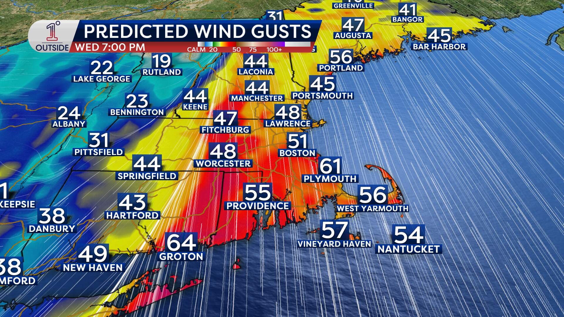
The strongest winds come between 4 and 9 p.m. Wednesday evening, coinciding with heavy rain. Gusts over 50 mph in Boston and the surrounding towns are most likely during that time. Isolated gusts 60 to 70 mph will be possible, with that threat greatest over the southeastern part of the state, Cape Cod and Cape Ann. Scattered wind damage is likely, with downed tree limbs and power outages.
Ahead of the storm, secure loose outdoor items, especially lightweight holiday decorations.
Unseasonable warmth
A surge of warm air will accompany the system, pushing high temperatures in Boston into the lower 60s on Wednesday — a stark contrast to the recent chill. While this is notably warm for December, it won’t challenge the record high of 68 degrees set in 1911.
Despite the warmth, rain and wind will dominate the day, so dress for wet weather. Perhaps skip the umbrella and opt for the raincoat because of the strong winds.
Cooler, drier air returns
As the storm moves out, temperatures will drop significantly. However, there’s no threat of ice or freezing conditions Wednesday night into Thursday thanks to the lingering southerly flow.
Highs will settle into the low 40s on Thursday, with brisk northwest winds gusting up to 30 mph adding a chill to the air.
