Support WBUR
Winter’s grip tightens: Winds roar and temperatures fall across Boston
Winter returns in full force the first week of 2025, in Boston and across New England.
A cold pattern moved in on Thursday, accompanied by gusty winds, dropping temperatures and mountain snow showers. Gusts of up to 50 mph whipped through the city, making temperatures in the upper 30s feel more like the low 20s and causing thousands to lose power.
These strong winds, driven by a powerful low-pressure system parked over the Canadian Maritimes, are pulling in cold air from the west creating a biting wind chill.
Expect powerful gusts through Friday, though the wind will begin to ease slightly by the evening.
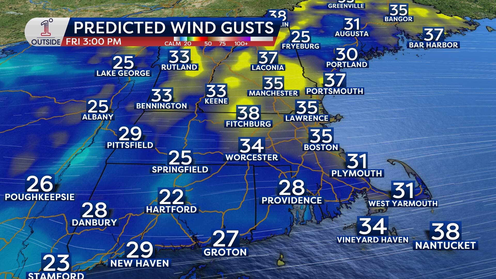
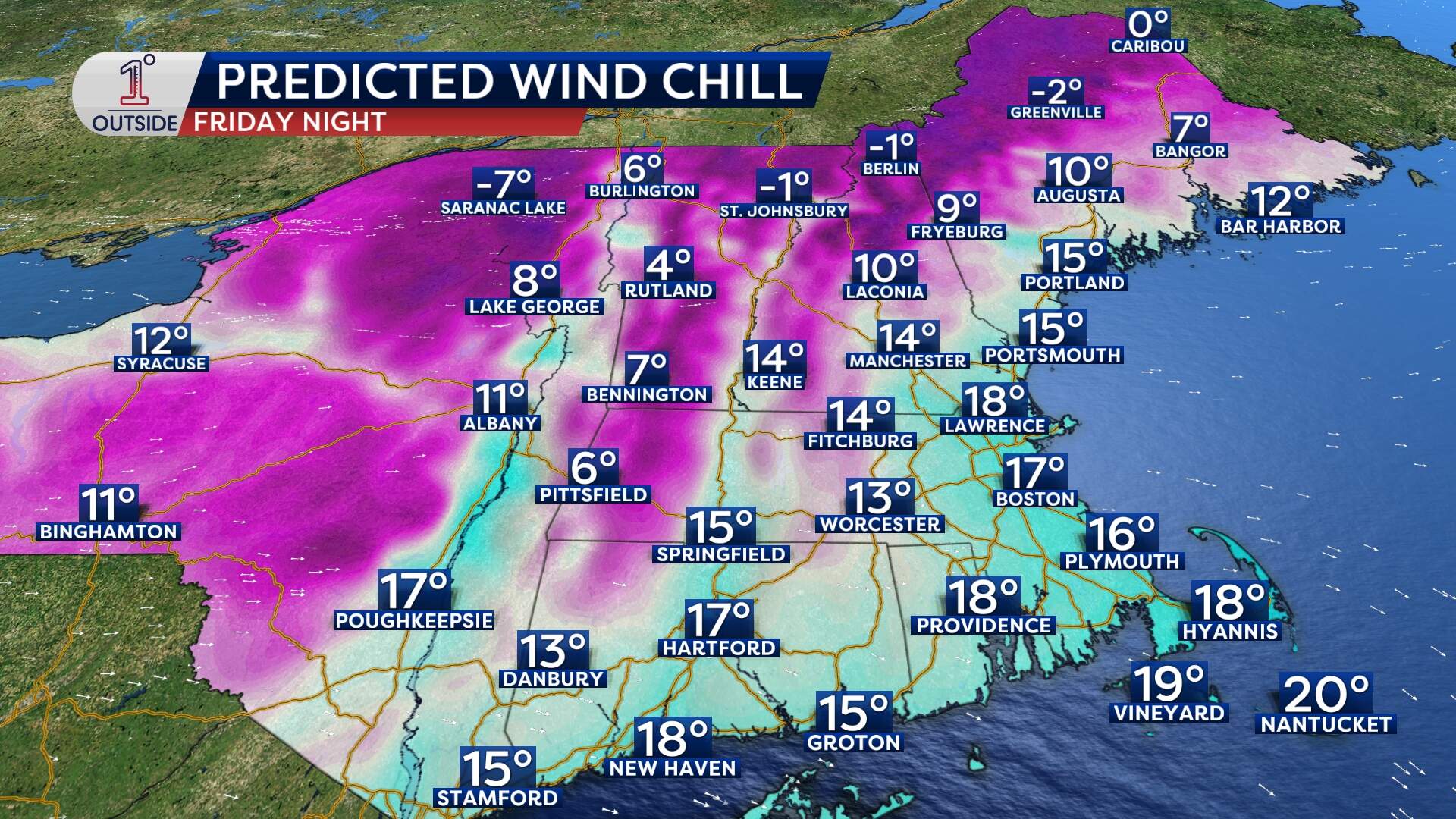
Daytime highs will hover near 40, but with wind gusts continuing in the 30 to 40 mph range, it will feel like the lower 20s. Overnight lows will dip into the mid-20s, reinforcing the winter chill that’s settling into the region.
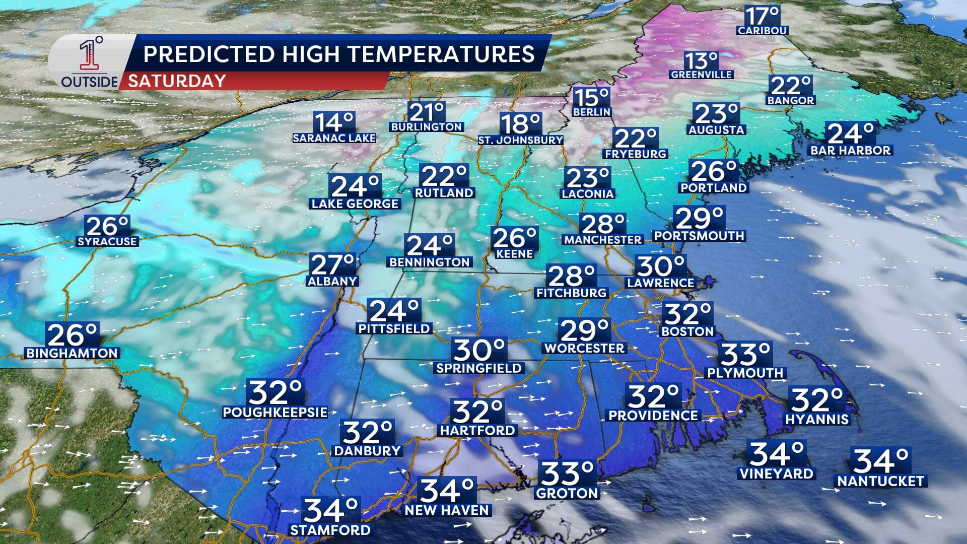
Looking ahead to the weekend, Boston will see a continuation of brisk conditions, with highs in the mid 30s and wind chill values in the 20s. While much of the area will be dry, ocean-effect snow showers could graze the outer Cape on Saturday night.
Next week holds promise for another potential storm system, but the track currently favors the mid-Atlantic for significant snowfall. For Boston, we'll have to wait and see if this system will impact us, or bypass New England altogether.
As the winter pattern locks in for January, it’s clear that Boston is in for a seasonably chilly stretch with periodic chances for snow.
This article was originally published on January 02, 2025.
