Support WBUR
A little more snow is heading toward New England
Several rounds of wintry weather will pass through New England in the days to come. Boston residents can expect light snow, a mix of precipitation, and noticeable temperature swings, all accompanied by a gusty breeze.
Tuesday morning: Snow showers and squalls
A sharp cold front will sweep through the region early Tuesday, bringing scattered snow showers and bursts of heavier snow squalls:
- Timing: Squalls are most likely between 7 a.m. and 11 a.m. in Boston and the surrounding areas.
- Impacts: These squalls will be fast-moving but could briefly reduce visibility and leave a quick coating to an inch of snow, particularly on untreated roadways. Gusty winds of 35–40 mph may accompany these bursts of snow, adding to the challenge of morning travel.
- What to watch: Although not everyone will see a squall, be prepared for sudden changes in visibility and road conditions during your morning commute.
Wednesday: Light snow and rain
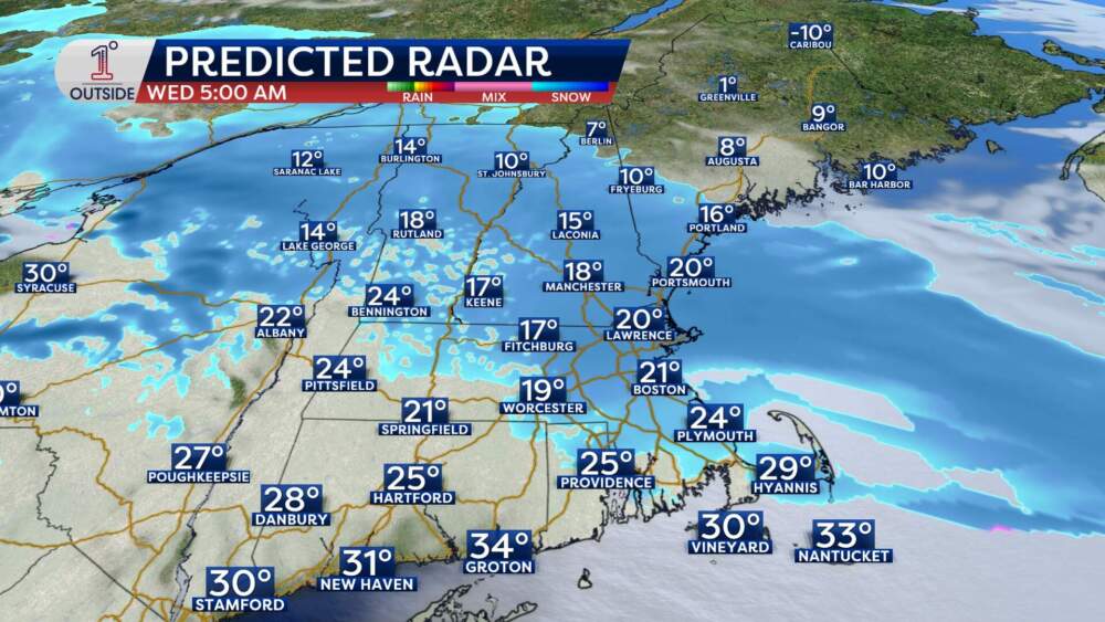
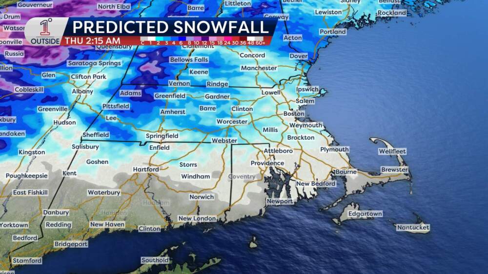
The most significant weather of the week arrives late Tuesday night into Wednesday, bringing a period of light snow followed by a mix of rain in some areas.
- Timing:
- Snow begins just after midnight into Wednesday morning.
- The steadiest snow is expected between 4 a.m. and 8 a.m., tapering to lighter snow or rain showers by late morning.
- Precipitation may briefly intensify again Wednesday afternoon before wrapping up around 10 p.m.
- Boston: Expect 1–2 inches of snow by late morning Wednesday, with slightly higher totals north of the city.
- Metro West: Areas west of I-95 may see 2–3 inches of snow, with isolated higher amounts in elevated areas.
- Farther north: Central and Northern New England are likely to receive 2–4 inches, with some mountain locations picking up even more.
- Temperatures in Boston could reach 40 degrees by Wednesday afternoon. This will likely lead to rain mixing with or briefly replacing snow south of the Mass. Pike, especially along the South Coast and Cape Cod.
Wednesday evening: Rapid refreeze
As colder air rushes back into the region Wednesday evening:
- Temperatures: Boston will drop to freezing by 6 p.m. and continue falling into the teens overnight.
- Wind: Northwesterly winds gusting up to 30 mph will create wind chills in the single digits.
- Impact: Any slushy or wet surfaces could quickly freeze, creating slick conditions on untreated roads and walkways. Be cautious during your evening commute and take steps to avoid icy spots.
Looking Ahead
- Thursday: A blast of arctic air will bring temperatures in the 20s and wind chills near zero in Boston during the morning. Skies will be bright but cold.
- Friday and beyond: Warmer air returns on Friday, with highs approaching the low 40s in southern New England. However, a developing system late in the week could bring another round of rain and snow, with details becoming clearer in the days ahead.