Support WBUR
Snow and sleet to hit Boston Thursday, ahead high winds and more snow this weekend
Boston is bracing for a classic New England winter stretch, with a series of storms set to bring snow, wind and potentially messy conditions over the next several weeks.
The next system arrives Thursday, delivering widespread snow changing to sleet to the Massachusetts-New Hampshire border and potentially mixing with rain south of the city, before strong winds sweep in Friday.
Thursday
Thursday’s storm starts in the morning, moving from southwest to northeast across the region. Expect snow to begin in the Boston area around 9 a.m., which will stick right away thanks to the cold air already in place.
The snow will be fluffier at the onset, but it will mix with rain closer to the South Shore and Cape Cod later in the day.
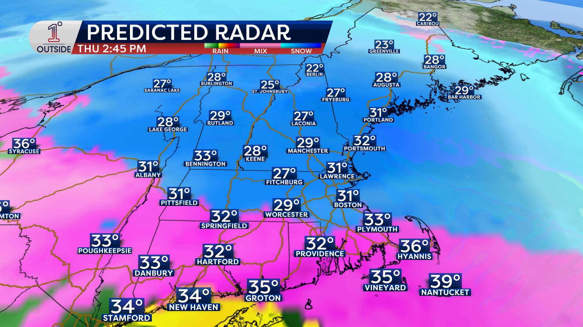
The heaviest snowfall is likely from late morning into early afternoon before tapering off in the evening. The ground is cold enough that even light snow will accumulate quickly, leading to slick travel for the morning and evening commutes.
Residents should expect around two inches of accumulation in Boston, with up to four inches north and west of the city, and less to the south.
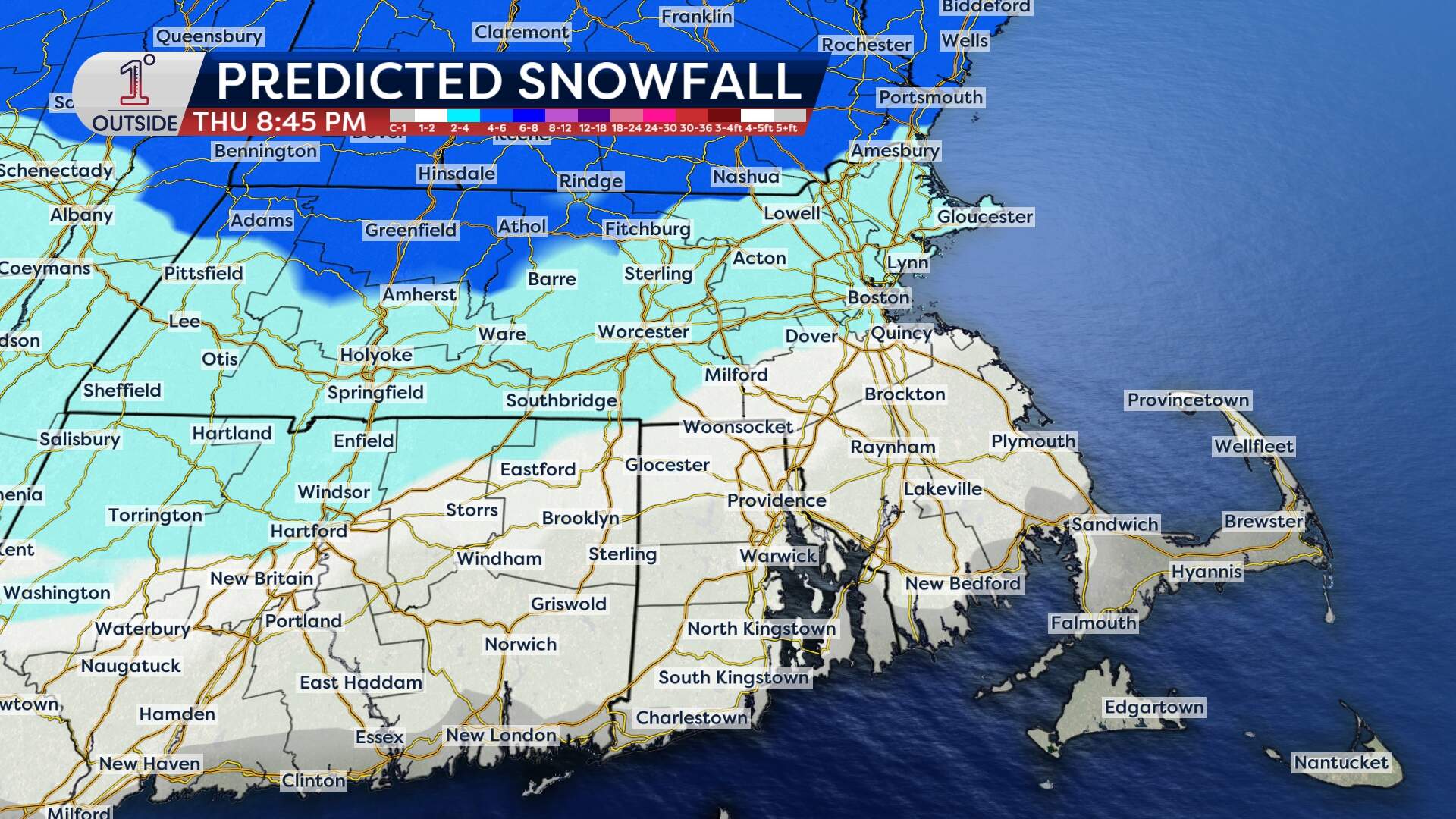
The biggest question mark right now is how far north the rain/snow line gets. That said, the back edge of the precipitation will also arrive fairly quickly, between 4 p.m. and 6 p.m. Lingering slippery travel is likely for the Thursday evening commute.
Friday
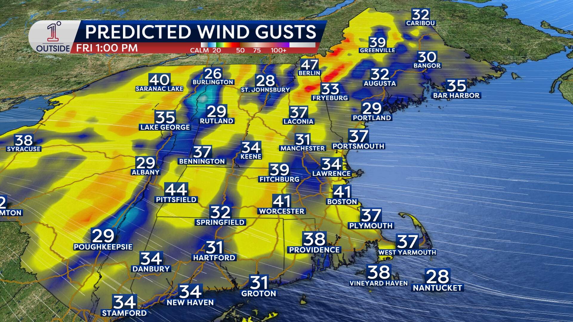
Gusts of 40 to 50-plus mph will develop out of the northwest on Friday, with isolated pockets of wind damage and outages as a result.
Weekend
Another storm moves in late Saturday night into Sunday. Snow will start Saturday evening and continue into early Sunday, with yet another chance for mixing in Southern New England, depending on track.
It’s still too early to pin down snowfall totals, but this could be another plowable, quick-moving event.
And winter doesn’t look to be slowing down anytime soon — yet another storm looms for the middle of next week.
With an active pattern continuing through the end of February, Boston is likely to end the month with above-average snow accumulation.
