Support WBUR
Most of New England may get at least half a foot of snow this weekend
New England is gearing up for a classic February snowstorm this weekend, with widespread heavy snowfall expected across the region, including Boston. While this storm will move quickly, it won’t be short on impact, bringing accumulating snow and tricky travel conditions.
Saturday will be quiet, offering plenty of time to prepare before the storm arrives. Snow is expected to begin between 7 p.m. and 10 p.m. across southern and central New England.
By midnight, most of the region should see steady snowfall, and it will only pick up from there. Overnight into early Sunday morning, some areas will see snowfall rates of 1 to 2 inches per hour, leading to rapid accumulation.
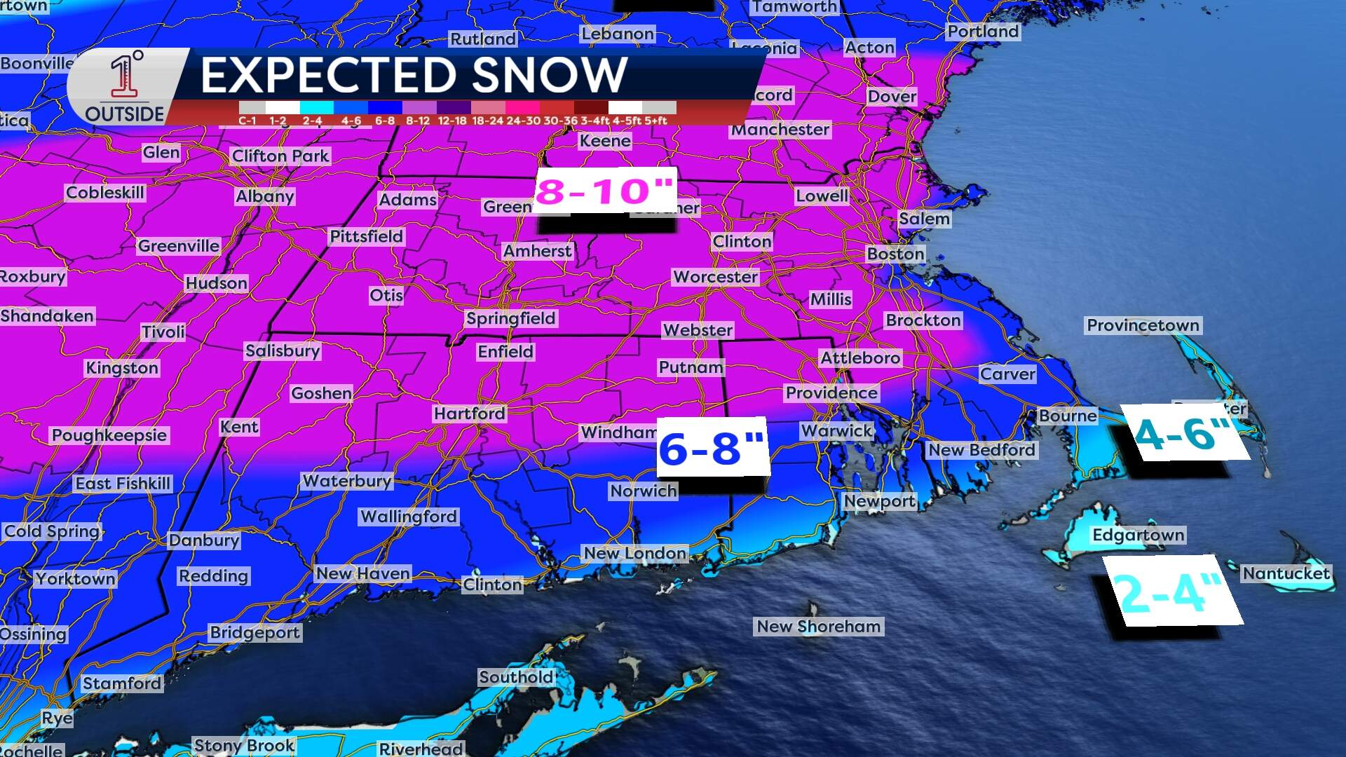
By 10 a.m. Sunday, the storm will wind down, but lingering light snow and ocean-enhanced flurries could persist into the afternoon, particularly along the South Shore and Cape Cod. A northerly wind will take over, blowing and drifting snow before skies begin to clear later in the day. There's still the potential for some mixing to come into play, with that risk greatest on Cape Cod.
Right now, it looks like 6 to 10 inches of snow will fall across much of southern and central New England, including Boston, while areas in northern New England will see 4 to 6 inches of fluffier snow. There’s still some uncertainty with the exact storm track, so expect some adjustments in the next 24 hours. A worst-case scenario? Some spots in Southern New England could end up with over a foot.
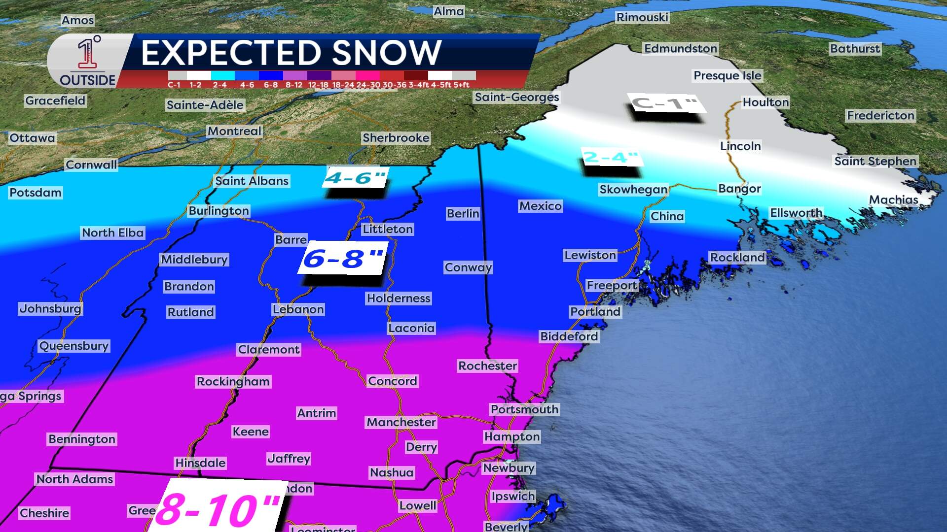
This storm is just the beginning of a busy stretch of winter weather. Another storm arrives Tuesday night into Wednesday, with a rain/snow line in play to our south —most of New England should stay all snow, but there’s potential for some mixing depending on the storm’s track. Then, another storm is likely on Thursday before another next weekend.
For those who love winter weather, this is shaping up to be an exciting couple of weeks.