Support WBUR
Forecast: Minor storm expected Wednesday night, and possibly this weekend
Winter continues to roll along in New England. And while a few storms arrive this week, they may leave snow lovers in Boston wanting more.
First, the Cape and Islands will be grazed by a distant storm from our south, which will bring a coating to 1" of snow Tuesday night into Wednesday morning. Meanwhile, ocean-effect snow showers will develop across eastern Massachusetts on Wednesday due to an easterly wind coming off the Atlantic. These snow showers will be scattered and light, but could bring a coating to localized areas, especially in the afternoon.
The next system arriving Wednesday night into Thursday is not shaping up to be a major snow producer for most of southern New England, including Boston. A lack of strong atmospheric support means snowfall amounts will be limited. The best chances for accumulating snow will be in northern Massachusetts, New Hampshire and Maine, where colder temperatures will allow for fluffier snow.
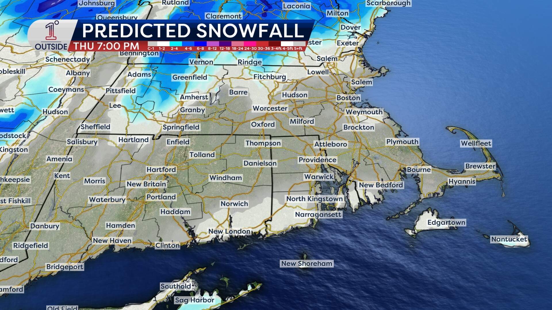
For Boston and areas south, it’s not even certain that the precipitation will start as snow — some sleet and light freezing rain may mix in overnight before a change to plain rain early Thursday morning. While this system isn’t expected to bring major snowfall, untreated roads could still be slick Thursday morning, particularly outside of the city and north of I-95.
What's ahead for the weekend
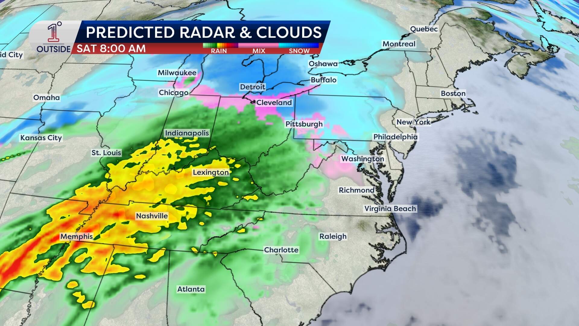
Another storm is expected to develop this weekend, but questions remain about timing and precipitation type. Right now, it looks like Saturday will start dry with precipitation holding off until later Saturday evening or night, similar to previous weekend storms this winter.
With this storm, the challenge will again be how much warm air is pulled north. Southern New England, including Boston, may once again find itself in a mix or changeover situation, while the mountains to the north will likely see accumulating snow.
Next week brings bitter cold and more chance of snow
Once the weekend storm departs, a blast of Arctic air is expected to settle in early next week, bringing a sharp temperature drop and frigid wind chills. This will set the stage for the next possible storm mid-to-late week, which could have a better chance of producing snow across all of New England.
