Support WBUR
Forecast: A sloppy mix of snow and rain is coming this weekend
We've been in a pattern where there's a storm every few days, with several coming during the weekend. This week is no exception. If you love snow, we'll get some. If you hate snow, just wait — it’ll likely turn to rain. And if you just want a calm winter weekend, well, this storm has other plans.
Before the storm even gets here, cold air is settling back into the region. The wind will howl through Friday afternoon, with gusts of 40-50 mph at times. Temperatures will struggle to climb to the freezing mark, and with that biting wind, it'll feel like the teens in many spots, including Boston. The gusts slowly throttle back Friday night, with temperatures dropping into the teens, it won't take much of a breeze to make it feel like the single digits.
Saturday Evening: Here Comes the Snow
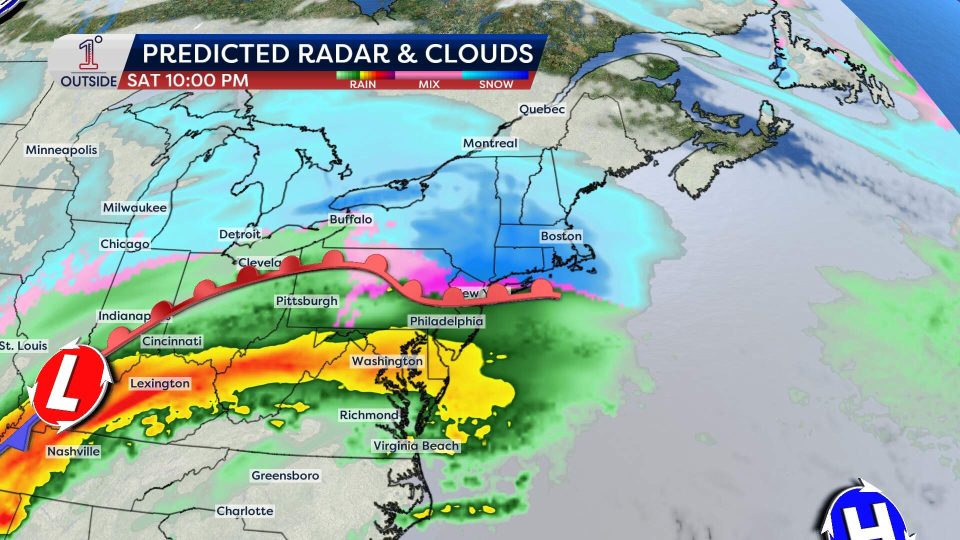
Because of all that cold air over New England, when the first flakes fly — likely between 3 p.m. and 6 p.m. — they’ll stick. Snow will accumulate quickly after sunset, especially on untreated roads, making for slick travel. As the storm strengthens, it will pull warm air northward, setting up a sharp transition from snow to sleet and eventually rain in central and southern New England Saturday night into Sunday.
By Sunday morning, southern New England will be deep into a messy mix of sleet and freezing rain, with plain rain likely from the South Coast to Cape Cod. Boston will go from accumulating snow to an icy slop before changing over to rain.
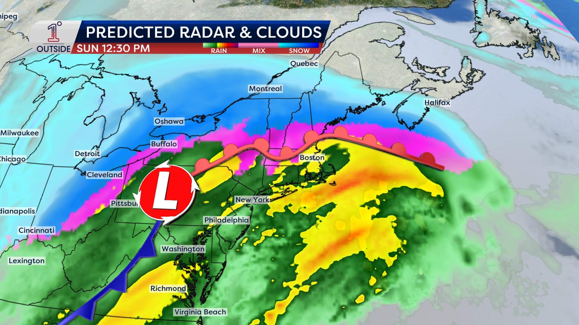
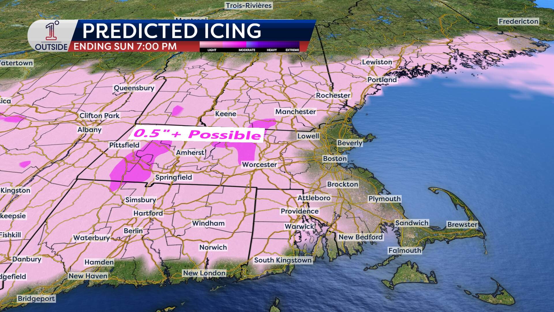
Localized flooding is possible and ponding of water on the roads. Through the interior, especially from the Worcester Hills west, cold air at the surface may hang on long enough for a period of ice accretion, which could lead to some pockets of tree/limb damage and power outages depending on how much falls. Stay tuned for details on that as they become clearer.
It'll be a different story in northern New England. Heavy snow will continue falling in much of Vermont, New Hampshire and Maine, where a foot or more is expected in higher elevations. That will be tough for travellers, especially with bursts of snow falling at 1-2 inches per hour at times, but winter sports enthusiasts and snow lovers should be pumped.
How Much Snow?
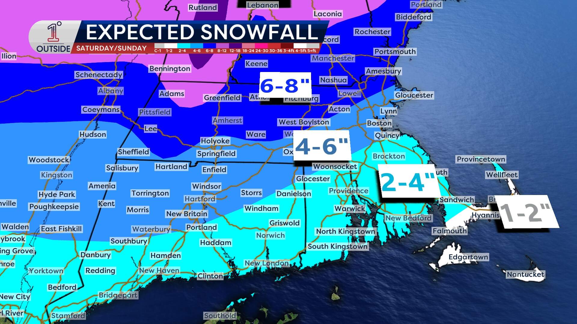
This is still a developing storm, and exact snowfall amounts will likely shift a bit depending on the final track, but here’s an early look at how things could shake out:
- Boston: 3-6 inches are likely.
- Northern New England: 12-18 inches in the higher elevations of the Green and White mountains, and northern Maine.
- Central New England: 6-12 inches before mixing with sleet and freezing rain.
- Southern New England: 4-8 inches north of the turnpike, with lower totals where sleet and rain mix in sooner.
- Cape Cod & the Islands: A coating to 3 inches before a change to rain washes it away.
Monday: The wind blows back in
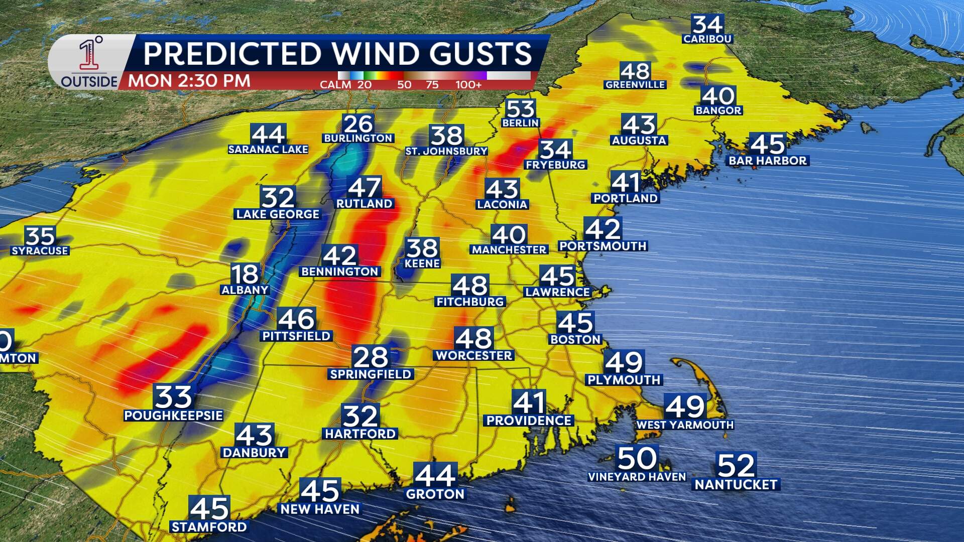
As the storm pulls away, the wind will crank up, which has been a trend with several recent storms. Gusts to 55 mph Monday could cause scattered power outages and difficult travel.
With cold air rushing back in, wind chills will be downright brutal. Expect subzero feels-like temperatures in parts of northern New England, while Boston and southern New England will feel wind chills in the single digits.
This article was originally published on February 13, 2025.
