Support WBUR
Forecast: Fall weather arrives for the long weekend, capped by a stormy holiday
Change is in the air! After an unseasonably warm stretch for October, the coolest air of the season so far is moving in, signaling the start of a pattern shift that will be here for an extended stay.
As we gear up for the long holiday weekend, capped on Monday by Indigenous Peoples/Columbus Day, here’s what you need to know about the weather.
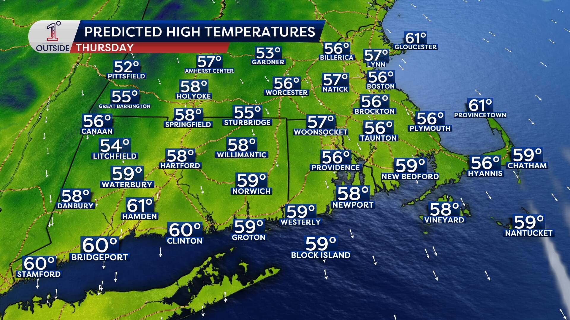
Thursday: Brisk fall day
- Morning/Day: Think true fall vibes and sweater weather — finally! Expect lots of sunshine, breezy north winds at 10–20 mph, and highs only in the 50s.
- Evening: As the wind dies down, temperatures drop fairly quickly after sunset. Boston could dip to 39 degrees Thursday night — the first sub-40 reading since April 13 — so cover tender plants and grab an extra blanket. The suburbs will see widespread temperatures in the 30s.
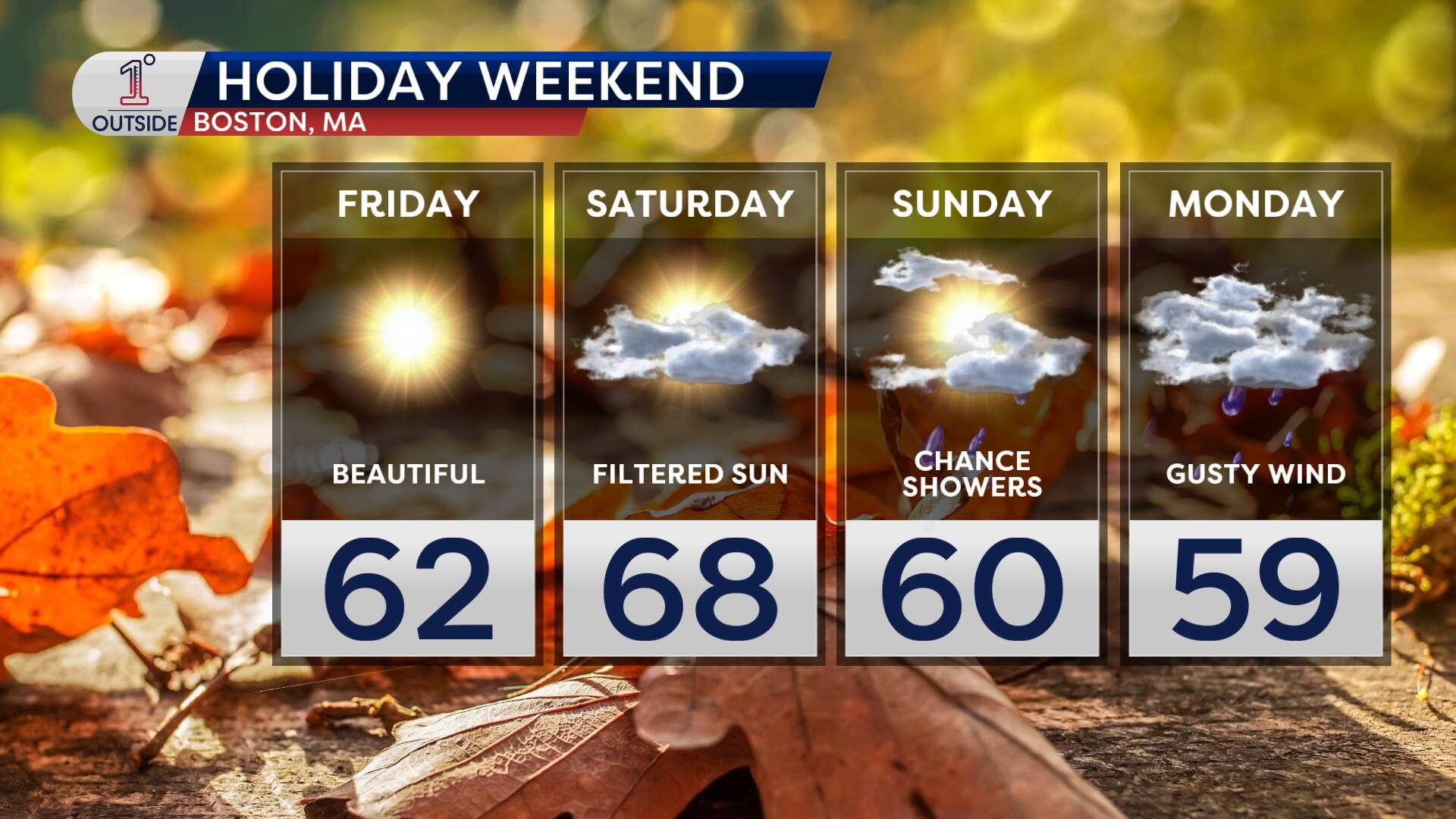
Friday: A welcome rebound
- Highs climb into the low 60s, with light winds and sunny skies. It’ll feel relatively mild compared to Thursday.
Saturday: Classic October day
- Seasonable, with high-thin cirrus clouds giving the sunshine a soft, milky glow. Highs will be in the mid-60s, with low humidity — ideal weather for any and all outdoor plans.
Sunday into Monday: There's a storm brewing
A complex coastal low will spin up off of the Carolinas this weekend, fueled by moisture from the southeast and energy tapping into a Canadian upper-level trough. This developing storm could even become tropical or hybrid in nature, with an expansive wind field as it slowly works northward.
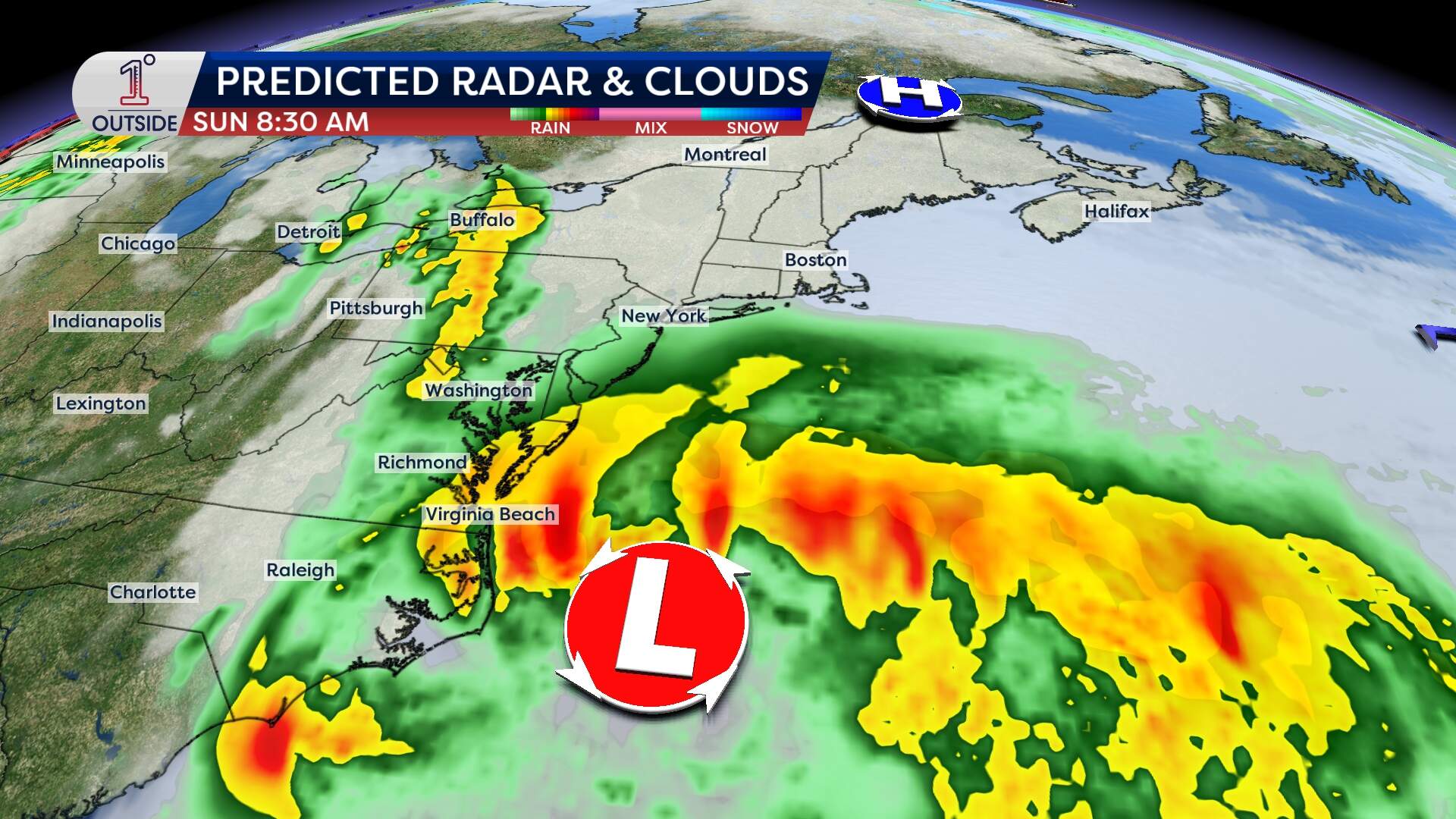
There are still many details to be ironed out, but it's a good idea to prepare early for potentially damaging wind gusts, coastal flooding and erosion, and dangerous conditions out on the ocean. How much wet weather Massachusetts receive is uncertain. While the heaviest rain looks like it will stay to our south, there are some signs we may see some pockets of rain and showers developing Sunday and lasting into Monday.
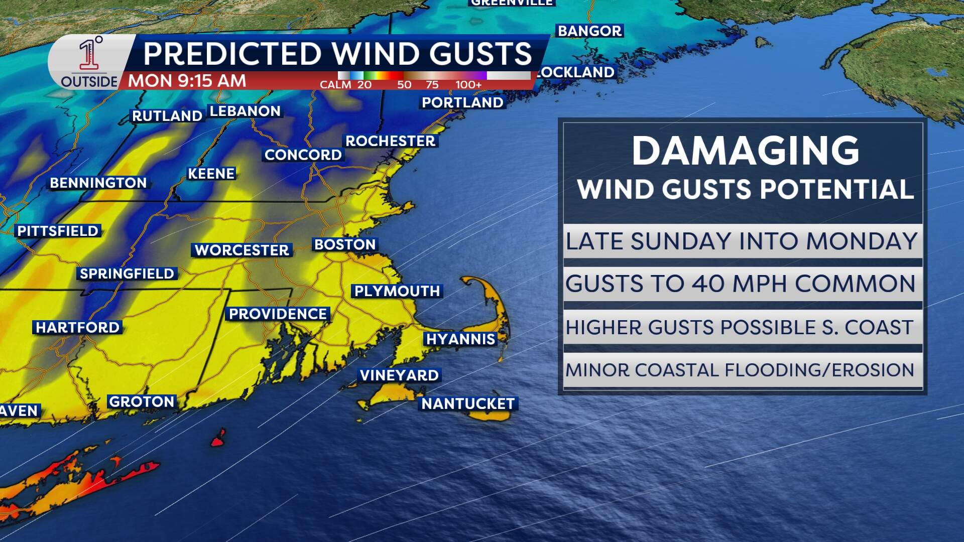
- Late Sunday: Offshore seas climb to 10-15 feet, while nearshore wave heights may top 5–8 feet. Increasing northeast wind with numerous gusts to 40 mph Sunday evening from Cape Cod to the south coast.
- Sunday night into Monday (Columbus/Indigenous Peoples Day): Wind gusts to 40 mph may be common, with the potential for gusts to 45 mph in much of eastern Massachusetts and the hilly terrain. Some gusts over 50 mph will be possible, with that risk greatest from the Cape to the south coast. Pockets of scattered wind damage will be possible. Minor coastal flooding is likely around the high tide cycles late Sunday and Monday, along with beach erosion, especially following the midweek king tides.
Bottom line: keep a raincoat handy and watch for updates in the coming days.
Quick tips for the long weekend
- Layer up Friday morning, then shed layers by afternoon.
- Savor Saturday’s calm — it’s your best bet for strolling and photography.
- Prepare for some wind and rain Sunday evening through Monday: secure loose patio furniture and be ready to tie down boats/marine equipment.
