Support WBUR
Nor'easter to whip up wind, waves and rain beginning Sunday evening
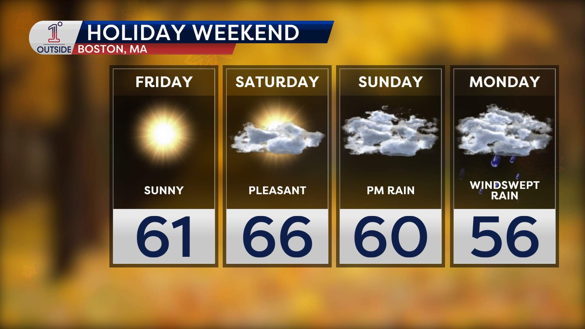
A nor'easter is set to bring heavy wind and rain to Massachusetts. Sunday starts out overcast, with steady rain developing in the evening. Overnight, rain will be heavy at times.
Two separate pieces of upper-level energy — one spinning over the southeast U.S. and another swinging down from central Canada — will interact and spawn a coastal low.
🌧️ Rain
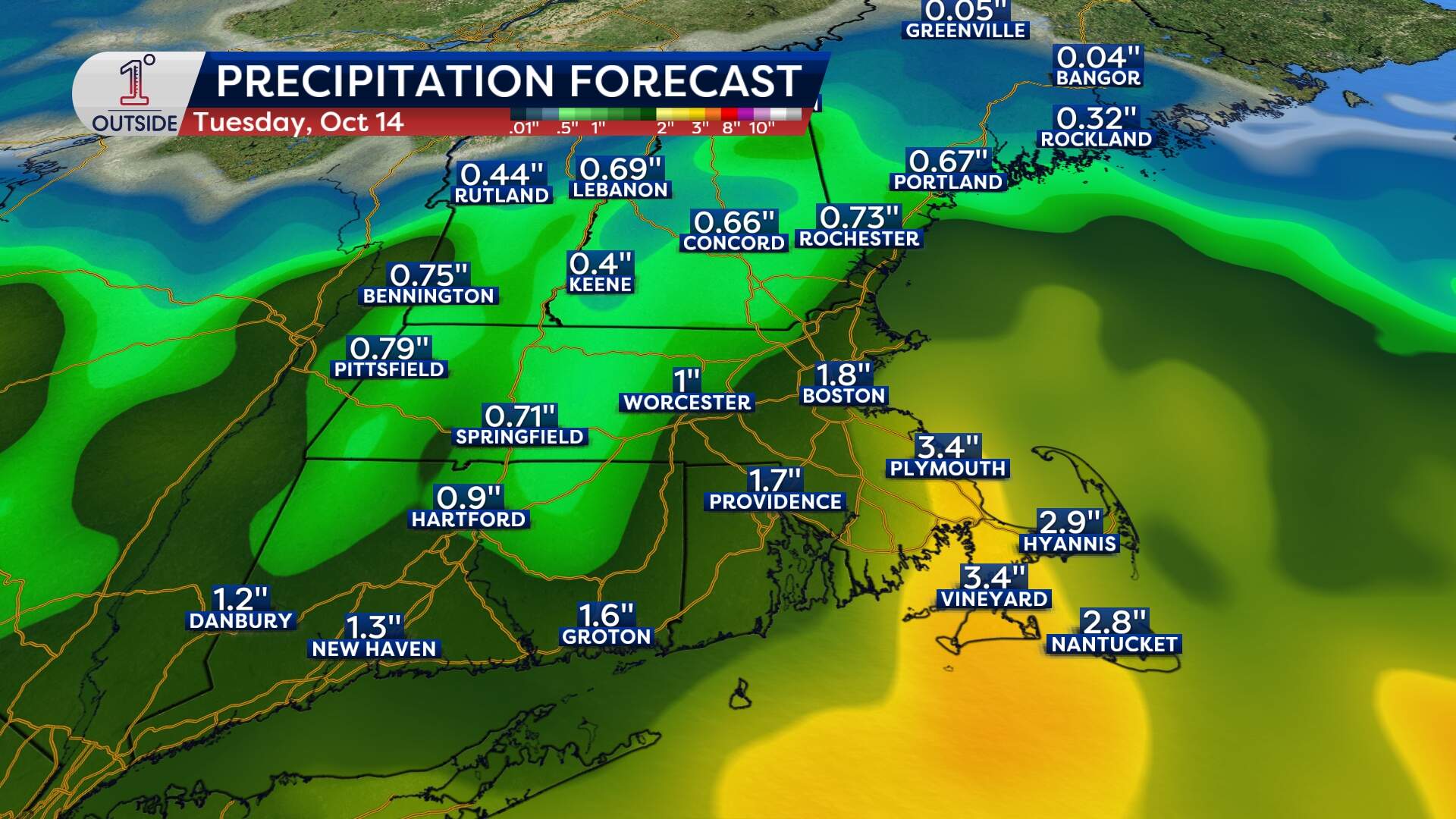
Areas of flooding rain, gusty wind and coastal flooding will impact many up and down the East Coast in the coming days. Rain will expand across southern New England late Sunday, with the heaviest downpours likely along the South Shore and Cape Cod Sunday night into Monday morning.
In Boston, expect a wind-swept, chilly rain beginning late Sunday, lingering potentially into Tuesday. Rainfall totals through Monday will generally run around 1-2 inches, with some locally higher amounts likely on the South Shore to Cape Cod. Localized flooding is likely, and fallen leaves will make travel extra slick.
🌬️ Wind
This coastal storm won’t just bring rain: It tightens the pressure gradient between the building high to our north and the new low offshore. This will whip east-northeast winds into gusts of 40–45 mph around Greater Boston and 45–55 mph from the South Shore down through Nantucket.
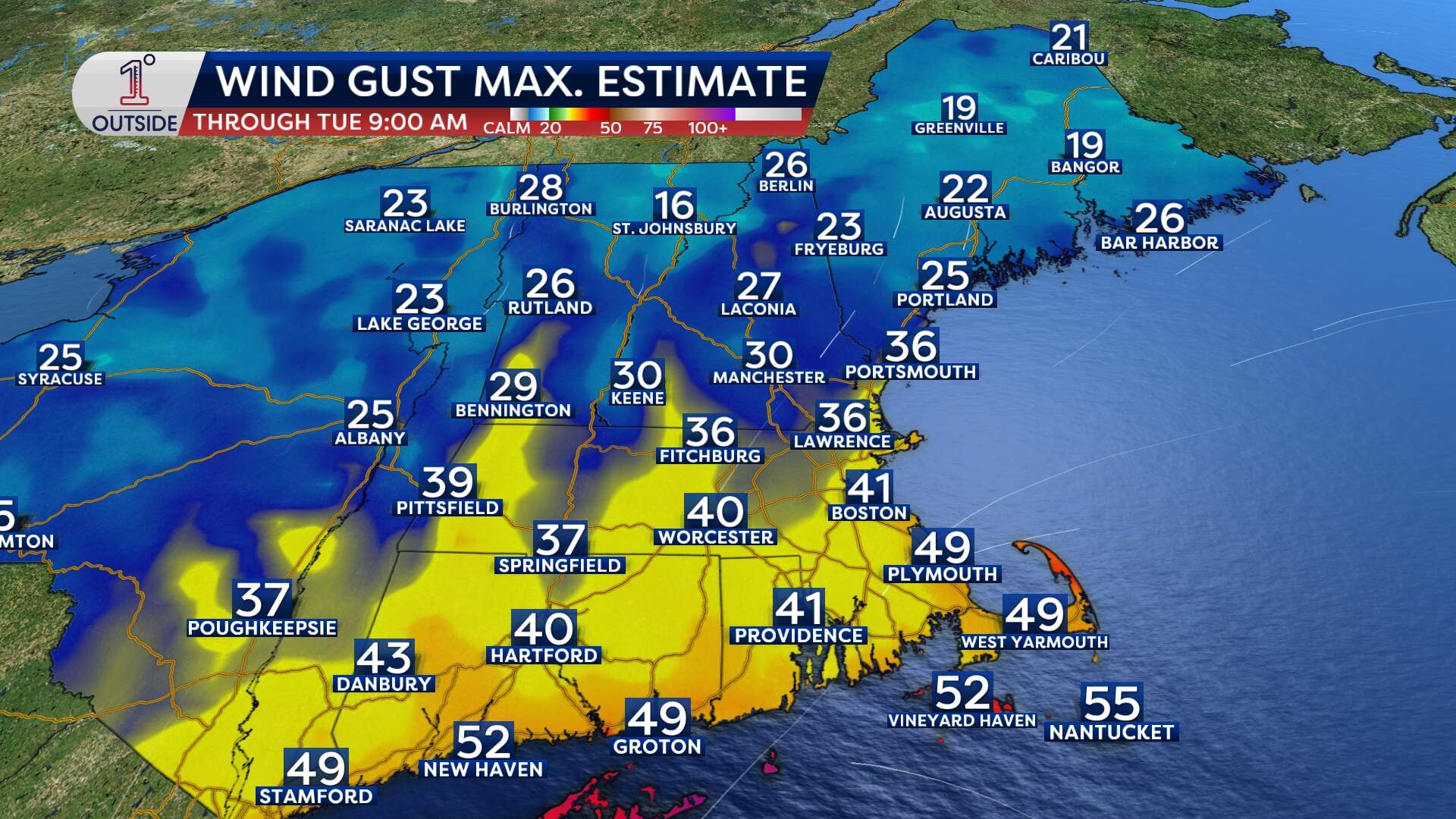
Expect the wind to ramp up Sunday evening, with the strongest window from pre-dawn Monday until Monday midday. Be prepared for pockets of outages and damage.
If you’ve got boats to haul, patio furniture to secure, or Halloween decorations to stake down, anytime prior to Sunday evening is the best window to do that.
🌊 Waves
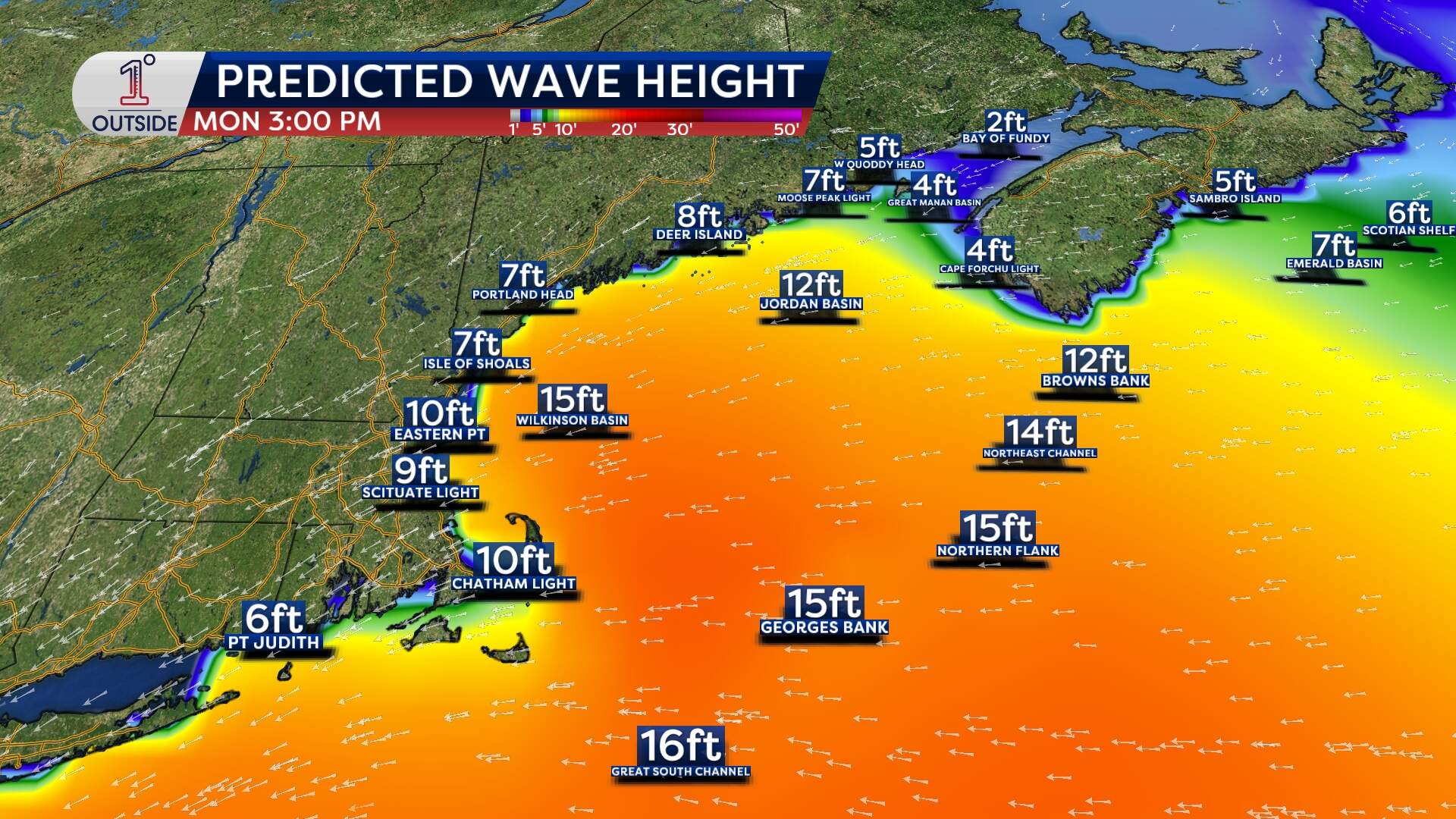
Offshore, seas will climb dramatically. By Sunday afternoon, 12-foot waves may rock vessels offshore, swelling to 15–20 feet by Monday, with 6–10-foot breakers pounding our beaches.
Coming off of the highest tide cycles of the year this week, the combination of the wind and waves will create a surge resulting in minor coastal flooding and beach erosion. It's a good reason to pause the shoreline selfie and keep a safe distance from the surf.
The storm is slow to depart to our south on Tuesday, so some lingering pockets of rain and even some gusts to 40 mph will be possible.
Keep an eye on the free 1DegreeOutside app for real-time radar, wind alerts and more.
