Support WBUR
Forecast: High waves and pockets of rain to remain as nor'easter moves on
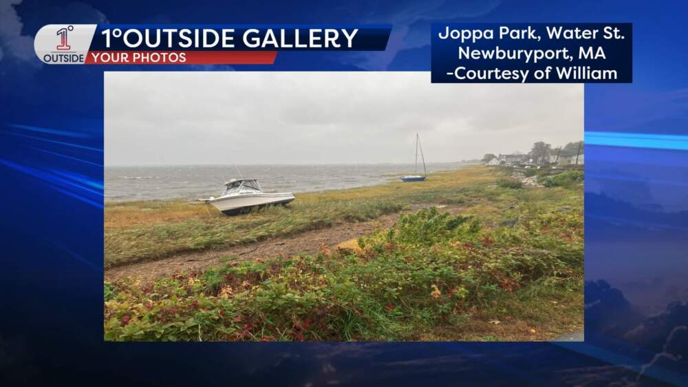
Two boats washed ashore Monday morning in Joppa Park along Water Street in Newburyport — powerful proof that this nor’easter isn't messing around.
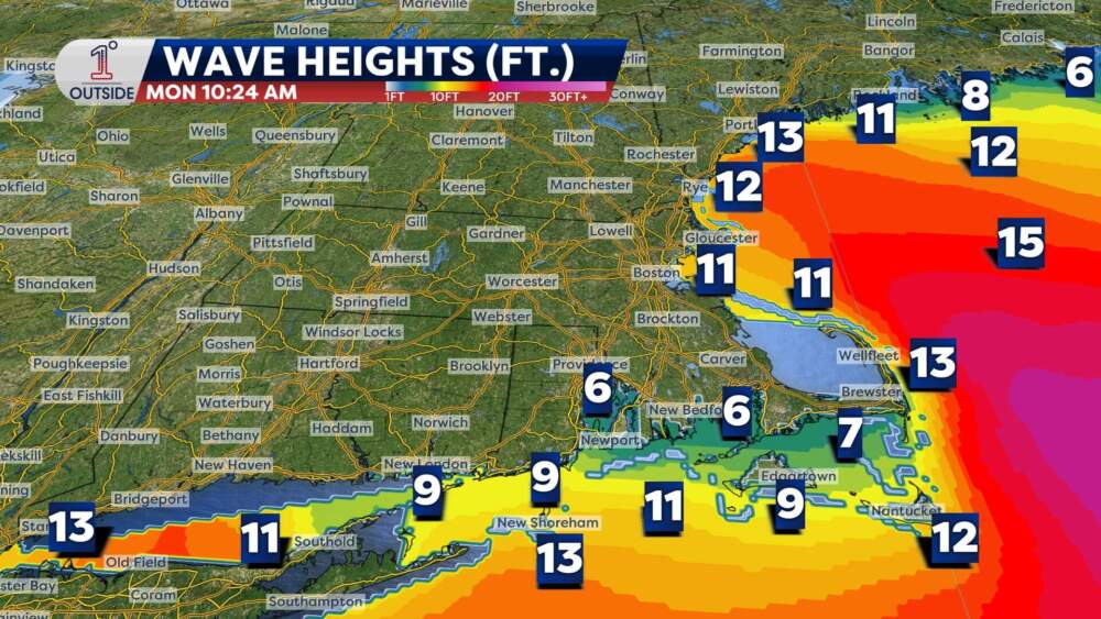
Even as the storm’s center slips slowly farther south midday, the seas remain treacherous. The south coast is still getting pounded by 6–12-foot waves, and 10–15-foot seas near and offshore are making this a hazardous marine storm. Don’t expect a quick fix; those swells will ease slightly tomorrow but then increase again though the middle and end of the week.
Another round of minor coastal flooding and splash over is likely during the Monday afternoon high tide. Wind gusts will ease in the coming hours, but remain active 20-30 mph for many. Isolated higher gusts are possible at the coast.
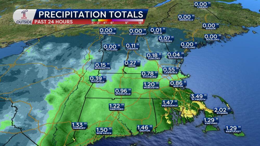
Meanwhile, rainfall totals so far tell a tale of two New Englands. In the parched extreme drought zones of northern New England, gauge readings have barely budged. Some central New England cities and towns have seen a few tenths of an inch of rain, while southern New England communities from Boston to Worcester and down through Cape Cod picked up 1–3 inches. Another inch still possible in places like southeastern Massachusetts in the coming 24 hours.
As the coastal low drifts east on Tuesday, a few lingering pockets of rain will hang on from the South Shore to the Cape, with localized flooding possible. Elsewhere, a few showers can't be ruled out with many clouds and an active breeze.
Weekday weather
Midweek ushers in a shift. A robust area of high pressure will fling cooler air our way, and you’ll really feel it as a brisk north-northwest wind kicks up on Wednesday and Thursday. Sustained 20–30 mph gusts are expected, with gusts as high as 40 mph on Cape Cod and Nantucket. It shouldn't cause damage, but it will be crisp and undeniably fall-like.
The ocean won’t calm quite as quickly, either. Expect 6–8-foot waves near the Outer Cape, 8–10-foot swells offshore, and even higher rollers over Georges Bank and the Great South Channel.
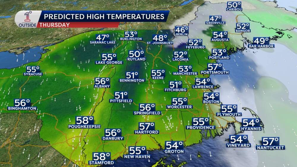
Thursday features bright skies but highs only in the mid 50s, with a brisk feel. We moderate a bit on Friday, with sun and clouds and highs near 60.
An early look at the weekend: Partly sunny and a bit warmer, low 60s Saturday and well into the 60s Sunday. Some spots may even eclipse 70.
Have storm photos of your own? Drop them into our “Send to Us” tab on the free 1DegreeOutside app!